This item has been sold, but you can get on the Waitlist to be notified if another example becomes available, or purchase a digital scan.
1952 Waldsmith City Plan or Map of Fort Lauderdale and Lauderdale Harbours, Florida
LauderdaleHarbors-waldsmith-1952$175.00

Title
Lauderdale Harbors Map or Fort Lauderdale Florida.
1952 (undated) 22 x 16.25 in (55.88 x 41.275 cm) 1 : 19200
1952 (undated) 22 x 16.25 in (55.88 x 41.275 cm) 1 : 19200
Description
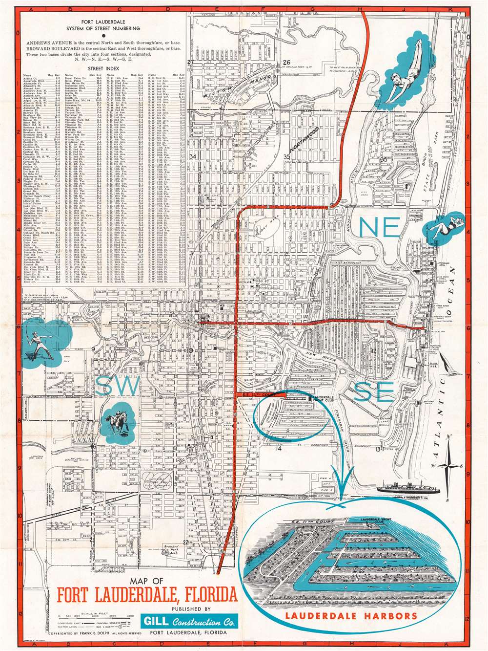
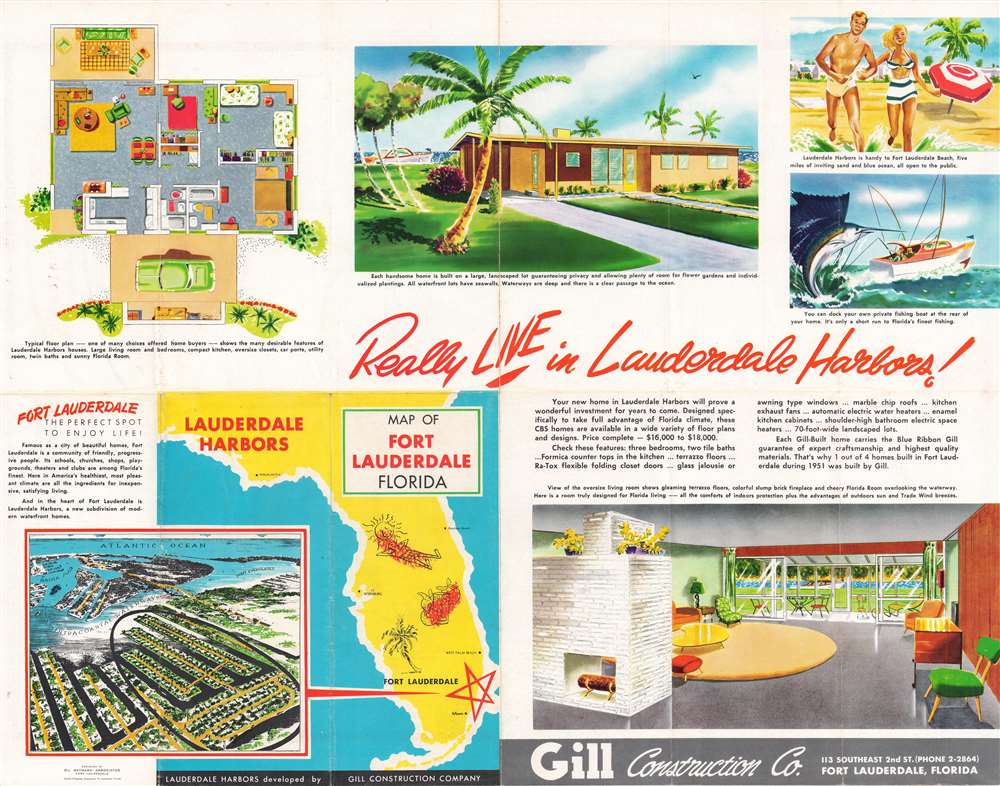
This is a c. 1952 Arnold J. Waldsmith city plan or map of Fort Lauderdale, Florida, promoting Lauderdale Harbors (Lauderdale Harbors), a new subdivision in Fort Lauderdale. Streets throughout the city are illustrated, as are highways, and and bus lines. Pictorial vignettes highlight the luxuries of living in Florida, among them lounging, the beach, swimming, and fishing. The highlight is an inset view in the lower right of the then-new development, Lauderdale Harbors. Overlooking the neighborhood from the south, the view reinforces this new area's main attraction: private boat docks for every home. Built on islands surrounded by canals, every house has its own waterfront. In addition, the Lauderdale Yacht Club is just to the north. Full color illustrations on the verso reinforce the luxury and expertise a buyer would experience if they acquired one of the homes built in Lauderdale Harbors. Today Lauderdale Harbors remains a vibrant community popular with young professionals.
Publication History
This map was drawn by Arnold J. 'A.J.' Waldsmith and published by the Gill Construction Company c. 1952. We have been unable to locate any other surviving examples.Cartographer
Arnold J. 'A.J.' Waldsmith (May 26, 1907 - March 16, 2005) was an American cartographer and surveyor. Born in Metamora, Illinois, Waldsmith moved to Florida in 1934. During World War II, he served with the Navy Engineers and worked on the construction of the Fort Lauderdale Naval Air Station and other airfields. Waldsmith became a licensed surveyor in Florida in 1948 and founded Waldsmith Surveyors. He joined the Knights of Columbus in 1930 and helped organize and charter the Knights of Columbus chapter in Fort Lauderdale. He married Tillie R. Rosenthal on January 20, 1938 More by this mapmaker...
Condition
Very good. Exhibits wear and toning along original fold lines. Color advertisements printed on verso.