1855 Cruchley Folding Wall Map of London, England
London-cruchley-1855$1,500.00

Title
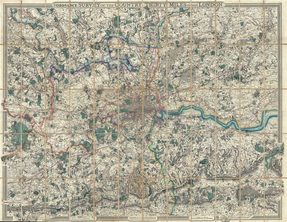
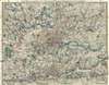
From the Ordnance Survey of the Country Thirty Miles round London.
1855 (undated) 40 x 50 in (101.6 x 127 cm) 1 : 63360
1855 (undated) 40 x 50 in (101.6 x 127 cm) 1 : 63360
Description
This is an uncommon 1855 George Frederick Cruchley map of London and its immediate environs. Presented here in case format, Cruchley's map depicts the area thirty miles around London, or from Hertford to Turnbridge and Godalming, and from Windsor to Chatham. Exceptionally vivid color work identifies counties, rail lines, roads, and forests. The detail throughout is extraordinary, with even such insignificant features as the ancient earthen embankments on Wimbledon Common illustrated. Similarly, market towns and market days are carefully identified throughout. Within London itself, Hyde Park, Kensington Gardens, Regent's Park, and the Tower of London are illustrated.
Publication History and Census
George Frederick Cruchley based this map on an earlier map issued by J. W. Froggett from 1831 to 1854. He must have acquired the map plates in that year, as the first Cruchley issue also dates to 1854. It was published from Cruchley's offices at 81 Fleet Street, London. Victorian map historian Ralph Hyde identifies six states of this map - of which this corresponds to none. The present edition is not noted in the catalogs of any of the major private or institutional collections that Hyde canvassed, signaling its exceptional rarity. Even so, although not mentioned by Hyde, the present example, based upon the date, must be considered the second edition, between Hyde 333-1 (1854) and 333-2 (1857).Cartographer
George Frederick Cruchley (April 23, 1797 - June 16, 1880) was a London based book and map seller active in the middle part of the 19th century. Cruchley began his cartographic career as an apprentice at the venerable Aaroon Arrowsmith firm. Many of Cruchley's earliest maps bear the words 'From Arrowsmith's' on the imprint. In 1844, Cruchley acquired the massive stock of the important early 19th century firm of John Cary. Cruchley published his own maps as well as reissues of Cary's stock well into the 1870s. He is best known for his detailed plans of London, which in recent years have become increasingly scarce and desirable. Cruchley was based in London on 38 Ludgate Street until 1834 when he moved his offices to 81 Fleet Street. Shortly before his death in 1880 Cruchely auctioned (Hodgson's Auctions, Jan 16, 1877) his entire stock. Many of his map plates were thusly acquired by 'Gall and Inglis' who continued the Cruchley tradition well into the early 20th century. Cruchley's son, also George Frederick (1837 - 1882), continued to work as a book and map seller until his death. More by this mapmaker...
Condition
Very good. Backed on original linen. Folds into binder. Linen exhibits minor splits here and there, mostly near edges.
References
Hyde, Ralph, Printed Maps of Victorian London, 1851 - 1900, 333 (this however is a scarce state not identified by Hyde, but fits between Hyde 333-1 and 333-2).