
1944 Thomas Brothers Map of Los Angeles and Nearby Cities


This item has been sold.
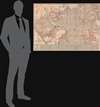
Thomas Bros. 1944 map, main portion of Los Angeles and vicinity.
Los Angeles on the eve of a population and freeway-building boom.
- Digital Map Information
- Suitable for large format printing
- Full resolution TIFF file
- ICC color profile embedded
- Delivered instantly via download link
Los Angeles on the eve of a population and freeway-building boom.
This is a rare 1944 Thomas Brothers map of Los Angeles and surrounding communities (Beverly Hills, Santa Monica, Pasadena, etc.). It offers a glimpse of the geography of L.A. before the postwar population boom and development of interstate system.A Closer Look
The map is detailed and overlaid with a grid corresponding to a lengthy index at bottom and on the verso (back). The verso also has a map and separate road index of the San Gabriel Valley (Pasadena, San Marino, Alhambra, etc.). A series of concentric circles are drawn at 1 mile, 5 miles, and 10 miles from downtown L.A. (7th and Broadway).The names and geography are easily recognizable compared to L.A. today, though there have been some changes, such as 'Barnes' City' to the south of Culver City, today's Del Rey. In the 1910s – 1920s, the area had been home to the Al G. Barnes Wild Animal Circus and Zoo, home to some 4,000 animals before neighbors irate at the noise of the animals and the antics of the circus workers forced the city to relocate it to Griffith Park. 'L.A. Airport,' indicated on the rail map on the verso, refers to the Los Angeles Municipal Airport, at the same location as today's LAX, though at that time it was an upstart compared to the better-established Union Air Terminal (now the Bob Hope Hollywood Burbank Airport).
Who Killed the Electric Railways?
The verso includes a map of the Los Angeles Railway and Pacific Electric Railway system of streetcars, light rail, and buses. Although today L.A. is known for clogged freeways, and a number of the parkways that formed the basis of today's freeways are already present here, in the early 20th century it had one of the best mass transit systems in the U.S.The 'Yellow Car' streetcars of the Los Angeles Railway operated on narrow gauge (3 feet 6 in.) tracks and primarily connected downtown L.A. with other parts of the city and inner suburbs, while the 'Red Cars' of the Pacific Electric Railway operated on standard gauge (4 ft 8.5 in) tracks and connected L.A. with other nearby cities (Pasadena, Santa Monica, Long Beach, San Bernardino, etc.). Both companies were owned and managed in large part by Henry Huntington, an ambitious businessman who had cut his teeth managing railways for his uncle, Collis Potter Huntington, one of the 'Big Four' founders of the Central Pacific Railroad (later the Southern Pacific). After losing a power struggle at Southern Pacific, based in San Francisco, Huntington moved to Southern California to pursue his own business empire. In 1898, he bought the existing streetcar network, which had just gone through a series of mergers to form the Los Angeles Railway, and teamed up with Isaias W. Hellman, the most powerful banker in Southern California, to chart a course for 'inter-urban' railways connecting L.A. to nearby cities. To overcome the opposition of Southern Pacific, a deal was worked out to split some assets between the two railways and sell 40% of the company to Huntington's old rival at Southern Pacific, E. H. Harriman. In exchange, Harriman sold the banker Hellman the banking unit of Wells Fargo, which he also owned.
The Pacific Electric aimed to keep fares low to increase ridership. To offset the lower fares, Huntington focused on acquiring real estate along the lines and near stations on the correct assumption that the land would become extremely valuable. In fact, it would be accurate to say that for Huntington the railway was a means to an end, facilitating his real estate empire, rather than a business in its own right. This model worked brilliantly for a time, making Huntington one of the richest men in California, and the railway network expanded rapidly, even linking to the scenic Mt. Lowe Railway that took riders high into the San Gabriel Mountains from Altadena. But by the 1930s, the network had become overstretched and unprofitable, while real estate provided diminishing returns.
The more heavily-trafficked Yellow Cars were more profitable, but both systems faced increasing competition from automobiles. This map dates from an intermediate period when city planners struggled to accommodate the existing streetcar and rail network while also planning for the increasing use of automobiles. For instance, after the Hollywood Freeway (today part of US-101) was opened in 1940, Pacific Electric cars continued to run down the median of the freeway until 1952. This system has been revived in recent years by the Los Angeles County Metropolitan Transportation Authority (LA Metro) as it has tried to boost the use of mass transit, for example on the L (Gold Line) that runs on the median of the I-210 freeway between Pasadena and Arcadia.
Though the decline of streetcars in L.A. is often attributed to the interstate system, freeways were only the final nail in the coffin of an already declining system. Although both the Los Angeles and Pacific Electric Railways were defunct by the 1960s, some of their routes continued to be used by public transportation authorities and Southern Pacific and have provided a basis for the earnest (though still only partially successful) attempts to revive light rail transit in Southern California in recent years.
Publication History and Census
This map was published by Thomas Brothers, a prominent California map publisher with offices in Oakland and Los Angeles in 1944. Its only known institutional holdings are with Stanford University and the University of Oregon, and it has no known history on the market. There are several editions of the map, some of which are undated, but those that are dated mostly date from the late 1940s and early 1950s.Cartographer
Thomas Brothers (1915 – 1999) was a prominent California-based English-American publisher specializing in maps and guidebooks. Founded in Oakland in 1915 by George Copeland Thomas, Guilbert Thomas, and Leonard Thomas, the company began modestly, selling maps of movie stars' homes from a Hollywood street corner, before developing into a major cartographic and guidebook publisher. Following George Thomas's death in 1955, his widow retained attorney Warren Wilson to organize the company's affairs. When none of the Thomas heirs expressed interest in continuing the business, Wilson and accountant Tom Tripodic purchased it, preserving the Thomas Brothers tradition while pursuing a new direction and eventually relocating the company's headquarters from San Francisco to Irvine, California. The firm prospered under Tripodic, growing to more than 200 employees and dominating the West Coast map market. Rand McNally acquired Thomas Brothers in 1999, laid off many of its experienced cartographers and employees in 2003, and closed the company's remaining California operations in 2009. Further Details...
Condition
Good. Verso reinforcement along some fold lines.
References
OCLC 41634659. Glen Creason, 'CityDig: Barnes City and L.A.’s Long Lost Circus' Los Angeles Magazine November 19, 2014.