1970 Automobile Club of Southern California Map of Los Angeles and Vicinity
MetroLosAngeles-autoclubsocal-1970$200.00

Title
Metropolitan Los Angeles and Freeway System. / Automobile Road Map of Metropolitan Los Angeles. / Freeway System Los Angeles and Vicinity.
1970 (undated) 22.75 x 34.5 in (57.785 x 87.63 cm) 1 : 126720
1970 (undated) 22.75 x 34.5 in (57.785 x 87.63 cm) 1 : 126720
Description
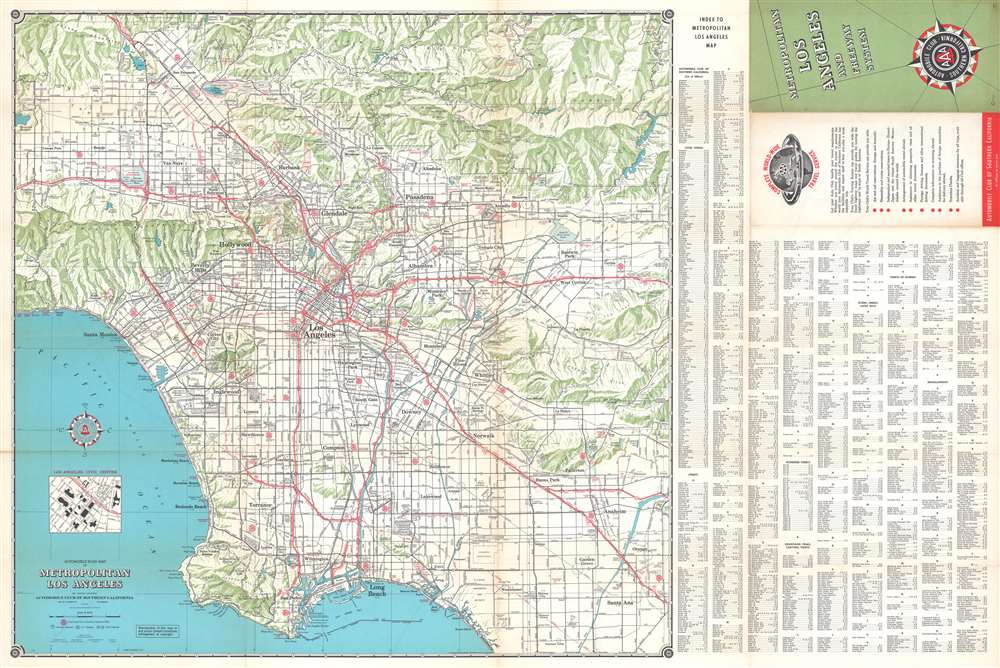
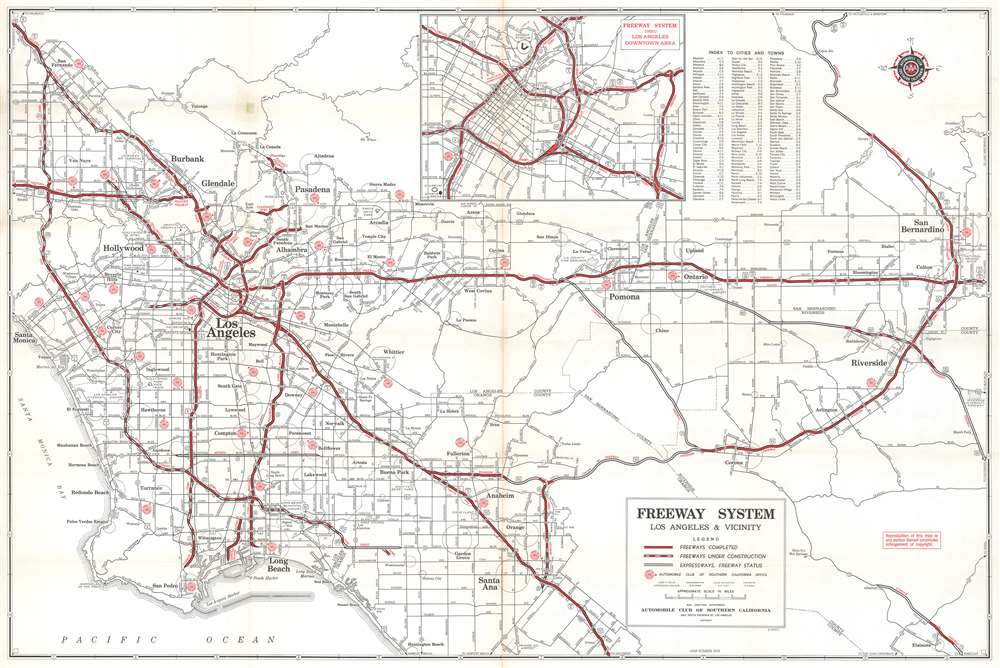
This is a 1970 Automobile Club of Southern California map of Los Angeles and vicinity, depicting from the Santa Susana and San Gabriel mountains south to Long Beach and Santa Ana. Los Angeles appears near center. Hollywood, Beverly Hills, Pasadena, Glendale, Burbank, Van Nuys, Manhattan Beach, Redondo Beach, and Anaheim rank among the identified cities. Red printed 'stamps' mark Automobile Club of Southern California offices, while red stippling and bold red lettering identify parks. Highways and freeways are illustrated in red, while other roads are in black. An index occupies the right side of the sheet and lists Automobile Club of Southern California offices; cities and towns; streets; mountains, peaks, canyons, and points; and points of interest among numerous other locations. A map of the freeway system of Los Angeles and vicinity is printed on the verso. An inset of downtown Los Angeles and its freeway system is situated along the top border on the verso.
Publication History and Census
This map was created and published by the Automobile Club of Southern California in 1970. Five examples are cataloged in OCLC and are part of the collections at Syracuse University, the University of South Carolina, the University of Arizona, the University of California San Diego, and Stanford University.Cartographer
The Automobile Club of Southern California (1900 - Present) is an auto club based in Los Angeles, California and an affiliate of the American Automobile Association (AAA). Founded in 1900, it was one of the first auto clubs in the United States and was dedicated to proposing traffic laws, improving road conditions, and the overall improvement of driving conditions. The Auto Club began producing its own maps in 1910, when it sent out its own team of cartographers to survey the state's roads. Its main office at the corner of Figueroa Street and Adams Boulevard was completed in 1923. Numbering nearly 8 million members in its home territory alone, today it is the largest single member of the AAA federation More by this mapmaker...
Condition
Very good. Exhibits light wear and toning along original fold lines. Verso repair to a fold separation. Map of Los Angeles and vicinity freeways printed on verso.
References
OCLC 830947641.