
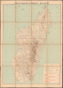
1903 Hausermann Folding Map of Madagascar

This item has been sold.
Carte des Missions Catholiques à Madagascar Supplément au Journal les Missions Catholiques, 1903.
France's 'Civilizing Mission' in Madagascar.
- Digital Map Information
- Suitable for large format printing
- File Size: 48.67 MB
- File Type: ZIP / TIFF
- ICC color profile embedded
- Delivered instantly via download link
France's 'Civilizing Mission' in Madagascar.
This is a large-format 1903 folding map of Madagascar, prepared by Rémy Hausermann for the missionary publication Les Missions Catholiques. It was produced as Catholic missionaries were dramatically expanding their footprint in Madagascar and leading the effort to eradicate the island's long-entrenched practice of slavery.A Closer Look
This map covers Madagascar along with the nearby smaller islands in the Comoros chain, including Mayotte, which is still an overseas département of France. Madagascar is divided into three neat sections, marked by red lines, indicating the limits of vicariates (dioceses). Cities and villages are labeled throughout, with those where a church or chapel is located or where a missionary or a vicar apostolic (bishop) is stationed noted with crosses. Ethnic groups are also recorded with capital letters, along with roads, railways (existing or under construction), and waterways. Mountains are illustrated with their elevation marked. The legend at the bottom-right provides statistics on the island's three vicarates, managed by the Jesuits, the Congregation of the Holy Spirit (Spiritans), and the Lazarists, respectively.Missionaries and the 'Mission Civilisatrice'
The turn of the 20th century marked a pivotal and often contradictory era for French missionaries in Madagascar. Following the French invasion in 1895 and the subsequent abolition of the Merina monarchy, Catholic and Protestant orders rapidly expanded their influence, most notably the Jesuits and the London Missionary Society. (Although the latter was British, it operated under the French colonial framework.) These missionaries viewed the island as a spiritual frontier and established a vast network of schools, clinics, and churches. Their presence was deeply intertwined with the 'civilizing mission' (mission civilisatrice), serving both as a moral justification for colonial rule and a primary vehicle for spreading the French language and culture.A central pillar of the missionary agenda during this period was the campaign against slavery. While the French colonial administration officially abolished slavery in 1896, in part to weaken the economic base of the Malagasy nobility, it was the missionaries who often spearheaded the social integration of the formerly enslaved. They established 'liberation villages' and provided education to the poorest classes, arguing that Christian egalitarianism was incompatible with human bondage. By offering a path to literacy and social mobility through the church, missionaries provided a refuge for those displaced by the collapse of the old feudal system. However, this often came at the cost of traditional ancestral customs.
Despite their humanitarian efforts, the relationship between French missionaries and the Malagasy people was fraught with tension. Many locals saw the missionaries' drive to eradicate 'pagan' practices as an assault on the very soul of Malagasy identity. Furthermore, while they fought against domestic slavery, missionaries often remained silent or complicit in the colonial administration's use of forced labor (prestations) for public works and on plantations, which many viewed as slavery under a different name.
Publication History and Census
This map was prepared by Rémy Hausermann and printed by Jean Noël Monrocq in 1903 as a supplement to Les Missions Catholiques, a publication of the Society for the Propagation of the Faith (Oeuvre de la propagation de la foi). Atypically, this example has been dissected and laid on linen for portability and durability. This map is cataloged in the holdings of only 10 institutions in OCLC, mostly in Europe, with the New York Public Library and the University of Wisconsin-Milwaukee being the only U.S. institutions holding examples.Cartographers
Rémy Hausermann (1843 - 1933) was a French map engraver who, among other roles, was the main engraver for the Missions Catholiques de Lyon, allowing him to introduce the geography of areas previously little known or unknown to a European audience. Little is known about his early life and training, but by 1879 he was the Vice President of the Congrès des Sciences géographiques. He was well-known and well-regarded in geographical study circles in the late 19th century, writing school textbooks on the subject and receiving accolades at the 1878 exposition universelle in Paris. Further Details...
Jean Noël Monrocq (December 25, 1819 - February 18, 1913) was a French printer and bookseller active in Paris in the mid to late 19th century. Monrocq was the son of a farmer, born on Christmas Day, hence his name, in Trelly, La Manche, France. In 1839, he moved to Paris for a more urban lifestyle. Although he had little formal education, he found work with the Parisian book and print seller Delarue. Meeting with success, he opened his own print shop in 1848. He initially applied for a bookseller's patent in 1853, but the application was initially rejected. It was formally approved in 1877. In 1859, he received a lithographer's patent for artistic and industrial prints for educational purposes. He took over the presses of Louis Etienne Stanislas Petit in 1859, but did not receive a formal intaglio imprint until 1865. In March 1874, he established a branch of his lithographic printing press in Ivry, Rue de Vitry, where he moved some of his equipment. He became known for zincographic lithography - the process of etching plates into zinc, which he falsely claimed to have invented. He did, nonetheless, contribute significantly to the industrialization of printing with zinc plates. Being of cheap materials, simple to make, and easy to modify, zinc plates became the standard for news printing. Zincography under Monrocq was also ideally suited to map production, and Monrocq produced a significant corpus of maps, spearheading the movement to centralize map production in France. The firm continued well after Monrocq's death, issuing maps for both Hachette Taride. For a time, his son, Léon Monrocq (1857 - 1902), worked with him, specifically printing maps, but tragically, he died young and did not inherit the business. The firm was taken over by the founder's son-in-law, who took the name Gaillac-Monrocq. Jean Noël Monrocq's grandson, Lucien Monrocq, eventually took over the business. Jean Noël Monrocq is interred in the family crypt at Paris's famous Père Lachaise Cemetery. Further Details...
Condition
Very good. Some toning and wear on old folds. Laid down on original linen - stable.
References
OCLC 1308980557, 556474921.