
1943 Fissore and Danoy Map of the Principality of Monaco


This item has been sold.
Principauté de Monaco.
Small but significant.
Choose a Collection:
- Digital Map Information
- Suitable for large format printing
- File Size: 34.29 MB
- File Type: ZIP / TIFF
- ICC color profile embedded
- Delivered instantly via download link
This Item
Enquire
Small but significant.
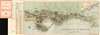
This is a c. 1943 J. Fissore and V. Danoy map of the Principality of Monaco, the second-smallest country in the world and also one of the richest. The map depicts the principality from the cemetery to Monte Carlo Beach and from the Route de la Moyenne Corniche to the Mediterranean. Charmingly executed, over one hundred locations throughout are identified. Among the identified locations are the palace, the cathedral, the museum of anthropology, the hospital, and several cinemas. Monuments, museums, theaters, post and telegraph offices, consulates, and banks are also identified in the index.Publication History and Census
This map was drawn by J. Fissore and and V. Danoy, printed by the Imprimerie Robaudy in Cannes, and published by the Monégasque National Office of Tourism c. 1943. Three examples of this map are catalogued in the OCLC, at the Library of Congress, the New York Public Library, and Stanford University.Condition
Very good. Wear along original fold lines. Exhibits some toning. Attached to original binder.