
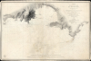
1833/ 1880 Depot de la Marine Harbor Chart of Montevideo, Uruguay


This item has been sold.
Plan du Port et de la Rade de Montevideo, dans Le Rio de la Plata, Leve en 1831, Par Mr. Lebourguignon Duperre, Ingenieur-Hydrographe, Chevalier de la Legion d'Honneur... 1833.
Early Chart of the Montevideo Road it its First Edition.
- Digital Map Information
- Suitable for large format printing
- File Size: 35.51 MB
- File Type: ZIP / TIFF
- ICC color profile embedded
- Delivered instantly via download link
Early Chart of the Montevideo Road it its First Edition.
This is a scarce Depot de la Marine nautical chart or map of Montevideo and its approaches, printed in about 1880 to update the first edition, which was published in 1833 and based on the 1831 surveys of Cyprien-Gabriel Le Bourguignon-Duperré. This state-of-the-art survey's updated detail reflects the bustling activity of the port and the rapid growth of Uruguay's new capital.A Closer Look
This large, detailed work presents the Rio de la Plata coast of Uruguay from Punta Yeguas in the west to the coast of Punta Carretas, beyond Punta Brava. Montevideo, which on the 1833 chart comprised only the walled and fortified Ciudad Vieja, is shown with its street grid spreading up the peninsula onto the mainland. The chart offers an unusual amount of inland coastal information, including villages overlooking Montevideo Bay; inland from the Ciudad Vieja, the town of Cordón is named. The coastal topography is presented in detail; across the bay from Montevideo, the Cerro de Montevideo and its lighthouse are very prominent. The Punta Brava lighthouse does not yet appear, but there is a fortification there. The chart includes a multiplicity of depth soundings and shows rocky shallows near the city approaches.Thoroughly Updated
Since its publication in 1833, this chart has been corrected substantially to record changes in the port. While this chart was executed from the same plate as was used in 1833, there are many changes evident. Latitude and longitude lines have been added, as has a simple compass rose. A note in the lower left indicates that the chart's corrections were recorded in 1870, 1872, 1873, 1876, and 1877; a notation on the compass rose indicates that the magnetic variation was taken in 1880.Comparison between the 1833 issue of this chart and the present example reveals a thorough update of the depth soundings throughout. Many buoys and beacons have been added, where none were marked on the 1833 chart. Along the shore of Montevideo Bay, significant changes have been noted in the development of piers and other shipping facilities, especially along the eastern shore of the bay from Punta del Fundo to the peninsula on which Montevideo's old city was built. In addition to the lighthouse atop the Cerro de Montevideo, the Punta Brava lighthouse is marked as well. Both are highlighted with original hand color.
The city itself is shown to have expanded significantly between 1833 and 1880. The city in 1833 had occupied only the outer half of the peninsula: here, the city's fortified wall extends from Punta Chica. Cagancha Square is shown and named. The Metropolitan Cathedral is marked Cathédrale Feu: not only as the Cathedral, but as a light for navigation.
A Working Chart
Pencil notations indicate that the chart was used at sea. Three positions are noted outside Montevideo Bay, with directional lines sighted to the Cerro de Montevideo and the Punta Brava lighthouses. The name of the ship - Tropique - is noted. We have been unable to connect this ship with any historical record, but a painting attributed to the ship portraitist Édouard Adam (1847 - 1929), 'The Ships La Pacifique and Tropique Passing at Sea', presents ships of the correct period, and may capture the one that moored using this chart.Publication History and Census
This chart was published by the Depot de la Marine in 1833. It remained in use long after, and this subsequent 1880 updated edition followed. We find no examples of this chart in institutional collections. It is scarce on the market.Cartographer
Dépôt des Cartes et Plans de la Marine (fl. 1720 - present), often called the Dépôt Général de la Marine, was a French hydrographic mapping organization founded in 1720 under Charles-Hercule of Albert de Luynes (1674 - 1734). Much like the U.S. Coast Survey, the British Admiralty, and the Spanish Deposito Hydrografico, the Dépôt was initiated as a storehouse and distribution center of existing nautical and marine charts. Eventually the Dépôt initiated its own mapping activities in an attempt to improve and expand upon existing material. Some of the more prominent cartographers and hydrographers associated with the of Dépôt Générale des Cartes were, Philippe Buache, Jacques-Nicholas Bellin, Giovanni Rizzi-Zannoni, Rigobert Bonne, and Jean Nicolas Buache. Further Details...
Condition
Very good. Few marginal mends. Pencil annotations preserved.
References
Not in OCLC. Rumsey 15934.498.