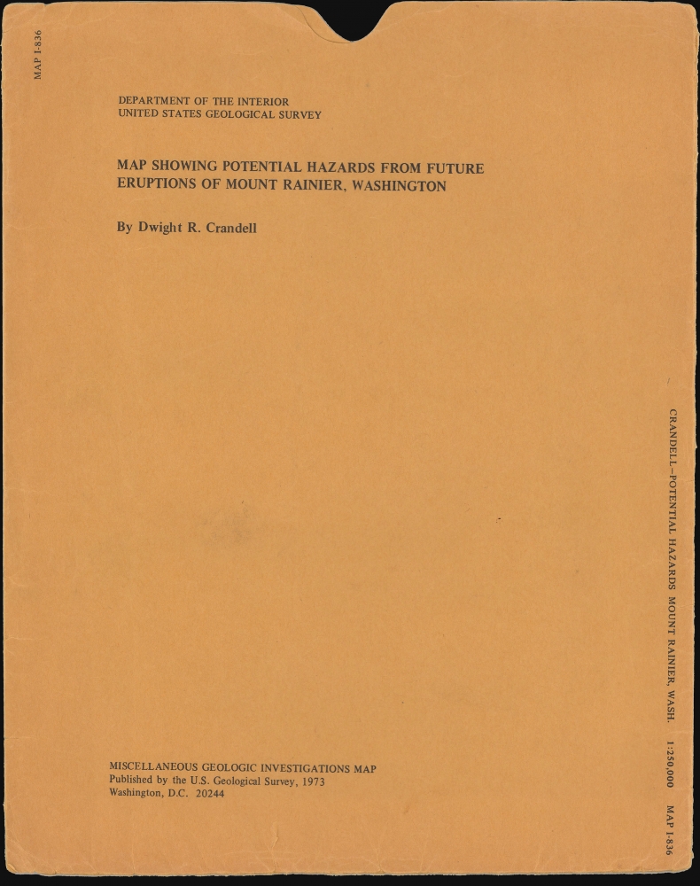
1973 U.S.G.S. Map of Mt. Rainier and Environs, Washington
MtRainierHazards-crandell-1973$750.00


Title
Potential hazards from future eruptions of Mount Rainier, Washington. / Miscellaneous Geologic Investigations Map I-836.
1973 (dated) 27.25 x 37.5 in (69.215 x 95.25 cm) 1 : 250000
1973 (dated) 27.25 x 37.5 in (69.215 x 95.25 cm) 1 : 250000
Description
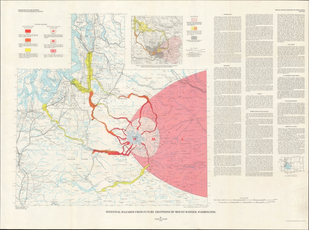
This is a 1973 Dwight 'Rocky' Crandell map of Washington State in the vicinity of the volcanic Mt. Rainier, considered North America's most dangerous active volcano. It illustrates the danger zones most at risk in a Mt. Rainier eruption.
A Closer Look
The map covers a large portion of Washington, including Puget Sound and the northern Cascade Range, with a focus on the volcanic Mt. Rainier. Cities and towns, administrative boundaries (including national parks and forests), airports, highways, waterways, mountains, ridges, buttes, lookout towers, and other features are labeled throughout. Shaded lines indicate the areas at the highest risk of mudflows in the event of an eruption of Mt. Rainier. A larger shaded area, mostly surrounding and to the east of the mountain, similarly marks areas at the highest risk of tephra (airborne rock debris) in the event of an eruption. An inset map at the top-right reflects Crandell's research on past eruptions of Mt. Rainier, namely the Osceola and Electron Mudflows (or Lahars), roughly 5,600 and 500 years ago, respectively. The text at right discusses Crandell's research and explains the impetus for the map, that is, the very real risk of Mt. Rainier erupting and threatening nearby populated areas. A small index map below the text displays the area covered in the main map as part of a wider index map of Washington state.Mt. Rainier
Mount Rainier, a towering stratovolcano located in Washington State, is the highest peak in the Cascade Range at 14,411 feet and is considered one of the most dangerous volcanoes in the United States. Formed over the past 500,000 years, its geologic history is marked by repeated cycles of eruption, lava flows, and massive debris avalanches that have shaped its steep, glacier-covered slopes. Rainier's most recent volcanic activity occurred in the 19th century, but it remains an active volcano, monitored closely due to its potential for future eruptions. The primary hazard is not just explosive activity but the risk of lahars - fast-moving volcanic mudflows triggered by melting ice or structural collapse - which could devastate surrounding communities in the densely populated Puget Sound region.Publication History and Census
This map was prepared by Dwight 'Rocky' Crandell in 1973 for the U.S. Geological Survey. It is based on Crandell's groundbreaking research on the geologic history of the region, which was published by the Geological Survey in the 1967 report Volcanic Hazards at Mount Rainier, Washington. While the earlier report is widespread in institutional collections, the present map is only noted in the OCLC among the holdings of the University of New Mexico, San Francisco State University, and the Bibliothèque Interuniversitaire de la Sorbonne, with a later (1980) reprint held by the Université d'Ottawa.CartographerS
Dwight R. 'Rocky' Crandell (January 25, 1923 - April 6, 2009) was a noted volcanologist at the U.S. Geological Survey best known for his studies of volcanoes in the Pacific Northwest. Born in Galesburg, Illinois, Crandell attended the local Knox College where he studied geology (earning him his nickname), then joined the U.S. Army in World War II, reaching the rank of Lieutenant. After the war, he received a doctorate at Yale University and afterwards (in 1951) went to work for the U.S.G.S. in Golden, Colorado, near Denver. Crandell and Donal R. Mullineaux (1925 - 2021) were assigned to study the geology of the Puget Sound region. In the process, they discovered and documented that the area's geology had not been formed by glaciers, as previously thought, but largely by activity from the presumed-dormant Cascade Volcanoes. The pair pioneered the study of volcanic ash, mudflows, and pyroclastic flows, as opposed to hardened lava flows, to determine future risk of eruptions. Realizing that so many volcanoes were recently active and could erupt again in the near future, causing considerable damage to life and property in the process, Crandell and Mullineaux developed a methodology for volcano hazard assessment. In 1978, they correctly predicted that Mt. St. Helen's could erupt in the following twenty years, and in fact it erupted only two years later to disastrous effect. Combining lessons learned from the disaster with Crandell and Mullineaux's research, better early warning and disaster preparedness systems were developed after 1980. More by this mapmaker...
The United States Geological Survey (1878 - Present), aka the U.S.G.S., is a scientific agency of the United States government, which was founded in 1879. USGS scientists study the landscape of the United States, its natural resources, and the natural hazards that threaten it. The organization has four major science disciplines: biology, geography, geology, and hydrology. It is a bureau of the United States Department of the Interior and is the department's only scientific agency. Learn More...
Condition
Very good. Verso repairs to fold separations. Pinholing in all 4 corners. Light wear along original fold lines and slight loss at a few fold intersections. Accompanied by original slipcase.
References
OCLC 966766418, 494225119, 57161105 (1980 reprint).