
1678 Kircher Atlas of the Interior of the World w/Volcanic Systems

This item has been sold.
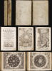
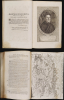
Athanasii Kircheri e Soc. Jesu Mundus subterraneus.
Kircher's exploration of the unseen world below.
Kircher's exploration of the unseen world below.
This is the 1678 edition of polymath Athanasius Kircher's celebrated description of the subterranean world, the first serious theoretical exploration of the physical structure of the Earth. Kircher's own experiences of the 1637 eruption of Mount Vesuvius and the catastrophic Calabrian earthquakes of 1638 led him to develop theories regarding the unseen underpinnings of the world.A Closer Look
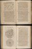
The work's maps focus on Kircher's theories that the subterranean world was made up of intermeshed systems of fire and water, foreshadowing modern ideas of vulcanology and the subterranean flow of water. But Kircher's curiosity led him broadly in his efforts to understand the hidden parts of creation. Thus, the two volumes, containing 12 chapters, touch on geometry, geography, magnetism, hydrography, climatology, paleontology, alchemy, the study of poisons, metallurgy, mining technology, and the certainty that beneath the surface dwelt a multiplicity of dragons. Technical innovations in the processes of distillation (essential to alchemists and chemists alike) are explored. A chapter is even dedicated to the eminently practical legal question as to whether gold, produced by alchemical means, could be lawfully sold as mined gold. While Kircher's explorations may not now seem modern - : his contemporary Descartes thought Kircher a charlatan - if Kircher's answers were rooted in Aristotelian, alchemical ideas, his questions were reflective of a European world moving towards a more rationalistic, recognizably modern approach to understanding the world.The Maps
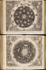
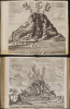
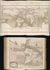
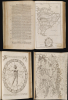
Kircher's work is embellished with an array of visually impactful maps, most illustrating his theories that subterranean channels connecting bodies of water governed the world's currents, that the world's volcanoes were similarly linked, and that the two systems interacted. The world map is notable for being the first to attempt the illustration of hydrographic currents. But Kircher's maps and views were not confined to the Earth. The depiction of the sun is particularly notable in its presentation not as a perfect orb, but as a post-Galilean, fiery sphere in flux, with ejections, sunspots, and areas of greater brightness. Both the solar view and that of the Moon are derived from fellow Jesuit Chistoph Scheiner (1573 - 1650) and reflect the increasing embrace of modern astronomy among Catholic thinkers. Kircher's work also contains two particularly magnificent engravings depicting the most famous volcanoes of his day, based on his own observations: Vesuvius and Etna; the Vesuvius plate is very often lacking in surviving examples of Mundus Subterraneus.Revealing the Source of the Nile
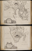
The present, 1678 edition expanded upon its predecessors - not only in its text, but also in the maps it contained. Three maps in particular - Vera et Genuina Fontium Nili Topographia, Chorogaphia Originis Nili, iuxta observationem Odoardi Lopez, and Chorographia Originis Nili Seu Fontium Ipsius Ex Arabum Geographia deprompta - appear only in this 1678 edition of the Mundus Subterraneus. They represent comparative theories on the origins of the Nile: an ancient one according to Arab sources, the discredited 16th-century model of Duarte Lopez, and a new one based on the report of Jesuit explorer and missionary Pedro Paez, presenting this last as the true discovery of the source of the Nile, replacing the former ones. The map had initially accompanied Kircher's 1652 Oedipus Aegyptacus, which contained the first printed report of Paez's 1618-1621 finding of the source of the Nile at Lake Tana (the missionary's own report would not be committed to print until the 20th century.) Kircher included his text concerning the source of the Nile in the 1665 and 1668 editions of Mundus subterraneus, but neglected to supply the illustrative map. This third edition of 1678 corrected the omission. The three maps were engraved to a single plate, and typically appear on a single fold-out sheet in this work; the separation of the plate for binding in two parts appears to be unique to this example of the book.Kircher's Hydro-Volcanic System
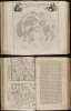
Inspired by two weeks of earthquakes in Calabria in 1638, and the volcanic eruption of Vesuvius in 1637, Kircher postulated two interacting systems, a volcanic system, as seen here, and a hydrosystem of underground seas and rivers. Kircher hypothesized that the volcanic system was centered in the core of the Earth, but connected via networks of tunnels and certain subterranean focal points to the surface. The volcanic system interacted with the hydrosystem by superheating parts of it, causing the movement of water to and from the surface - hence ocean currents, earthquakes, tides, and more.Publication History and Census
Kircher's Mundus Subterraneus was first published in 1665 by Johannes Janssonius van Waesberge (son-in-law of the Amsterdam mapmaker Jansson); a second edition appeared in 1668. This much-expanded third edition was published in 1678. The book is well represented in institutional collections, but often missing many of the plates that are present in this example.Cartographer
Athanasius Kircher (May 2, 1602 - November 27, 1680) was a 17th century German Jesuit scholar and one of the most respected and remarkable men of his time. A master of languages, mathematics, science, geography, physics and oriental studies, many consider Kircher to be 'the last true Renaissance man.' Kircher attained almost global fame in his lifetime for his numerous scholarly publications. Indeed, Kircher was the first documented scholar able to fully support himself on his own work, which, in his case, included some forty volumes on diverse fields. As a Catholic in Germany, Kircher was frequently at odds with the rising powers of Protestantism. Consequently, in 1628 he joined the priesthood and after extensive world travels eventually settled in Rome. There he was employed as a Professor of Mathematics and Oriental Languages at the Collegio Romano. Inspired by the eruption of Vesuvius in 1637 and the two weeks of earthquakes that shook Calabria in 1638, Kircher turned his considerable intellect to the natural world. Kircher's research into Geography and Oceanography culminated in the postulation that tides and currents were caused by water moving to and from a great subterranean ocean. Kircher published his geographic work in the important 1665 Mundus Subterraneus, which in addition to several world and oceanic charts, included a fascinating map of Atlantis. Kircher is nonetheless, not unimpeachable. One anecdote tells how a rival scholar presented Kircher with a manufactured gibberish manuscript he claimed to be an recently discovered ancient Egyptian text in need of translation. Kircher produced the translation instantly. In addition to his significance as a scholar, Kircher is best known for his invention of the Magic Lantern, precursor to modern cinema. He also founded the Museum Kircherianum in Rome. Further Details...
Source
Kircher, A., Mundus Subterraneus, (Amsterdam: Jannson van Waesberge) 1678.
Condition
Very good. Two folio volumes bound in original vellum. Volume 1 [20], 366, [6]; Signatures: *⁴ 2*⁶ A-2Z⁴ 3A²; Volume 2 [10], 507, [9] Signatures: *⁴ A-3R⁴ 3S⁶. 20 engraved plates and maps of which 10 double-page and 4 folding, 5 letterpress tables. Volvelles present in volume 1, but uncut. Few marginal mends; toning and cracking at lower extremities of a few plates; some areas of foxing and toning. Overall a strong example.
References
OCLC 7480666.