This item has been sold, but you can get on the Waitlist to be notified if another example becomes available.
1972 Pauline Baynes Promotional Map of C. S. Lewis' Narnia
Narnia-baynes-1972$450.00

Title
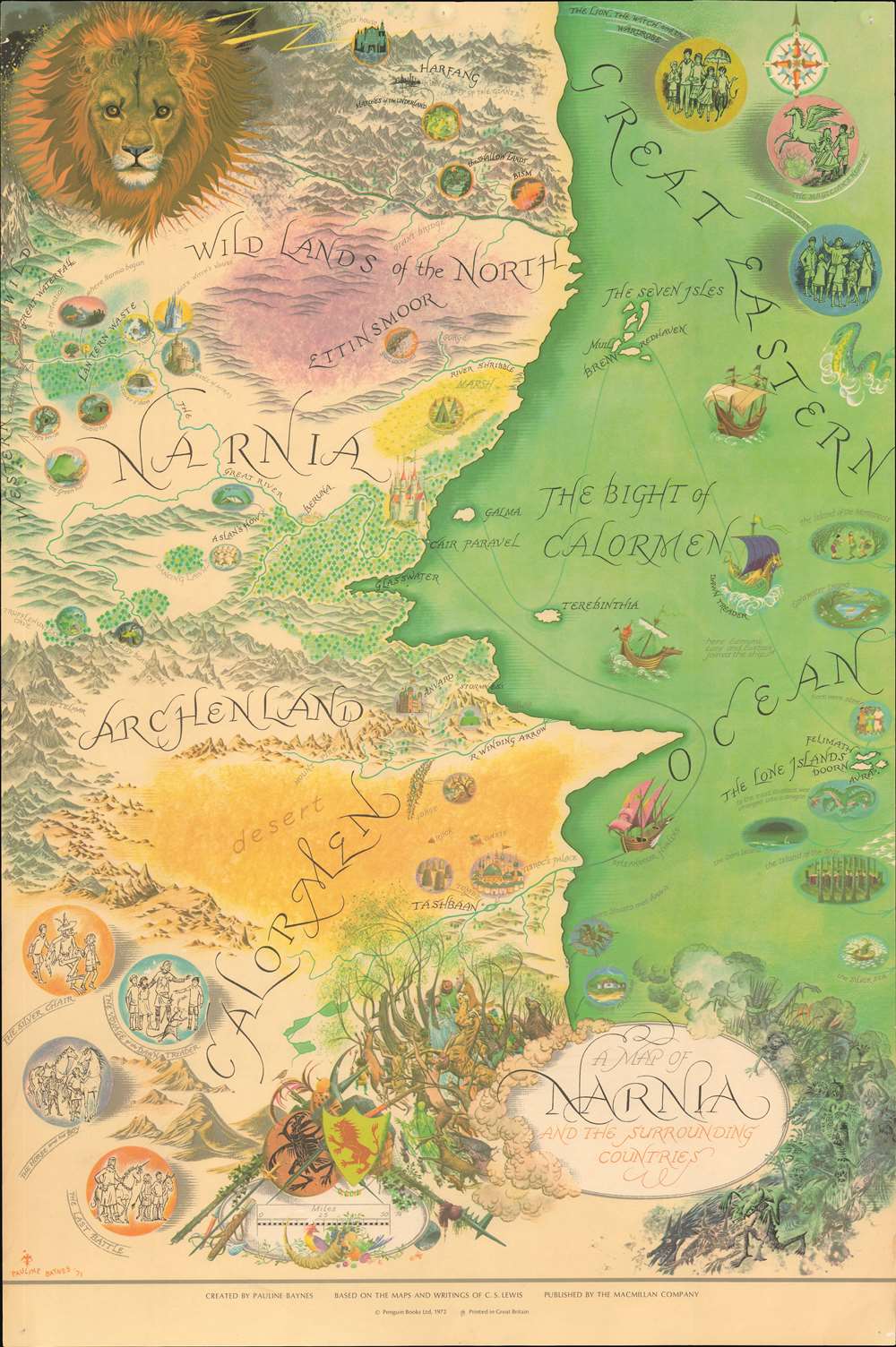
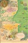
A Map of Narnia and the Surrounding Countries.
1972 (dated) 30 x 20 in (76.2 x 50.8 cm) 1 : 1267200
1972 (dated) 30 x 20 in (76.2 x 50.8 cm) 1 : 1267200
Description
A very attractive example of the rare 1972 Pauline Baynes' promotional poster map of C. S. Lewis' fantasy world Narnia, the setting for the 8-volume Chronicles of Narnia. Although published nearly 20 years after C. S. Lewis' death, this map offers the first representation of Narnia as a comprehensive whole. It is based directly on Bayne's collaboration with C. S. Lewis (1898 - 1963) from the early proof editions of the novels in the 1950s, through his death. Although Baynes and Lewis never became close, as she did with J. R. R. Tolkien (1892 - 1973), she illustrated his work both before and after his death.
The Map
The head of the creator-lion Aslan looks over the map from the upper left corner. Centered on Cair Paravel, seat of High King Peter and his siblings, coverage extends from the Harfang, the city of Giants, to Tashbaan, capital of semi-arid empire of Calormen. It is bounded on the west by mountains, where the pass to Telmar is noted, and the Western Wild; and on the east by the Great Eastern Ocean, the Bight of Calormen, and the Lone Islands. Maritime routes trace the voyages of the Dawn Treader and the Spleandour Hyaline. Vignette medallions surrounding the map highlight each of the 8 books in the Chronicles of Narnia. Smaller medallions throughout illustrate people and events from the novels.Praise When it was Published
In the children's book magazine, Puffin Post (Vol. 6, No. 2, 1972), the map was promoted at the time of publication,A Map of Narnia - Follow the route of the Dawn Treader, see Cair Paravel and the Lone Islands. Now, for the first time, you can see Narnia and the surrounding countries on one beautiful map measuring 20 ins by 30 ins. Pauline Baynes, who illustrated all of the Narnia books, has created a really glorious poster for us which you can hang on your wall or pin on a notice board.
Publication History and Census
Pauline Baynes drew this map in 1971 for publication in 1972. It was planned to promote the release of a new paperback edition of the Chronicles of Narnia. The first printing by Penguin Books bears an imprint of H. L. Vickery Ltd. at bottom center, as well as the text 'First printing 1972'. The present example was published concurrently, also in England, by Macmillan, for the American edition. This map was popular when issued and produced in some quantity. Most examples, sadly, had a short lifespan pinned to the walls of children's bedrooms, leading to considerable scarcity today.Cartographer
Pauline Diana Baynes (September 9, 1922 - August 1, 2008) was an English illustrator and commercial artist. Pauline was born in Hove, Sussex, England and spent her early years in Agra and Mussoorie, India, where her father was a magistrate with the British imperial Indian Civil Service. At age 5, she returned with her mother and sister to England, where she lived a nomadic life - seeing very little of her father thereafter, who remained in India. She studied at the Beaufort School, then at the Farnham School of Art, then at the prestigious Slade School of Fine Art. During World War II she severed with the Women's Voluntary Service at the Camouflage Development Training Centre at Farnham Castle. After the war she submitted several drawing to the publisher George, Allen and Unwin, through which they caught the attention of fantasy novelist J. R. R. Tolkien. Her subsequent collaboration with Tolkien including illustrations for Farmer Giles of Ham, The Adventures of Tom Bombadil, The Hobbit, and The Lord of the Rings, among others, as well as supplementary promotional work, including several maps. Baynes' illustrations for Tolkien's, caught the attention of C. S. Lewis, who contracted her to illustrate for the Chronicles of Narnia. She continued to illustrate for books and novels until she died of ischaemic heart disease at 85. More by this mapmaker...
Condition
Very good. A few minor pinholes at corners, reinforced on verso.
References
OCLC 70520633. Elphinstone, Abi, 'Beyond the Blue Door: Routes through Narnia', The Writers Map, pg. 144 - 153, illustrated pg. 145.