This item below is out of stock, but another example (left) is available. To view the available item, click "Details."
Details
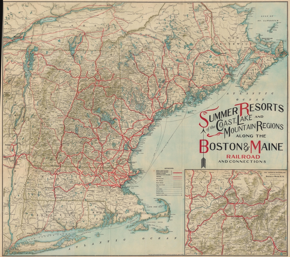
1913 Matthews-Northrup Map of New England Summer Resorts
1913 (dated) $350.00
1910 Matthews-Northrup Map of New England Summer Resorts
NewEngland-matthewsnorthrup-1910
Title
1910 (undated) 25.5 x 28.5 in (64.77 x 72.39 cm) 1 : 9000000
Description
A Closer Look
Coverage embraces from New York City northwards along the Atlantic coast as far as New Brunswick and the Gulf of Saint Lawrence and from the Hudson River Valley to the Atlantic Seaboard. Strong red lines highlight the Boston and Maine Railroad, as well as the Maine Central Railroad and the Somerset Railroad. Only a few years later the network expanded to include the 'New York, New Haven, and Hartford Railroad', and the 'Boston and Albany Railroad', along with several others. Thinner lines trace routes of connecting railroads, while other railroads, electric railways, stage lines, and canals, are illustrated by various notations. An inset map on the lower right highlights 'American Switzerland', the White Mountains of New Hampshire.Boston and Maine Railroad
Commonly known as the 'B and M', the Boston and Maine Railroad was chartered in New Hampshire on June 27, 1835. The firm consolidated several smaller companies, including the 'Andover and Haverhill Railroad' and the 'Boston and Portland Railroad'. It merged with the 'Maine, New Hampshire, and Massachusetts Railroad' in 1842, but retained the 'Boston and Maine' operating name. In the subsequent decades it acquired or leased several other railroads, including the 'Boston and Lowell' (1887), Northern (1884), Connecticut River (1893), 'Concord and Montreal' (1887), and Fitchburg (1900). In 1910 it was acquired by J. P. Morgan's 'New York, New Haven and Hartford Railroad'. The firm initially prospered on the development of mill towns throughout New England and later capitalized on tourism from Boston and New York. Nonetheless, the railroad went through a decline during the Great Depression, when most of the New England textile mills closed. Part of the 'Boston and Maine' network remains in operation today under the Pan Am Railways (PAS) brand.Publication History and Census
This map was published c. 1910 by Matthews Northrup for the 'Boston and Maine Railroad'. The present example is not dated (a rarity for this map series), but it corresponds with the 1910 edition digitized by the Osher Map Library at the University of Southern Maine. We note two examples of the 'Season 1910' edition cataloged in OCLC: Osher Map Library and the University of Wisconsin Milwaukee. This map was published in several editions from different years, as late as 1915.Cartographer
Matthews-Northrup Works (fl. c. 1895 - 1930) were a Buffalo, New York based, in their own words, "writing, designing, engraving, printing, [and] binding" firm. The firm was founded by James Newson Matthews (November 21, 1828 - December 20, 1888) as the J. N. Matthews Company. William Phelps Northrup (April 2, 1850 - February 2, 1929) later joined the company as an apprentice and then partner, at which point the firm was reincorporated as the Matthews-Northrup Works. The Matthews-Northrup Works rose to prominence as publishers and printers of railroad maps, with dozens to their credit. When James died, his shares were inhered by George Edward Matthews (1855 - 1910), who ran the business until his death in 1910. Also in 1910, they famously redesigned the cover of National Geographic Magazine. Despite some six previous cover changes in just 21 years, the Matthews-Northrup layout proved so popular that it was used for nearly 50 years. The firm can also take credit for the Winchell typeface, designed in 1903 under E. E. Winchell's tenure as art director. Curiously, the partners of Matthews-Northrup maintained an unusual affectation in which only the officers of the company could wear beards or mustaches. In this same spirit, the firm also had its own private social club, the Fellowcraft Club, where the all-male employees could relax, play pool, drink and dine. Matthews-Northrup maintained offices on Washington Street, Buffalo, where they were based, as well as Madison Square, New York City, Garden Tower, Boston, and the Citizens Building in Cleveland. More by this mapmaker...

