
1860 Dodge Wall Map of New Hampshire

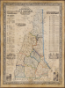
Township and Rail Road Map of New Hampshire.
Iron Rails across the Granite State.
- Digital Map Information
- Suitable for large format printing
- File Size: 4144.03 MB
- File Type: ZIP / TIFF
- ICC color profile embedded
- Delivered instantly via download link
Iron Rails across the Granite State.
This is Jacob Richard Dodge's 1860 wall map of New Hampshire, printed by L. H. Bradford. It provides a detailed overview of the state, highlighting its rail network and including statistics, geographical information, and vignette illustrations.A Closer Look
The map covers New Hampshire, with portions of Vermont, Maine, Massachusetts, and Canada. Cities, towns, and villages are labeled throughout, with counties traced in hand color and shaded for easy distinction. The boundaries of towns and land grants are also outlined. Mountains, lakes, and rivers are indicated throughout, while roads and rail lines (existing and proposed) are sketched. As the title states, railroads are highlighted, most congregating in the southern portion of the state and converging on Concord, but also extending to the northernmost reaches of the state in Coos County.Information surrounding the map includes vignette illustrations of Portsmouth, Nashua, mills in Manchester, the House of Reformation in Manchester, the State House in Concord, the Old Man of the Mountain in Franconia, and the Flume in Lincoln. A small inset railroad map of Boston and vicinity appears at bottom right. Tables include statistics on the state's counties' population and property values, the population of various cities and towns (with the Indian meaning of their name, where applicable), lakes, rivers, bays, harbors, islands, and more.
Iron Rails across the Granite State
The early history of railroads in New Hampshire reflects the state's transition from an isolated, rural economy to one increasingly tied to regional trade and industry in the 19th century. The first significant railroad development began in the 1840s, with Concord and Manchester linked by rail in 1842, as local investors and industrialists sought to connect inland towns with seaports and with the growing industrial centers of Massachusetts and Maine. Additional rail lines were added later in the 19th century to expand to additional markets and for passenger travel, including to the Lakes Region and the White Mountains.In the decades after this map's publication, railroads went through a process of consolidation, with many of the lines seen here being subsumed by giants like the Boston and Maine Railroad, the Grand Trunk Railway, and the Concord and Montreal Railroad. Some portion of these lines still operate for freight and passenger service today, including the Conway Scenic Railroad, which operates along part of the old Great Falls and Conway Railroad (not even projected to reach Conway yet on this map, despite its name).
Publication History and Census
This map was printed by L. H. Bradford of Boston and published by Dodge in Nashua in 1860. Dodge published four editions of the present map between 1854 and 1860, reflecting the rapidly evolving rail network of the state. Each edition not only added new information on railroads and updated the state's geography, but also became more elaborate, especially the information and illustrations in the margins, making this the most detailed edition. We note three examples of the 1860 edition cataloged in OCLC, held by Dartmouth College, the New Hampshire Historical Society, and the British Library. Rare to the market.Cartographers
Jacob Richard Dodge (September 28, 1923 - c. 1890) was an American publisher, poet, and journalist. Born in New Boston, New Hampshire, Dodge learned the art of printing in the offices of the Amherst Cabinet, a local newspaper. After graduating from school he accepted a post as a schoolmaster in Mississippi, where he remained for five years, before returning to Nashua, New Hampshire. During this period in Nashua he published his only map, a railroad guide and wall map of New Hampshire. In 1855 he moved to Ohio, where he published the American Ruralist, a regional agricultural newspaper. In 1861 Dodge again relocated, this time to Washington D. C. There he took a position as Senate Reporter for the National Intelligencer. From 1866 to 1878 he worked as Statistician for the Department of Agriculture. In this role he was sent to Europe to represent United States agriculture at the 1873 Vienna Exhibition. Dodge continued to work in statistics with the U.S. Government until the 1880s. It is unclear when Dodge died. Further Details...
Lodowick Harrington Bradford (November 10, 1820 - December 13, 1885) was a Boston based engraver lithographer active in the second half of the 19th century. Bradford was born in Boston, Massachusetts. He studied as a line engraver before transitioning to the then new art of lithography. He even invented his own photolithographic ambrotype process that created a durable photographic picture on lithographic stone. In 1849 he partnered with Ebenezer Tappen (1815 - 1854) to form the Boston firm of Tappan and Bradford. The partnership remained active until Tappan's untimely death in January, 1854. From 1854 to 1859 Bradford continued to operate the firm, but the imprint changed to 'L. H. Bradford and Company.' It is not clear who the 'and Company' was, possibly Tappan's heirs? From late 1859 until his 1870, he printed under 'L. H. Bradford.' His last known lithographs appeared in 1860, but he did continue copper and steel engraving until his death. Bradford was married to Martha Brown, from an old Gloucester Family. After his wedding in 1849, he divided his time between Gloucester and Boston. In Gloucester he made the acquaintance of the local painter Fitz Henry Lane (1804 - 1865) and worked with him to produce several views in the 1850s. He died on the road between Boston and Gloucester in 1885. Further Details...
Condition
Very good. Some foxing and toning. Devarnished and laid down on fresh linen.
References
Cobb, New Hampshire Maps to 1900, #217. OCLC 556778561. Dartmouth College Baker-Berry Library, Evans Map Room Special: G3740 1860 .D64. New Hampshire Historical Society Object ID: 912.778 D644 1860.