This item has been sold, but you can get on the Waitlist to be notified if another example becomes available, or purchase a digital scan.
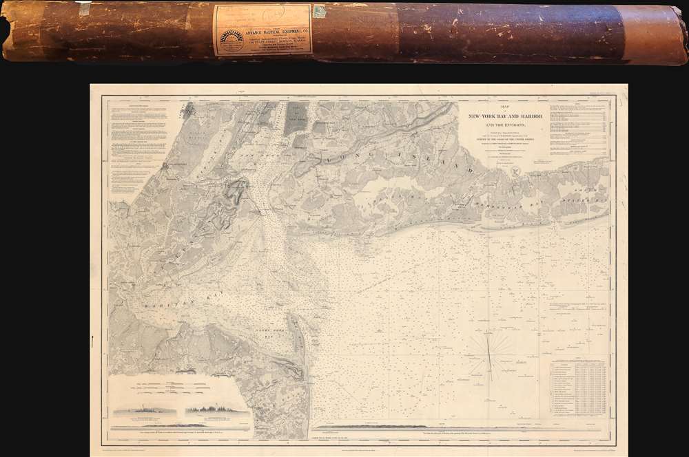
1845 U.S. Coast Survey Nautical Map of New York Harbor w/ original mailer
NewYorkBayandHarbor-uscs-1845$475.00


Title
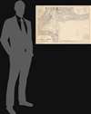
Map of New-York Bay and Harbor and the Environs.
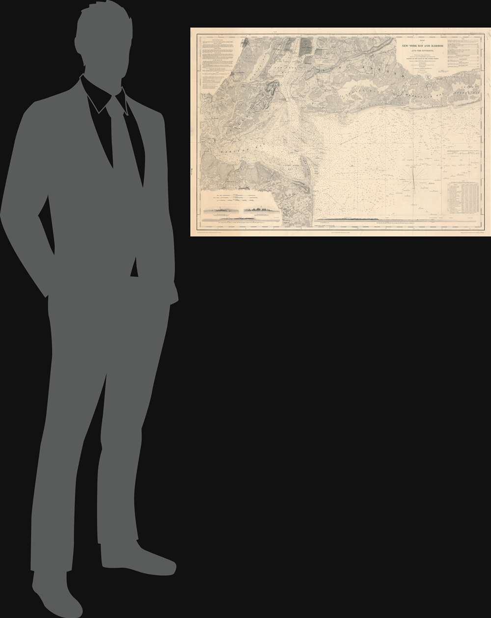
1845 (dated) 25.25 x 36 in (64.135 x 91.44 cm) 1 : 80000
1845 (dated) 25.25 x 36 in (64.135 x 91.44 cm) 1 : 80000
Description
This is the 1845 first edition of the U.S. Coast Survey nautical chart or maritime map of New York Bay and Harbor and its environs - uniquely accompanying its original mailing tube. The chart depicts from Newark to South Oyster Bay and from the City of New York to Sandy Hook and Black Point.
A Detailed Nautical Chart
Highly detailed and meticulously engraved, depth soundings fill New York Bay, Raritan Bay, and the New York/New Jersey Bight. Numerous sailing hazards are indicated throughout, all of which are labeled. New York City is illustrated up to 28th Street, including Washington Square Park, Union Square Park, and Madison Square Park. Both Williamsburg and Brooklyn are illustrated and labeled on Long Island. Coney Island and Rockaway Beach are illustrated along the southern coast of Long Island.Shore Profiles
Situated along the bottom border, several profile views intended to help mariner recognize visible coasts. These include the Sandy Hook Lighthouse from different directions, and a view of the opening of the Old North Channel. A table containing information concerning the direction and force of currents throughout New York Bay and Harbor is included on the lower right. Sailing directions are included in the upper left, while other notes pertaining to the chart's use are included in the upper right.Publication History and Census
This chart was produced from a survey directed by Ferdinand Rudolph Hassler, the first Superintendent of the United States Coast Survey, with triangulation, topography, and hydrography work completed by several teams of surveyors and their assistants, and published by the United States Coast Survey in 1845 when A. D. Bache was superintendent. This map is well represented in institutional collections, but it is scarce on the private market.CartographerS
The Office of the Coast Survey (1807 - present) founded in 1807 by President Thomas Jefferson and Secretary of Commerce Albert Gallatin, is the oldest scientific organization in the U.S. Federal Government. Jefferson created the "Survey of the Coast," as it was then called, in response to a need for accurate navigational charts of the new nation's coasts and harbors. The spirit of the Coast Survey was defined by its first two superintendents. The first superintendent of the Coast Survey was Swiss immigrant and West Point mathematics professor Ferdinand Hassler. Under the direction of Hassler, from 1816 to 1843, the ideological and scientific foundations for the Coast Survey were established. These included using the most advanced techniques and most sophisticated equipment as well as an unstinting attention to detail. Hassler devised a labor intensive triangulation system whereby the entire coast was divided into a series of enormous triangles. These were in turn subdivided into smaller triangulation units that were then individually surveyed. Employing this exacting technique on such a massive scale had never before been attempted. Consequently, Hassler and the Coast Survey under him developed a reputation for uncompromising dedication to the principles of accuracy and excellence. Unfortunately, despite being a masterful surveyor, Hassler was abrasive and politically unpopular, twice losing congressional funding for the Coast Survey. Nonetheless, Hassler led the Coast Survey until his death in 1843, at which time Alexander Dallas Bache, a great-grandson of Benjamin Franklin, took the helm. Bache was fully dedicated to the principles established by Hassler, but proved more politically astute and successfully lobbied Congress to liberally fund the endeavor. Under the leadership of A. D. Bache, the Coast Survey completed its most important work. Moreover, during his long tenure with the Coast Survey, from 1843 to 1865, Bache was a steadfast advocate of American science and navigation and in fact founded the American Academy of Sciences. Bache was succeeded by Benjamin Pierce who ran the Survey from 1867 to 1874. Pierce was in turn succeeded by Carlile Pollock Patterson who was Superintendent from 1874 to 1881. In 1878, under Patterson's superintendence, the U.S. Coast Survey was reorganized as the U.S. Coast and Geodetic Survey (C & GS) to accommodate topographic as well as nautical surveys. Today the Coast Survey is part of the National Oceanic and Atmospheric Administration or NOAA as the National Geodetic Survey. More by this mapmaker...
Alexander Dallas Bache (July 19, 1806 - February 17, 1867) was an American physicist, scientist and surveyor. Bache is best known in cartographic circles as the Superintendent of the U.S. Coast Survey from 1843 to 1865. Born in Philadelphia, Bache, a great grandson of the statesman and inventor Benjamin Franklin, had a varied career primarily focused on education. He toured Europe on behalf of Girard College and composed an important treatise on European Education. Later he served as president of Philadelphia's Central High School and was a professor of natural history and chemistry at the University of Pennsylvania. On the death of Ferdinand Rudolph Hassler, Bache was appointed Superintendent of the United States Coast Survey. Picking up where Hassler left off Bache presided over the Survey during its most prolific period and oversaw the mapping of most of the United States coastline. To this day his name appears on countless marine pilot books and U.S. Coast Survey nautical charts. For his work he was elected Associate Fellow of the American Academy of Arts and Sciences, a Fellow of the Royal Society of Edinburgh, and a Foreign Member of the Royal Society. Following the Civil War, Bache was elected a 3rd Class Companion of the Military Order of the Loyal Legion of the United States. He died at Newport, Rhode Island and was buried in the Congressional Cemetery in Washington, DC, where he is commemorated with a monument built by American architect Henry Hobson Richardson. Learn More...
Andrew Atkinson Humphreys (November 2, 1810 - December 27, 1883) was a career U.S. Army officer. Born in Philadelphia, Pennsylvania, Humphreys came from an illustrious family. His grandfather is remembered as the 'Father of the American Navy', because he served as the chief naval constructor from 1794 - 1801, and designed the first U.S. warships, including the USS Constitution. Samuel Humphreys, Andrew's father, designed the USS Pennsylvania, the largest and most heavily armed ship at the time. Humphreys graduated from Nazareth Hall (modern day Moravian College and Theological Seminary), then entered the United States Military Academy at West Point. Humphreys graduated on July 1, 1831, was commissioned as a second lieutenant, and joined the Second Artillery Regiment. in South Carolina. In the summer of 1836, Humphreys and his regiment went to Florida to fight in the Seminole Wars. Disgusted by the war's mismanagement, Humphreys resigned his commission on September 30, 1836, and became a civil engineer. Nearly two years later, on July 7, 1838, Humphreys rejoined the U.S. Army as a 1st lieutenant in the Corps of Topographical Engineers. In 1844, Humphreys was put in charge of the Central Office of the U.S. Coast Survey in Washington, D.C. He received a promotion to captain in 1848. Humphreys began an extensive survey of the Mississippi River Delta in 1850, a project that lasted ten years. He also worked on the Pacific Railroad Surveys from 1853 - 1857. During these years just before the American Civil War, Humphreys earned a glowing reputation as a scientist both nationally and abroad. Humphreys was promoted to major at the beginning of the American Civil War and became the Army of the Potomac's chief topographical engineer. During the war, Humphreys fought beside McClellan during the Peninsula Campaign, when he was prmoted to brigadier general, given command of a division, and saw combat at the Battle of Antietam, the Battle of Fredericksburg, and the battle of Chancellorsville. He was transferred to a different division just before the Battle of Gettysburg, where, because of poor command decisions by his immediate superior, his division was annihilated. Humphreys was promoted to major general after the Battle of Gettysburg and consented to becoming General Meade's chief of staff, a position he had been offered in the days before Gettysburg. He served in this position until November 1864, when he was given command of the II Corps during the Siege of Petersburg. He held this command until the end of the war and his corps played a part in the Appomattox Campaign. After the war, Humphreys became Chief of Engineers in 1866, a position he held until he retired on June 30, 1879. Learn More...
Condition
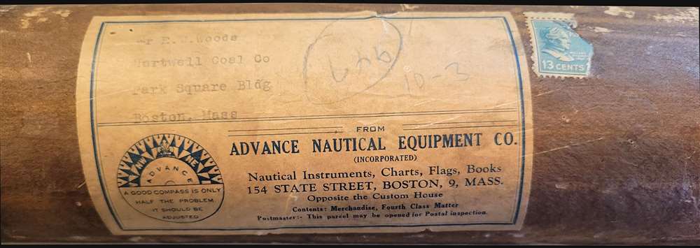
Very good. Platemark visible. Closed margin tears professionally repaired on verso. Accompanied by original mailing tube.
References
OCLC 23118177.