
United States Coast Survey (USCS)
The Office of the Coast Survey (1807 - present) founded in 1807 by President Thomas Jefferson and Secretary of Commerce Albert Gallatin, is the oldest scientific organization in the U.S. Federal Government. Jefferson created the "Survey of the Coast," as it was then called, in response to a need for accurate navigational charts of the new nation's coasts and harbors. The spirit of the Coast Survey was defined by its first two superintendents. The first superintendent of the Coast Survey was Swiss immigrant and West Point mathematics professor Ferdinand Hassler. Under the direction of Hassler, from 1816 to 1843, the ideological and scientific foundations for the Coast Survey were established. These included using the most advanced techniques and most sophisticated equipment as well as an unstinting attention to detail. Hassler devised a labor intensive triangulation system whereby the entire coast was divided into a series of enormous triangles. These were in turn subdivided into smaller triangulation units that were then individually surveyed. Employing this exacting technique on such a massive scale had never before been attempted. Consequently, Hassler and the Coast Survey under him developed a reputation for uncompromising dedication to the principles of accuracy and excellence. Unfortunately, despite being a masterful surveyor, Hassler was abrasive and politically unpopular, twice losing congressional funding for the Coast Survey. Nonetheless, Hassler led the Coast Survey until his death in 1843, at which time Alexander Dallas Bache, a great-grandson of Benjamin Franklin, took the helm. Bache was fully dedicated to the principles established by Hassler, but proved more politically astute and successfully lobbied Congress to liberally fund the endeavor. Under the leadership of A. D. Bache, the Coast Survey completed its most important work. Moreover, during his long tenure with the Coast Survey, from 1843 to 1865, Bache was a steadfast advocate of American science and navigation and in fact founded the American Academy of Sciences. Bache was succeeded by Benjamin Pierce who ran the Survey from 1867 to 1874. Pierce was in turn succeeded by Carlile Pollock Patterson who was Superintendent from 1874 to 1881. In 1878, under Patterson's superintendence, the U.S. Coast Survey was reorganized as the U.S. Coast and Geodetic Survey (C & GS) to accommodate topographic as well as nautical surveys. Today the Coast Survey is part of the National Oceanic and Atmospheric Administration or NOAA as the National Geodetic Survey.
United States Coast Survey is also known as: USCS
Navigating New Haven's Tricky Harbor.
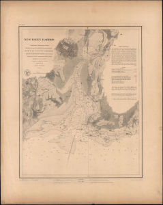
New Haven Harbor.
$500.00
Acquire
- Digital Map Information
- Suitable for large format printing
- Full resolution TIFF file
- ICC color profile embedded
- Delivered instantly via download link
This is a rare, separately issued example of the 1846 U.S. Coast Survey nautical chart or map of the harbor of New Haven, Connecticut, printed on thicker paper than the charts appearing in the Coast Survey's Annual Report. (more details)
1849 U.S. Coast Survey Chart of the Buttermilk Channel (Brooklyn and Governor's Island), New York Ha
Foundations of Brooklyn's Maritime Century.
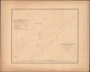
Sketch of Buttermilk Channel New York Harbor.
$300.00
Acquire
- Digital Map Information
- Suitable for large format printing
- Full resolution TIFF file
- ICC color profile embedded
- Delivered instantly via download link
This is a separately-issued 1849 nautical map or chart of the Buttermilk Channel, situated between Brooklyn and Governor's Island in New York Bay. It was issued just after the completion of the Atlantic Basin, a major project that set off rapid development of shipping facilities and warehouses in Brooklyn. (more details)
Labels numerous locations throughout the region, including New York, Brooklyn, and Williamsburg.
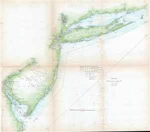
Sketch B. Showing the progress of Section No. 2.
$225.00
Acquire
- Digital Map Information
- Suitable for large format printing
- DPI: 300
- File Size: 7.8 MB
- File Type: ZIP / TIFF
- ICC color profile embedded
- Delivered instantly via download link
This is an 1850 United States Coast Survey triangulation chart or map of the Mid-Atlantic coast of the United States including all or part of the Delaware, New Jersey, New York, Connecticut, and Rhode Island coasts. The map depicts from Indian River Bay, Rehoboth ... (more details)
Nautical chart of the Mississippi River Delta.
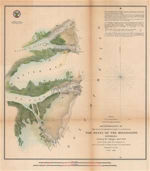
H No. 8 Reconnoissance of the N.E. and S.E. Passes and Passe A l'Outre of The Delta of the Mississippi Louisiana.
$250.00
Acquire
- Digital Map Information
- Suitable for large format printing
- DPI: 600
- File Size: 25.76 MB
- File Type: ZIP / TIFF
- ICC color profile embedded
- Delivered instantly via download link
This is an attractive 1851 U.S. Coast Survey nautical chart or maritime map of the Mississippi Delta. Depicting the Louisiana coast from Passe À L'Outre to the Southeast Pass, numerous depth soundings are indicated, and the locations of lighthouses, shoals, drift trees, and stakes are illustrated. Due to the quick and dramatic changes in the Delta area caused by sudden storms and hurricanes, charting the Mississippi Delta was one of the U.S. Coast Survey's most daunting tasks. Notes on tides, sailing instructions, and commentary on the chart are situated in the upper right corner. (more details)
Coast Survey chart of Trinidad Bay, gateway to the California Coastal National Monument.
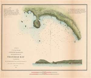
J. No. 5 Reconnaissance of Trinidad Bay California.
$250.00
Acquire
- Digital Map Information
- Suitable for large format printing
- DPI: 600
- File Size: 4.39 MB
- File Type: ZIP / TIFF
- ICC color profile embedded
- Delivered instantly via download link
This is a nice example of the 1851 U.S. Coast Survey chart or map of Trinidad Bay, California. Centers on Trinidad Head and includes details noting Trinidad City, including a street grid. A beautiful elevation profile and view of Trinidad Head and City is also ... (more details)
Gateway to Texas
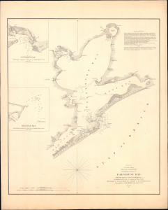
(I No. 2) Preliminary Sketch of Galveston Bay.
$450.00
Acquire
- Digital Map Information
- Suitable for large format printing
- Full resolution TIFF file
- ICC color profile embedded
- Delivered instantly via download link
This is a rare, separately issued example of the U.S. Coast Survey's 1851 maritime map, or nautical chart, of Galveston Bay, Texas. It depicts the city and its surrounding waters as Galveston emerged as Texas's primary port, commercial hub, and maritime gateway. (more details)
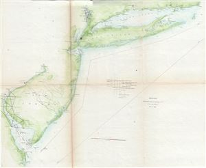
Sketch B. Shewing the progress of Section No. 2.
$225.00
Acquire
- Digital Map Information
- Suitable for large format printing
- Full resolution TIFF file
- ICC color profile embedded
- Delivered instantly via download link
This is an unusual triangulation chart of the New York and New Jersey coast line from the scarce 1851 edition of the Superintendent's Report. It covers from the Delaware Bay north to New York City then east along Long Island as far as Block Island. Shows ... (more details)
Nautical chart of the Mississippi River Delta.
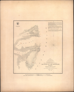
H No. 8 Reconnoissance of the N.E. and S.E. Passes and Passe A l'Outre of The Delta of the Mississippi Louisiana.
$300.00
Acquire
- Digital Map Information
- Suitable for large format printing
- Full resolution TIFF file
- ICC color profile embedded
- Delivered instantly via download link
This is a rare, separately-issued 1851 nautical map or chart of the Mississippi River Delta. It is among the earliest detailed surveys of this portion of the notoriously tricky and vitally important waterway. This example is notable for being separately-issued on thicker paper and engraved rather than lithographed. (more details)
The South's Second Great Port on the Gulf.
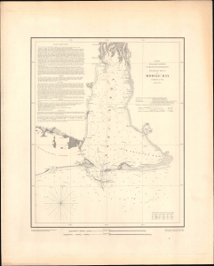
H No. 10 Preliminary Sketch of Mobile Bay.
$650.00
Acquire
- Digital Map Information
- Suitable for large format printing
- Full resolution TIFF file
- ICC color profile embedded
- Delivered instantly via download link
This rare, separately issued example of the U.S. Coast Survey's 1851 nautical chart of Mobile Bay, Alabama, captures one of the antebellum South's most important commercial gateways at the height of the cotton boom. By 1851, these waters carried an immense flow of cotton from Alabama's Black Belt to markets in the North and Europe, transforming Mobile into one of the Gulf Coast’s great ports. (more details)
Beautiful coastal chart of the harbor on Pass Christian, Mississippi, before it was destroyed by Hurricane Katrina.
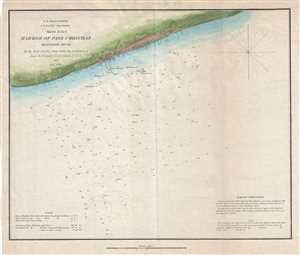
Sketch H No. 9 Harbor of Pass Christian Mississippi Sound.
$250.00
Acquire
- Digital Map Information
- Suitable for large format printing
- DPI: 300
- File Size: 3.32 MB
- File Type: ZIP / TIFF
- ICC color profile embedded
- Delivered instantly via download link
This is a beautiful 1851 U.S. Coast Survey map or chart of the harbor of Pass Christian on the Mississippi Sound, Mississippi. It covers the southern coastline of Pass Christian, a city is Harrison County, Mississippi. The chart features beautiful inland ... (more details)
A blockade-runner's chart.
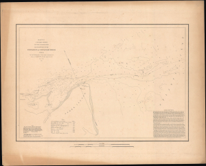
1851 U.S. Coast Survey Map or Chart of the Entrance of Savannah River, Georgia.
$350.00
Acquire
- Digital Map Information
- Suitable for large format printing
- Full resolution TIFF file
- ICC color profile embedded
- Delivered instantly via download link
This is an 1851 U.S. Coast Survey nautical map or chart of the entrance of the Savannah River, including Tybee Island, Cockspur Island, and Fort Pulaski, Georgia. This is a rare, separately-issued example, printed on thicker paper for durability. (more details)
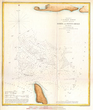
(Sketch H No. 2) Romer and Flynn's Shoals, New York Bay
$150.00
Acquire
- Digital Map Information
- Suitable for large format printing
- DPI: 300
- File Size: 3.89 MB
- File Type: ZIP / TIFF
- ICC color profile embedded
- Delivered instantly via download link
A very attractive example of the 1853 U.S. Coast Survey chart or map of the Romer and Flynn's Shoals. Details the shoals located between Coney Island and Sandy Hook in New York Bay. Offers numerous depth soundings, tidal notes, and notation on buoys. ... (more details)
Beautiful nautical chart of Plymouth Harbor, Massachusetts.
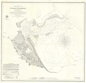
{A No. 8} Preliminary Chart of Plymouth Harbor Massachusetts.
$600.00
Acquire
- Digital Map Information
- Suitable for large format printing
- DPI: 300
- File Size: 7.6 MB
- File Type: ZIP / TIFF
- ICC color profile embedded
- Delivered instantly via download link
This is a beautiful example of the U.S. Coast Survey's 1854 nautical chart or maritime map of Plymouth Harbor, Massachusetts. It covers the important harbor located just south of Boston near Cape Cod and includes Saquish Head, Clark’s Island and Long ... (more details)
Separately-issued edition.
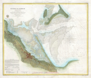
Plymouth Harbor Massachusetts.
$650.00
Acquire
- Digital Map Information
- Suitable for large format printing
- File Size: 11.21 MB
- File Type: ZIP / TIFF
- ICC color profile embedded
- Delivered instantly via download link
This is a beautiful, separately-issued example of the U.S. Coast Survey's 1857 nautical chart or maritime map of Plymouth Harbor, Massachusetts. (more details)
Triangulation chart of Mississippi City Harbor, Mississippi.
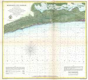
Mississippi City Harbor Mississippi.
$200.00
Acquire
- Digital Map Information
- Suitable for large format printing
- File Size: 5.65 MB
- File Type: ZIP / TIFF
- ICC color profile embedded
- Delivered instantly via download link
An attractive hand colored 1857 U.S. Coast Survey nautical chart or map depicting Mississippi City Harbor, Mississippi. This chart depicts the Mississippi Coast between Mississippi City and Biloxi, Mississippi. Inland regions are depicted in ... (more details)
Portland and Kennebunkport.
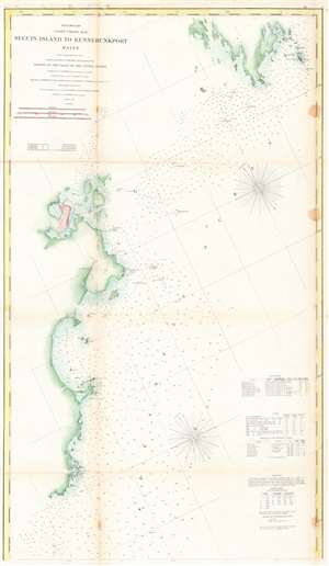
Preliminary Coast Chart No. 8 Seguin Island to Kennebunkport, Maine.
$100.00
Acquire
- Digital Map Information
- Suitable for large format printing
- File Size: 25.77 MB
- File Type: ZIP / TIFF
- ICC color profile embedded
- Delivered instantly via download link
This is an 1859 U.S. Coast Survey nautical chart or map of the southern coast of Maine. Depicting portions of coastal Maine from the mouth of the Kennebec River and Seguin Island to Goat Island and Kennebunkport (although Kennebunkport is unlabeled), innumerable depth soundings are recorded here in aid of navigation. Coastal islands abound and are nearly all identified, along with many lighthouses, such as the Goat Island Light, the Wood Island Light, the Cape Elizabeth Light, the Seguin Island Light, the Pond Island Light, and the Breakwater Light near Portland. Coves, points, and bays along the coastline are also identified. Tables detailing the region's lighthouses, tides, and magnetic variations are included along the right border, along with notes concerning the depth soundings and abbreviations employed on the map. (more details)
Civil War blockade-runners map of the Savannah River.
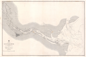
Savannah River Georgia From the United States Coast Survey 1855.
$1,900.00
Acquire
- Digital Map Information
- Suitable for large format printing
- File Size: 57 MB
- File Type: ZIP / TIFF
- ICC color profile embedded
- Delivered instantly via download link
This is an extremely scarce 1861 British Admiralty Chart of the Savannah River and city of Savannah, Georgia, issued at the outset of the American Civil War (1961 - 1865). Although formally neutral in the conflict, British private interests financed blockade runners that sent munitions and luxuries to Confederate ports in return for cotton and tobacco. This map of the Savannah River was doubtless produced for this purpose.
The map is derived from U.S. Coast Survey work in the Savannah region completed in 1855, and although the Admiralty chart is superior in construction and presentation, is substantively similar. Coverage extends from the mouth of the Savanna River, Hilton Head, and Tybee Island, westward towards savanna, as far north as Argyle Island. The triangulation for this map was completed by E.O. Cord, C. O. Boutelle, C. P. Bolles and D. T. Van Buren. The topography is the work of H. I. Whiting. The Hydrography was accomplished by a party under the command of J. N. Maffitt. (more details)
The map is derived from U.S. Coast Survey work in the Savannah region completed in 1855, and although the Admiralty chart is superior in construction and presentation, is substantively similar. Coverage extends from the mouth of the Savanna River, Hilton Head, and Tybee Island, westward towards savanna, as far north as Argyle Island. The triangulation for this map was completed by E.O. Cord, C. O. Boutelle, C. P. Bolles and D. T. Van Buren. The topography is the work of H. I. Whiting. The Hydrography was accomplished by a party under the command of J. N. Maffitt. (more details)
Appealing chart of Barnstable Harbor in Cape Cod, Massachusetts.
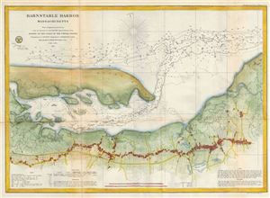
Barnstable Harbor Massachusetts.
$350.00
Acquire
- Digital Map Information
- Suitable for large format printing
- File Size: 13.28 MB
- File Type: ZIP / TIFF
- ICC color profile embedded
- Delivered instantly via download link
An uncommon and highly appealing U.S. Coast Survey nautical chart or maritime map of Barnstable Harbor, Cape Cod, Massachusetts. The map covers from Great Creak and Sandy Neck south to the Cape Cod Railroad and Dennis Pond in Yarmouth. Covers ... (more details)
Beautiful sea chart depicting the entrance to the Coquille River in Oregon.
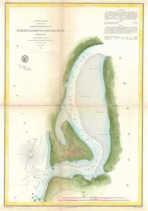
Reconnaissance of Entrance and Part of Coquille River Oregon.
$250.00
Acquire
- Digital Map Information
- Suitable for large format printing
- File Size: 6.86 MB
- File Type: ZIP / TIFF
- ICC color profile embedded
- Delivered instantly via download link
This is a beautiful 1861 U.S. Coast Survey chart or map of the entrance and part of the Coquille River in Oregon. It covers the entrance of the stream as it empties into the Pacific Ocean. The chart shows incredible inland detail in terms of ... (more details)
Railroads in the Eastern Theater of the American Civil War.
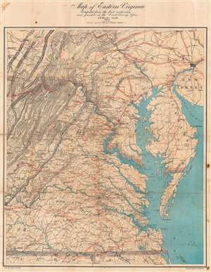
Map of Eastern Virginia.
$2,000.00
Acquire
- Digital Map Information
- Suitable for large format printing
- Full resolution TIFF file
- ICC color profile embedded
- Delivered instantly via download link
This is an 1862 Walter L. Nicholson map of eastern Virginia and Maryland, published during the second year of the American Civil War (1861 - 1865). The map embraces the Eastern Theater of war, from Pennsylvania south to the North Carolina - Virginia border. Washington, D.C. stands out on the Potomac River, while red concentric circles in ten mile increments focus upon Richmond. No battlefields are explicitly marked, but landmarks for which battles were named both before and after this map was published, including Fredericksburg, Chancellorsville, Spotsylvania Court House, and Gettysburg, appear. Red overprinting illustrates the railroad network, which proved critical to both the Union and Confederate war effort. Both sides used the railroads to move men and supplies to and from battlefields. Railroads and railroad hubs thus became strategic targets for raids and advancing armies. (more details)
Issued for the Civil War - one of just two known examples.
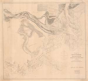
Preliminary Chart of Savannah River Wassaw Sound Wilmington and Tybee Rivers Georgia.
$1,200.00
Acquire
- Digital Map Information
- Suitable for large format printing
- File Size: 47.3 MB
- File Type: ZIP / TIFF
- ICC color profile embedded
- Delivered instantly via download link
An exceptionally rare separate issue c. 1862 Civil War Era U.S. Coast Survey nautical chart or map of the Savannah River and surrounding waters. This chart combines existing surveys of the Savannah River with separate charts prepared of the Wassaw Sound and the Wilmington and Tybee Rivers. Given the presentation on heavier stock and the maps relative rarity, it is likely this was a separate issue prepared for naval action early in the American Civil War (1861 - 1865). (more details)
The Potomac River during the American Civil War.
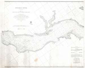
Potomac River (in four sheets) Sheet No. 2 From Piney Point to Lower Cedar Point.
$500.00
Acquire
- Digital Map Information
- Suitable for large format printing
- File Size: 21.56 MB
- File Type: ZIP / TIFF
- ICC color profile embedded
- Delivered instantly via download link
This is an 1862 U.S. Coast Survey nautical chart or maritime map of part of the Potomac River. Separating Maryland and Virginia, the map depicts from Lower Cedar Point to Piney Point. Depth soundings are indicated throughout, including in St. Clement's Bay and Breton's Bay. Points and other coastal features, including the Nomini Cliffs, are labeled. Navigational aids, such as buoys and lights, are illustrated and labeled, along with navigational hazards, including shoals and islands. (more details)
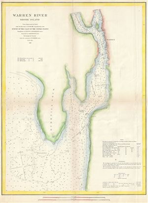
Warren River Rhode Island.
$175.00
Acquire
- Digital Map Information
- Suitable for large format printing
- File Size: 7.51 MB
- File Type: ZIP / TIFF
- ICC color profile embedded
- Delivered instantly via download link
This is a fine example of the U.S. Coast Survey's 1866 nautical chart or maritime map of Warren River, Rhode Island. Centered on Rumstick Neck, the map covers the Warren River from Tyler Point south past Jacob's Point to The Brothers and ... (more details)
Features an inset map of Cape Henlopen and the Delaware Breakwater.
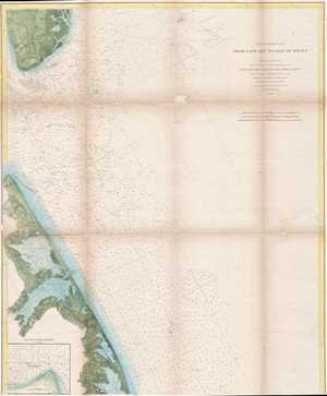
Coast Chart No. 27 From Cape May to Isle of Wight.
$250.00
Acquire
- Digital Map Information
- Suitable for large format printing
- File Size: 13.09 MB
- File Type: ZIP / TIFF
- ICC color profile embedded
- Delivered instantly via download link
An unusual 1866 U.S. Coast Survey nautical chart or maritime map of the entrance to Delaware Bay. The map depicts the entrance of the bay from Cape May, New Jersey to Assawoman Bay, Delaware. The map offers countless depth soundings ... (more details)
The Atlantic Coast of Northern New England.
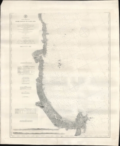
Coast Chart No. 8 From Wells to Cape Ann.
$600.00
Acquire
- Digital Map Information
- Suitable for large format printing
- File Size: 40.81 MB
- File Type: ZIP / TIFF
- ICC color profile embedded
- Delivered instantly via download link
A remarkably detailed nautical map or chart originally produced by the U.S. Coast Survey in 1867, updated to 1878, of the Atlantic coast of New England from Wells and Ogunquit in Maine to Gloucester on Cape Ann, Massachusetts. (more details)
Confederate Camaradas?
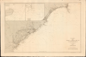
América Septentrional, Costa Este. Hoja III. Georgia y Carolina del Sur desde Savannah hasta cabo Fear.
$1,200.00
Acquire
- Digital Map Information
- Suitable for large format printing
- File Size: 1227.68 MB
- File Type: ZIP / TIFF
- ICC color profile embedded
- Delivered instantly via download link
An intriguing nautical chart or map of the Georgia and South Carolina coasts, produced in 1868 by Spain's Dirección de Hidrografía. Surveyed before the U.S. Civil War but published afterwards, the chart reflects both Spain's investment in naval modernization in the preceding decades and a continued interest in the Americas, despite having lost most of its colonial empire earlier in the century. (more details)
Before the Great Galveston Hurricane.
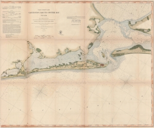
Coast Chart No. 105 Galveston Bay to Oyster Bay Texas.
$600.00
Acquire
- Digital Map Information
- Suitable for large format printing
- File Size: 138.67 MB
- File Type: ZIP / TIFF
- ICC color profile embedded
- Delivered instantly via download link
This is the 1870 edition of the U.S. Coast Survey nautical map of Galveston Bay, Texas. When this map was made Galveston was one of the most important American ports on the Gulf of Mexico. In just thirty years, it would be destroyed by the 1900 Great Galveston Hurricane, considered the deadliest natural disaster in United States history and the third-deadliest Atlantic hurricane. (more details)
Detailed Early Coastal Chart of Edgartown Harbor

Section I, Edgartown Harbor and Cotamy Bay, Mass.
$750.00
Acquire
- Digital Map Information
- Suitable for large format printing
- File Size: 45.16 MB
- File Type: ZIP / TIFF
- ICC color profile embedded
- Delivered instantly via download link
A very rare 1871 U.S. Coast Survey Map of Edgartown and Katama Bay on Martha's Vineyard, Massachusetts. This detailed working harbor chart was produced to illustrate the buildup of sand in the bay (making it unnavigable) in order to argue for the opening of a safe passage through Katama Beach. The chart shows the approaches to Edgartown - both the main approach from the northeast, marked by a lighthouse, and also the approaches via Katama Bay (Cotamy on the map)- whose mouth is shown entirely blocked by Katama Beach. Historical natural openings in the beach are noted, including a 1776 opening which had appeared on Des Barres' chart of the island, are noted. Nine cross sections of the beach are shown, indicating the height of the beach above sea level. A further cross section, showing the increasing silt blockage of the northern mouth of the Bay between the west shore and Chappaquiddick Point is shown as well. Tidal patterns measured inside and outside Katana bay are compared in a chart. Detailed soundings are provided throughout. (more details)
Features Mount Desert Island and Passamaquoddy Bay!
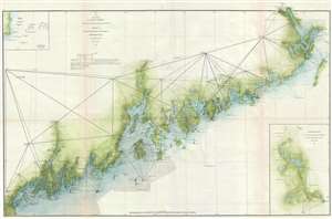
Sketch A Showing the Progress of the Survey in Section No. 1 from 1852 to 1871.
$1,200.00
Acquire
- Digital Map Information
- Suitable for large format printing
- File Size: 9.94 MB
- File Type: ZIP / TIFF
- ICC color profile embedded
- Delivered instantly via download link
This is an 1871 U.S. Coast Survey nautical chart or maritime map of the coast of Maine. The map depicts the region from Portland Maine to Passamaquoddy Bay and inland as far as Bangor and Calais. Intricately charted, myriad coastal ... (more details)
The Western Shores of Lake Champlain.
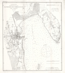
Plattsburgh and Cumberland Bay Lake Champlain New York.
$1,000.00
Acquire
- Digital Map Information
- Suitable for large format printing
- File Size: 30.16 MB
- File Type: ZIP / TIFF
- ICC color profile embedded
- Delivered instantly via download link
A rare 1873 U.S. Coast Survey nautical map of Plattsburgh and Cumberland Bay, Lake Champlain, New York. This example is printed on thick paper, suggesting intended use on a ship. (more details)
The culmination of the Coast Survey's work in New York Harbor.
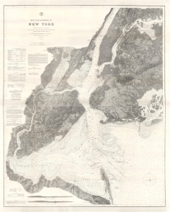
Bay and Harbor of New York.
$1,200.00
Acquire
- Digital Map Information
- Suitable for large format printing
- File Size: 256.04 MB
- File Type: ZIP / TIFF
- ICC color profile embedded
- Delivered instantly via download link
This 1874 double-sized nautical map of New York City represents the ultimate expression of the Coast Survey's work in and around New York harbor. Its refined detail provides not only state-of-the-art navigational information, but also a valuable record of land usage and development. (more details)
A highly detailed chart of part of the Potomac River.
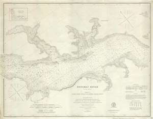
Potomac River Sheet No. 2 From Piney Point to Lower Cedar Point.
$375.00
Acquire
- Digital Map Information
- Suitable for large format printing
- File Size: 11.41 MB
- File Type: ZIP / TIFF
- ICC color profile embedded
- Delivered instantly via download link
This is an 1877 U.S. Coast Survey nautical chart or maritime map of a section of the Potomac River. The map depicts the region from Lower Cedar Point to Piney Point and from Leonardtown, Maryland to Wakefield, Virginia. Highly ... (more details)
Meticulous chart of the Atlantic Coast from Maine to Massachusetts.
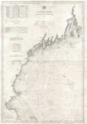
Atlantic Coast from Isle au Haut to Cape Cod.
$600.00
Acquire
- Digital Map Information
- Suitable for large format printing
- File Size: 12.3 MB
- File Type: ZIP / TIFF
- ICC color profile embedded
- Delivered instantly via download link
This is an 1881 U.S. Coast and Geodetic Survey nautical chart or maritime map of the northern Atlantic coastline of the United States. The map depicts the Atlantic coastline from the Isle au Haut and Penobscot Bay, Maine to ... (more details)
East Penobscot Bay for mariners.
East Penobscot Bay.
$400.00
Acquire
- Digital Map Information
- Suitable for large format printing
- File Size: 59.37 MB
- File Type: ZIP / TIFF
- ICC color profile embedded
- Delivered instantly via download link
This is an 1882 U.S. Coast and Geodetic Survey nautical map of East Penobscot Bay, Maine. (more details)
The North Landing River forms the head of Currituck Sound, part of the coastline of both North Carolina and Virginia.
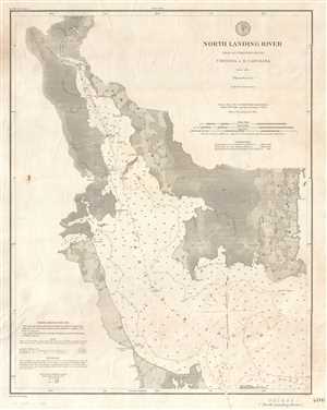
North Landing River (Head of Currituck Sound) Virginia and N. Carolina.
$400.00
Acquire
- Digital Map Information
- Suitable for large format printing
- File Size: 7.92 MB
- File Type: ZIP / TIFF
- ICC color profile embedded
- Delivered instantly via download link
This is a separate issue 1882 U.S. Coast and Geodetic Survey nautical chart or maritime map of the North Landing River, which comprises the head of Currituck Sound, in both North Carolina and Virginia. The map depicts the ... (more details)
Shows individual buildings throughout the Boston area!
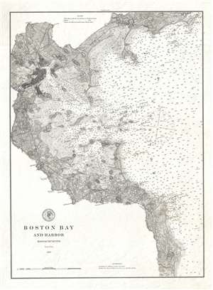
Boston Bay and Harbor Massachusetts.
$550.00
Acquire
- Digital Map Information
- Suitable for large format printing
- File Size: 7.8 MB
- File Type: ZIP / TIFF
- ICC color profile embedded
- Delivered instantly via download link
A stunning 1883 U.S. Coast Survey (USCS) nautical chart or maritime map of Boston Bay and Boston Harbor. The map covers from Marblehead to Scituate, and as far west as Cambridge. While the map is primarily a nautical ... (more details)
Last Days of the Age of Sail.
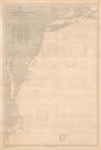
North America Atlantic Coast of the United States Buzzard's Bay to Cape Lookout.
$1,500.00
Acquire
- Digital Map Information
- Suitable for large format printing
- File Size: 73.45 MB
- File Type: ZIP / TIFF
- ICC color profile embedded
- Delivered instantly via download link
This is a rare large-format 1890 nautical chart of the Atlantic Coast of the United States prepared by the U.S. Hydrographic Office. Among other interesting features, the chart has a very clear provenance, having been purchased by Captain Thomas R. Anderson for use aboard the ship Albania. (more details)
Dawn of Modern New York City.
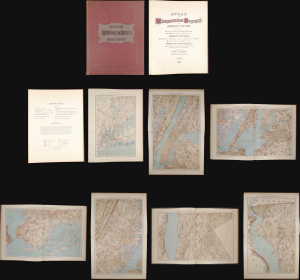
This is a stunning elephant folio chromolithograph atlas of New York City and environs by Julius Bien and C. C. Vermeule, dated 1891. It captures New York City and its surrounding area during a period of frenetic growth and modernization, which, in the following years, led to the consolidation of the five boroughs and the adoption of cutting-edge technology to facilitate the movement of people and goods through the metropolis. (more details)
Highlights illegal fur seal hunting in the Bering Sea
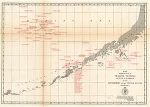
Map Showing Positions of Sealing Vessels Seized or Warned by the Government of the United States during the season of 1891.
$350.00
Acquire
- Digital Map Information
- Suitable for large format printing
- File Size: 8.67 MB
- File Type: ZIP / TIFF
- ICC color profile embedded
- Delivered instantly via download link
This is a rare c.1891 U.S. Coast and Geodetic Survey map of the Aleutian Islands highlighting sealing vessels warned or seized by the U.S. government during the 1891 season. Depicting from Atka Island to the Alaska Peninsula, the map identifies nearly 100 vessels boarded or seized by the United States. These vessels hailed from the United States and Britain and were stopped sometime between June and August 1891. Each citation references the name of the ship in question, whether it was boarded or seized and on what date, and whether a British or American ship stopped the offender. (more details)
Southernmost Part of Alaska.
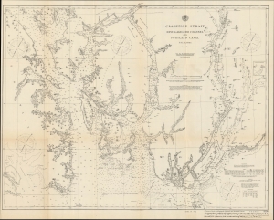
Clarence Strait Revillagigedo Channel and Portland Canal S.E. Alaska.
$300.00
Acquire
- Digital Map Information
- Suitable for large format printing
- File Size: 24.42 MB
- File Type: ZIP / TIFF
- ICC color profile embedded
- Delivered instantly via download link
A highly detailed 1895 U.S. Coast Survey nautical map of the southeastern corner of Alaska, including the Gravina Islands of the Alexander Archipelago, the Portland Channel, and Ketchikan. This region was one of the most hotly debated portions of the Alaska-Canada border during an extended dispute at the end of the 19th century, set off by the discovery of gold in Alaska and the Yukon. (more details)
Where the Mississippi meets the Gulf.
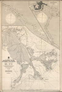
Gulf of Mexico. Louisiana. Mississippi River The Passes to New Orleans.
$1,500.00
Acquire
- Digital Map Information
- Suitable for large format printing
- File Size: 71.86 MB
- File Type: ZIP / TIFF
- ICC color profile embedded
- Delivered instantly via download link
This is a 1903 / 1908 British Admiralty nautical chart or map of the Mississippi River from New Orleans to The Passes: a richly detailed working chart for the navigation of one of the most important water routes in the United States, with all the data necessary for navigating the mouth of the great river. (more details)
Navigating the Bay.
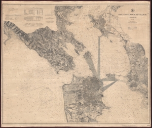
San Francisco Entrance California.
$950.00
Acquire
- Digital Map Information
- Suitable for large format printing
- File Size: 91.18 MB
- File Type: ZIP / TIFF
- ICC color profile embedded
- Delivered instantly via download link
This is a 1903 U.S. Coast and Geodetic Survey nautical chart or map of San Francisco Bay, California. (more details)
The Mississippi Sound and Mobile Bay.
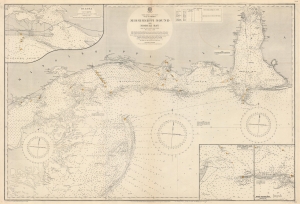
North America. East Coast. Gulf of Mexico. Mississippi Sound and Mobile Bay.
$850.00
Acquire
- Digital Map Information
- Suitable for large format printing
- File Size: 119.39 MB
- File Type: ZIP / TIFF
- ICC color profile embedded
- Delivered instantly via download link
This is a 1919 British Admiralty nautical chart or map of Mobile Bay and Mississippi Sound, part of the Gulf Littoral Intercoastal Waterway. The map provides an overview of the region while insets detail important areas. (more details)
Hydrocarbons along the Alaska Coast.
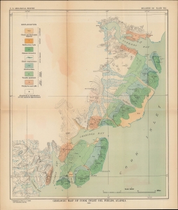
Geologic Map of Cook Inlet Oil Fields, Alaska.
$250.00
Acquire
- Digital Map Information
- Suitable for large format printing
- Full resolution TIFF file
- ICC color profile embedded
- Delivered instantly via download link
A colorful map of the southwestern portion of the Cook Inlet in Alaska produced in 1921 by the U.S. Geological Survey. This period saw a thorough exploration of the Alaskan coast for large-scale oil and gas deposits, which were eventually discovered and exploited in the Cook Inlet Basin several decades later. (more details)
Surveying Alaska in the 1920s.
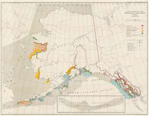
U.S. Coast and Geodetic Survey. Condition of Field Work Alaska. June 30, 1926.
$175.00
Acquire
- Digital Map Information
- Suitable for large format printing
- File Size: 44.55 MB
- File Type: ZIP / TIFF
- ICC color profile embedded
- Delivered instantly via download link
This is a 1926 U.S. Coast and Geodetic Survey map of Alaska. (more details)
Part of a U.S. government study trying to make the Alaska Railroad profitable.
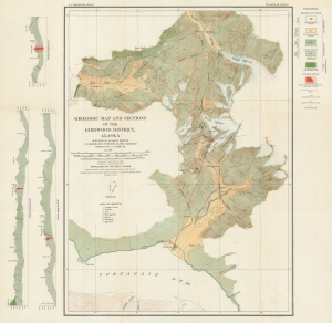
Geologic Map and Sections of the Girdwood District, Alaska.
$500.00
Acquire
- Digital Map Information
- Suitable for large format printing
- File Size: 27.35 MB
- File Type: ZIP / TIFF
- ICC color profile embedded
- Delivered instantly via download link
This is a 1933 U.S. Coast and Geodetic Survey geologic map of the Girdwood District in Alaska. The map accompanies a report published by the U.S. Department of the Interior commissioned to investigate mineral deposits in 9 different regions along the route of the Alaska Railroad. These studies hoped to discover deposits of sufficient magnitude that their exploitation would help the Alaska Railroad become profitable. Of the 9 districts, 5 were investigated for gold deposits, including Girdwood. (more details)
Making the Case for Foreign Trade during the Depression.

World Trade Benefits All National Foreign Trade Week - May 17 - 23, 1936.
$350.00
Acquire
- Digital Map Information
- Suitable for large format printing
- File Size: 13.8 MB
- File Type: ZIP / TIFF
- ICC color profile embedded
- Delivered instantly via download link
A striking piece of persuasive cartography, this map and poster were prepared in 1936 by the Bureau of Foreign and Domestic Commerce of the Department of Commerce to advocate for a National Foreign Trade Week. It is notable for taking the unpopular position of advocating for foreign trade at a time of intense protectionism in the U.S. (more details)
An ecotourist's paradise.
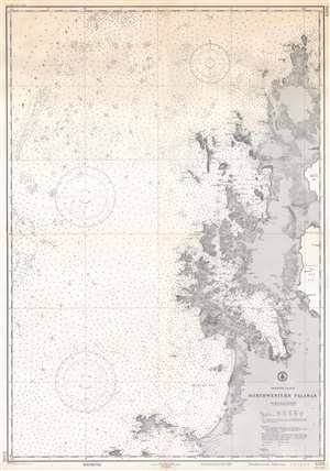
Philippine Islands. Northwestern Palawan.
$500.00
Acquire
- Digital Map Information
- Suitable for large format printing
- File Size: 68.11 MB
- File Type: ZIP / TIFF
- ICC color profile embedded
- Delivered instantly via download link
This is a 1944 U.S. Coast and Geodetic Survey nautical chart or maritime map of the northwestern coast of Palawan, Philippines - prepared for World War II, but today representing a world renowned ecotourism mecca. The present example represents a special printing published in May 1944 in preparation for the Allied invasion of the Philippines. Coverage extends from Cabuli Island south along the coast to Pagdanan Bay, with peninsulas, bays, and points are illustrated and labeled. Inland topography is defined by contouring with elevations in feet. Depth soundings appear along the coast and as far west as the China Sea, providing essential maritime data. Information concerning tides, abbreviations, and other important data is included below the title in the lower right. (more details)
A Center of America's Aviation Industry.
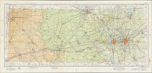
A large-format aeronautical chart of northern Texas, focusing on the Dallas-Fort Worth region, prepared in 1957 by the U.S. Coast and Geodetic Survey. The map records Dallas' pioneering contributions to early American aviation. (more details)
Southern California in the Early Jet Age.
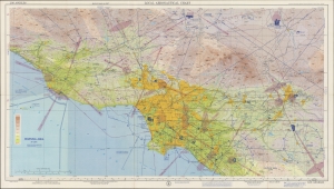
An impressive, large-format aeronautical chart of the Los Angeles metro area, prepared in 1958 by the U.S. Coast and Geodetic Survey. Among other features, it records Los Angeles' pioneering contributions to American aviation. (more details)