1950 Garbush Map of Manhattan, New York City
NewYorkNorman-garbush-1950
Title
1950 (undated) 33.5 x 21.75 in (85.09 x 55.245 cm)
Description
A Closer Look
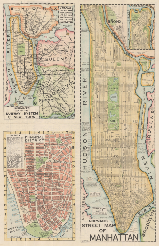
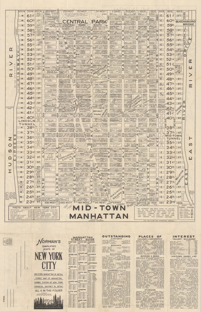
The recto consists of three maps. A large map of Manhattan covers the right half of the sheet, with the area north of 180th St. separated as an inset at the top-right. Streets are labeled throughout, along with bridges, piers, subway stations, parks, and landmarks (museums, famous buildings, sporting venues, churches, and temples). Descriptive text discusses distinctive neighborhoods, such as Harlem and Greenwich Village. On the other side of the sheet is a subway map of the city, indicating the complex system in play at the time, when the three independent systems were undergoing a gradual process of unification. At the bottom left is a detailed map of the Financial District in Lower Manhattan, which allows for the granular mapping of individual buildings (some pulled out in an index on the left), including banks, department stores, and office buildings.The verso contains a similarly detailed map of Midtown Manhattan between 23rd and 62nd St. While Garbush includes a disclaimer at the bottom-right that not all buildings are individually indicated, the map is quite remarkable for labeling many if not most of the individual buildings in the area, including hotels, churches, theaters, museums, and landmarks like Grand Central Station, (old) Pennsylvania Station, and the New York Public Library. Some facts about New York City are included in a table at the bottom left, while additional tables below the map give the traveler a helpful short-hand list of popular destinations.
Publication History and Census
This map was prepared and published by Norman Garbush, care of the New York Litho. Corp. and distributed by the Interborough News Company. The map is undated, but from its content and style, it must date to the late 1940s. In particular, the map includes features that were completed in the early 1940s, such as the IRT's Dyer Ave. Line, but does not include features from the early 1950s, such as the IND Rockaway Line. Notably, the Brooklyn-Battery Tunnel (now the Hugh L. Carey Tunnel) is described as under construction; it opened to traffic on May 25, 1950.Cartographer
Norman Lawrence Garbush (March 7, 1897 - May 10, 1972) was a mostly Minnesota-based cartographer and map publisher. The details of his life are difficult to determine and he remarkably seems to have disappeared from census and other records for several decades. Garbush was raised in Stillwater, Minnesota (near Minneapolis) and received training as a civil engineer and surveyor, producing at least one map of his native region in the 1920s (OCLC 882500843). At some point in the mid-late 1940s, he looks to have relocated to New York City, very likely for military service in the Second World War. Around this time, he began publishing his best known work, 'Norman's Simplified Maps of New York City,' which was issued in several editions (all undated) from roughly the late 1940s to the 1960s. However, Garbush appears to have only lived in the city for a short time, returning to Minnesota by the early 1950s. From there, he continued to publish his New York City maps with local partners, as well as branching out to issue similar maps of Miami, South Florida writ large, Denver, Dallas, and Los Angeles (being an outsider to these places and not knowing colloquial placenames, some of these maps failed to impress locals despite their comprehensiveness). Aside from his independent map publishing, Garbush looks to have worked at the Minnesota Department of Highways in the latter part of his career. More by this mapmaker...


