This item has been sold, but you can get on the Waitlist to be notified if another example becomes available, or purchase a digital scan.
1944 Hagstrom Map of New York City Subway Lines for Military Personnel
NewYorkSubways-hagstrom-1944$50.00


Title
New York Subways.
1944 (undated) 17.25 x 9.25 in (43.815 x 23.495 cm)
1944 (undated) 17.25 x 9.25 in (43.815 x 23.495 cm)
Description
An uncommon c. 1944 edition of Hagstrom's map of New York City showing subways and elevated trains, including the BMT and IRT lines. The map covers most of New York City with the exception of Staten Island. Parks are detailed, as are major avenues and streets, but the focus of the map is the subway and transit lines. Color coding defines the lines, the IRT (blue), BMT (yellow), IND (Red), and Joint lines (blue and yellow). The map also attempts to show major railway lines.
World War II-Era Verso Content
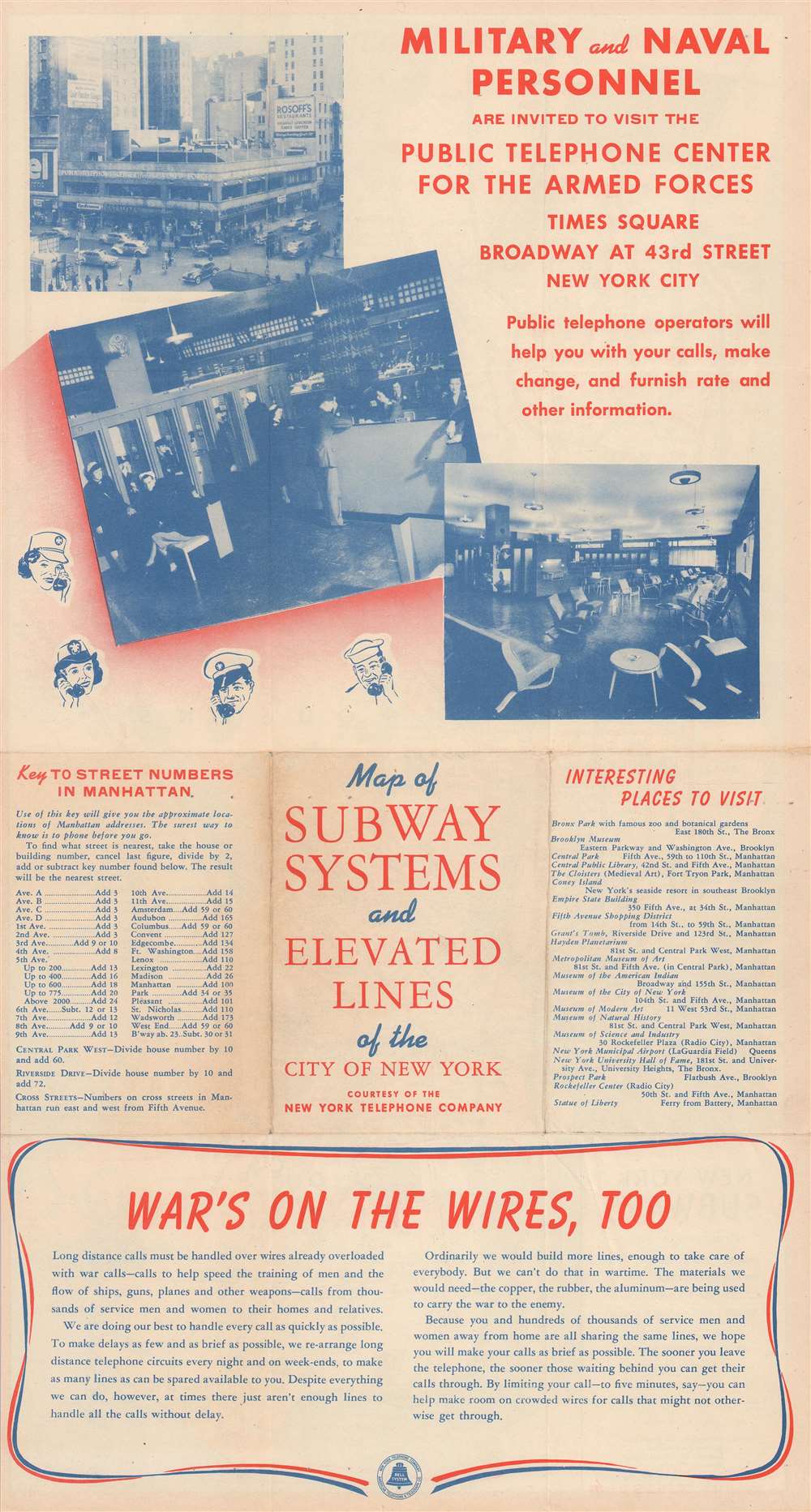
Text and images printed on the verso firmly date the map to the World War II Era. The New York Telephone Company published the map for military and naval personnel and grandly advertises the Public Telephone Center for the Armed Forces. The Public Telephone Center for the Armed Forces was opened by the New York Telephone Company on November 6, 1943 and remained open until September 1, 1946. Over its nearly three years in operation, more than 1,007,000 service men and women visited the Center, located at Times Square and 43rd Street, and over 565,000 out-of-town calls were placed on their behalf. A plea for patience when placing long distance calls appears along the bottom and explains that 'hundreds of thousands of service men and women away from home are all sharing the same lines, we hope you will make your calls as brief as possible'.Publication History and Census
This map went through many states and editions, most of which are undated. We have dated this example as c. 1944 due to the advertisement for the Public Telephone Center for the Armed Forces. We have seen no other examples of this edition.Cartographer
Andrew Gunnar Hagstrom (1890 - September 24, 1977) was a map publisher based in Maspeth, Queens. Hagstrom was a Swedish immigrant who came to new York in 1909 where took work milking cows at a farm near Coney Island, Brooklyn. He then worked in the meat packing industry while taking a degree in commercial art at the New York Mechanics Institute. Afterwords he founded a drafting business in Manhattan, creating a map to illustrate his drafting skill help customers locate his shop. His map proved popular and he expanded operations, founding the Hagstrom Map Company (1916 - 1968) and issuing additional maps of various parts of New York City and the surrounding regions. By 1949, Hagstrom had issued more than 150 maps, guides, and atlases, most of which focused on New York. Hagstrom pioneered a cartographic style that exaggerated street size to increase clarity and create additional room for large print readable labeling. Even the New York Subway system hired Hagstrom to produce its map, which was in use from the 1940s to 1958. Hagstrom died in 1977, at the age of 81. Hagstrom was knighted by the King of Sweden. His company flourished until 1968 when it was acquired by Macmillan. The brand has since passed through multiple corporate portfolios and is currently the property by Kappa Publishing Group. More by this mapmaker...
Condition
Very good. Exhibits light wear along original fold lines. Exhibits some toning. Text on verso.