
This item below is out of stock, but another example (left) is available. To view the available item, click "Details."
Details
1940 Hagstrom Map of Midtown Manhattan Theaters, New York City
1940 (undated) $400.00
1940 Hagstrom Map of Midtown Manhattan Theaters, New York City
NewYorkTheatres-hagstrom-1940-2$200.00

Title
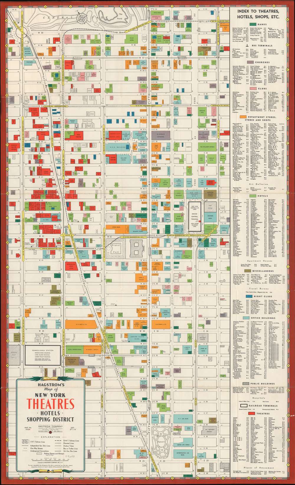
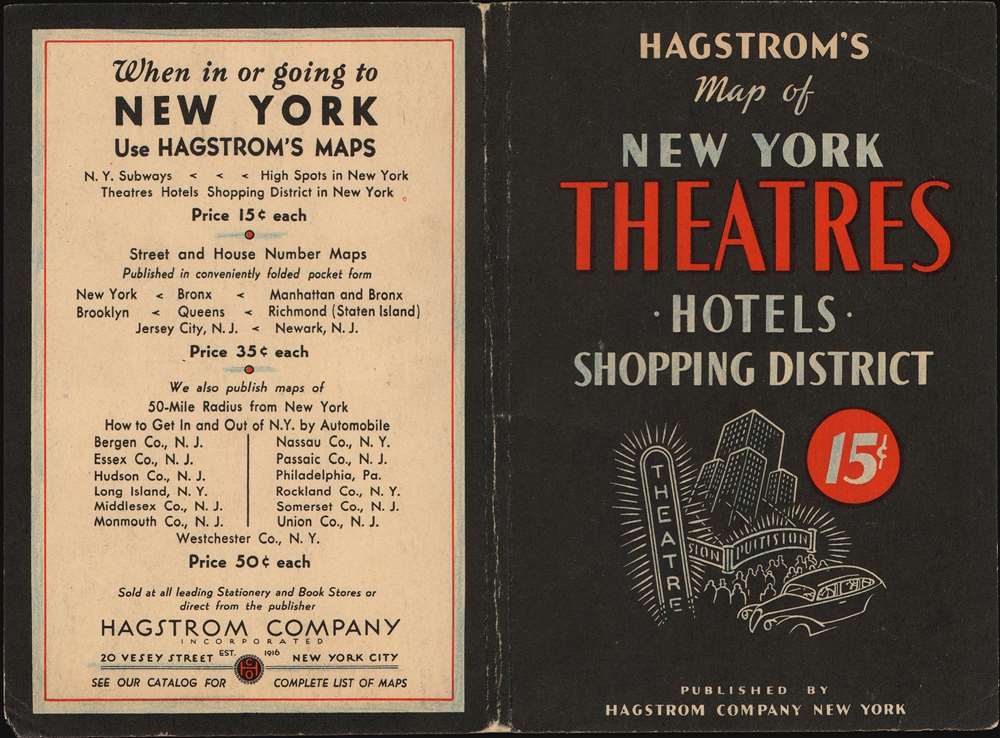
Hagstrom's Map of New York Theatres, Hotels, Shopping District.
1940 (undated) 26.5 x 16.25 in (67.31 x 41.275 cm) 1 : 4750
1940 (undated) 26.5 x 16.25 in (67.31 x 41.275 cm) 1 : 4750
Description
This is a c. 1940 Hagstrom map of Midtown Manhattan highlighting the Theatre District and its many theatres. The map depicts the city from Eighth Avenue to Lexington Avenue and from West 61st Street, Central Park, and East 61st Street to 22nd Street. Although numerous buildings are illustrated, not all the city blocks are filled. Banks, churches, clubs, department stores, hotels, nightclubs, office buildings, public buildings, train stations, and theatres are shaded using various colors to allow for easy differentiation and identification. An index, situated along the map's right side, lists the identified locations, offers a color-coding key, and notes each building's coordinates on the map.
Present here are many of the city's most iconic early theaters, including the New Amsterdam, the Lyric, the Majestic, the Broadhurst, the Booth, the Golden, the Barrymore, and the Music Box. Numerous others illustrated here have since been closed or repurposed.
Manhattan Theater District
The Manhattan Theatre District comprises a section of Manhattan along Broadway between, roughly, 38th and 54th Streets, Eight Avenue and Fifth Avenue. The area first began attracting theaters and restaurants following Metropolitan Opera's 1883 relocation to the, then remote, West 39th Street and Broadway. Oscar Hammerstein followed in 1899, opening the Victoria Theatre on 42nd Street. The area soon became a center for nightlife, especially after the tramways connected the area in 1899, and the subway in 1904. Over the decades since, the district has been referred to by New Yorkers as 'The Rialto,' as 'The Main Stem,' and as 'Broadway,' and at the turn of the 20th century, was simply 'The Street.' While continuing to be a theater destination, the area became run-down in the 1970s, the center of the city's seely x-rated scene. The area began a revival in the 1980s that continues to this day.Present here are many of the city's most iconic early theaters, including the New Amsterdam, the Lyric, the Majestic, the Broadhurst, the Booth, the Golden, the Barrymore, and the Music Box. Numerous others illustrated here have since been closed or repurposed.
Other Destinations of Note
Other New York City landmarks that fall within the map's borders include the Empire State Building, the central branch of the New York Public Library, the Museum of Modern Art (MoMA), Bryant Park, Grand Central Station, and Herald Square. Both Macy's and Bloomingdale's are labeled, as are the Waldorf Astoria Hotel and the Plaza Hotel.Publication History
This map was originally designed for the created the Hagstrom Company by R. W. Floyd. It was copyrighted on March 18, 1939, but went through multiple subsequent editions, all of which are undated. The first edition, 1939, is notable for bearing Floyd's imprint. Subsequent editions starting in 1940 remove the imprint. The present example is the 2nd edition.Cartographer
Andrew Gunnar Hagstrom (1890 - September 24, 1977) was a map publisher based in Maspeth, Queens. Hagstrom was a Swedish immigrant who came to new York in 1909 where took work milking cows at a farm near Coney Island, Brooklyn. He then worked in the meat packing industry while taking a degree in commercial art at the New York Mechanics Institute. Afterwords he founded a drafting business in Manhattan, creating a map to illustrate his drafting skill help customers locate his shop. His map proved popular and he expanded operations, founding the Hagstrom Map Company (1916 - 1968) and issuing additional maps of various parts of New York City and the surrounding regions. By 1949, Hagstrom had issued more than 150 maps, guides, and atlases, most of which focused on New York. Hagstrom pioneered a cartographic style that exaggerated street size to increase clarity and create additional room for large print readable labeling. Even the New York Subway system hired Hagstrom to produce its map, which was in use from the 1940s to 1958. Hagstrom died in 1977, at the age of 81. Hagstrom was knighted by the King of Sweden. His company flourished until 1968 when it was acquired by Macmillan. The brand has since passed through multiple corporate portfolios and is currently the property by Kappa Publishing Group. More by this mapmaker...
Condition
Very good. Light wear along original fold lines. Blank on verso.
References
New York Public Library, Map Division, 04-395 (1944 edition).