
1850 Ikeda Huge Folding Map of Niigata / Echigo Province, Japan

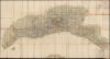

[Echigo Province].
Epic Map of Echigo.
- Digital Map Information
- Suitable for large format printing
- Full resolution TIFF file
- ICC color profile embedded
- Delivered instantly via download link
Epic Map of Echigo.
This is a very large format (81.75 x 42 in.) c. 1850 folding map of Echigo Province, now today's Niigata Prefecture, in Japan, based on an 1842 map of the same by Ikeda Tōritei. It presents the province in the late Tokugawa era, a period of considerable unrest and upheaval.A Closer Look
The map covers the Tokugawa-era administrative region of Echigo Province, consistent with today's Niigata Prefecture. It is oriented with southwest at the top, illustrating the Province from the direction of the Sea of Japan. In the foreground on the left is the island of Awashimaura, while a portion of the large Sado Island (here as 佐州) appears in the foreground at the center. Settlements are presented to a remarkable level of detail, ranging from castle towns (城下) like Niigata (新潟), Nagaoka (長岡), and Takada (高田, now Jōetsu) to intermediate-size post stations and market towns (駅市), down to tiny villages, some of which lack a name in kanji and whose names are written in kana. Additionally, temples and shrines are indicated along with old and new cultivated areas, as the late Tokugawa period saw a desperate search for more arable land through reclamation work. The area's many waterways and mountains are similarly displayed and labeled. Distances from these remote, mountainous parts of the province to cities like Nagaoka are recorded along the top edge.Historical Context
This region has long had a reputation for some of the most beautiful mountainous terrain in Japan, quite a claim in a highly mountainous country, and consequently is famous for its hiking trails, Shinto shrines, and, due to the area's northern latitude, opportunities for skiing. In the late Tokugawa period, Echigo was politically fragmented between the feudal lands of various daimyo and strategically-located tenryō (天領) lands held directly by the Tokugawa shoguns. As with other parts of Japan, the early 19th century was defined by widespread land reclamation projects to find or create new fields (新田) to cultivate to support the country's population, which had reached its demographic limits with the existing food supply and was facing periodic famines, including the devastating Tenpō famine of the mid-1830s. Food shortages set off a wider social crisis of vagrancy, banditry, and unrest, hastening the fall of the Tokugawa system in the following years. At the same time, Echigo benefited from its role in the kitamaebune (北前船) coastal trade and the fishing industry, which saw local fishermen range as far as the Kamchatka Peninsula. This maritime commercial prominence led to Niigata being selected as one of Japan's five initial treaty ports in the 1858 Japan-U.S. Treaty of Amity and Commerce. However, the port's shallow, silty waters made it difficult for foreign ships to anchor there. The region's political and physical distance from Edo and Kyoto meant that it never developed into an international trade entrepot like Yokohama.Publication History and Census
The map contains no publication information or even a title (the cover contains a space where a title likely appeared but has since fallen off), making identification difficult. However, it is consistent with the 1842 map of Echigo (越後國細見大絵圖) made by Ikeda Tōritei, which was reprinted several times in the years after its initial publication (sometimes with slightly different titles), often with sparse or no publication information, as here. Though it differs considerably in appearance, Ikeda's map itself was likely informed and influenced by the state-led cartographic project to update maps of every province in Japan (天保國絵圖). Given its foldability for portability, this map was likely meant for travelers, such as traders or religious pilgrims.Although Ikeda's map was printed on a sheet formed into a rectangle combining several smaller sheets, the reprints generally contain an additional small sheet at the bottom right to cover the southernmost portion of the province, which is missing here. Only a few cataloged examples of the map, either attributed to Ikeda or unattributed, are held in institutions outside of Japan, including at the Library of Congress, the University of California, Berkeley, the University of British Columbia, and the University of Illinois at Urbana-Champaign.
Cartographer
Ikeda Tōritei (池田東籬亭; 1788 - 1857) was an engraver, publisher, geographer, and scholar of the late Tokugawa period. He is best known for his contributions to the cartography of Kyoto, particularly an 1834 (天保改正新増細見京繪圖大全) and an 1840 map (天保改正京都指掌圖) that were the most detailed maps of the great imperial capital to date. Aside from cartographic work, he also published books on women's etiquette and women's education, and more broadly was an editor of works of popular literature. Most notably, he helped to prepare and publish an illustrated edition of the Kōnan Bunzan (江南文山), the first complete translation of the Romance of the Three Kingdoms (三國演義) from Chinese into Japanese, which replaced the translation's reliance on kanji with more kana to make it more accessible to a popular audience in Japan. Further Details...
Condition
Very good. Wear at juncture of folds with some areas of loss; one mended split. Folding map with original silk-covered boards.
References
Alternate printings - OCLC 7692241, 21836752, 909624558.