This item has been sold, but you can get on the Waitlist to be notified if another example becomes available, or purchase a digital scan.
1879 Colton Wall Map of the United States, Canada, Mexico, and the Caribbean
NorthCentralAmerica-colton-1879$750.00


Title
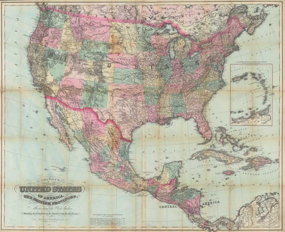
Colton’s map of the United States of America, the British provinces, Mexico and the West Indies. Showing the Country from the Atlantic to Pacific Oceans.
1879 (dated) 36.5 x 44.75 in (92.71 x 113.665 cm) 1 : 5274720
1879 (dated) 36.5 x 44.75 in (92.71 x 113.665 cm) 1 : 5274720
Description
A scarce, unrecorded 1879 edition of Colton's large-format folding map of the United States, southern Canada, Mexico, Central America, and the Caribbean. It provides enlightening detail regarding the developing rail infrastructure of the western United States and the ongoing Indian Wars.
The present map is distinct from earlier editions for the broad network of illustrated railway lines, both complete and under construction, especially in the central and western United States.
A Closer Look
Coverage embraces the United States, as well as Mexico, Central America, the Caribbean, and adjacent parts of British America (Canada). The political geography is recognizable to modern eyes, although some areas had not yet reached their ultimate configuration, namely the undifferentiated Dakotas and the Indian Territory, later subsumed by Oklahoma. Native American groups are indicated, among them the Blackfoot, Capote, and 'Pah-Utah' or Pahvant - a potent reminder of the ongoing Indian Wars.The present map is distinct from earlier editions for the broad network of illustrated railway lines, both complete and under construction, especially in the central and western United States.
Central American and the Antilles
Guatemala is displayed with its borders just prior to the 1882 agreement with Mexico that granted a portion of borderland (now the Reserva de la Biósfera Montes Azules) to the latter. An unresolved border dispute is also the basis for the portion of the Dominican Republic jutting into Haiti. An inset details the Lesser Antilles.Publication History and Census
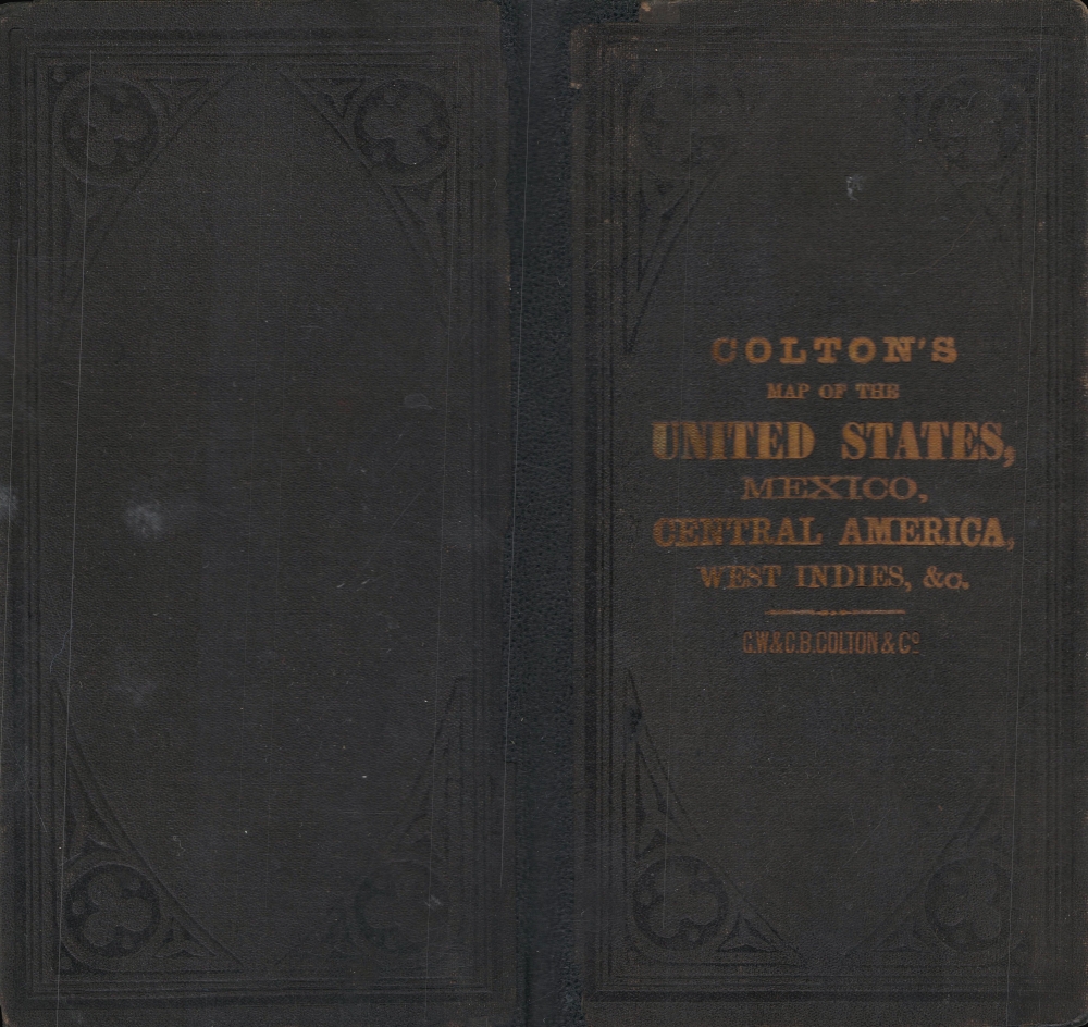
This map was published in 1879 by G. W. (George Woolworth) and C. B. (Charles B.) Colton, sons of Joseph Hutchins Colton. Colton published large-format folding maps with this title or very similar titles from around 1848 to 1885; this late edition is unrecorded in institutional collections and has no known history on the market.Cartographer
Joseph Hutchins Colton (July 5, 1800 - July 29, 1893), often publishing as J. H. Colton, was an important American map and atlas publisher active from 1833 to 1897. Colton's firm arose from humble beginnings when he moved to New York in 1831 and befriended the established engraver, Samuel Stiles. He worked under Stiles as the 'Co.' in Stiles and Co. from 1833 to 1836. Colton quickly recognized an emerging market in railroad maps and immigrant guides. Not a cartographer or engraver himself, Colton's initial business practice mostly involved purchasing the copyrights of other cartographers, most notably David H. Burr, and reissuing them with updated engraving and border work. His first maps, produced in 1833, were based on earlier Burr maps and depicted New York State and New York City. Between 1833 and 1855, Colton proceeded to publish a large corpus of guidebooks and railroad maps, which proved popular. In the early 1850s, Colton brought his two sons, George Woolworth Colton (1827 - 1901) and Charles B. Colton (1832 - 1916), into the map business. G. W. Colton, trained as a cartographer and engraver, was particularly inspired by the idea of creating a large and detailed world atlas to compete with established European firms for the U.S. market. In 1855, G.W. Colton issued volume one of the impressive two-volume Colton's Atlas of the World. Volume two followed a year later. Possibly because of the expense of purchasing a two-volume atlas set, the sales of the Atlas of the World did not meet Colton's expectations, and so, in 1856, the firm also issued the atlas as a single volume. The maps contained in this superb work were all original engravings, and most bear an 1855 copyright. All of the maps were surrounded by an attractive spiral motif border that would become a hallmark of Colton's atlas maps well into the 1880s. In 1857, the slightly smaller Colton's General Atlas replaced the Atlas of the World. Most early editions of the General Atlas published from 1857 to 1859 do not have the trademark Colton spiral border, which was removed to allow the maps to fit into a smaller format volume. Their customers must have missed the border because it was reinstated in 1860 and remained in all subsequent publications of the atlas. There were also darker times ahead; in 1858, Colton was commissioned at a sum of 25,000 USD by the government of Bolivia to produce and deliver 10,000 copies of a large format map of that country. Although Colton completed the contract in good faith, delivering the maps at his own expense, he was never paid by Bolivia, which was at the time in the midst of a series of national revolutions. Colton would spend the remainder of his days fighting with the Bolivian and Peruvian governments over this payment, and in the end, after a congressional intervention, he received as much as 100,000 USD in compensation. Nonetheless, at the time, it was a disastrous blow. J. H. Colton and Company is listed as one of New York's failed companies in the postal record of 1859. This led Colton into the arms of Alvin Jewett Johnson and Ross C. Browning. The 1859 edition of Colton's General Atlas lists Johnson and Browning as the 'Successor's to J. H. Colton' suggesting an outright buyout, but given that both companies continued to publish separately, the reality is likely more complex. Whatever the case may have been, this arrangement gave Johnson and Browning access to many of Colton's map plates and gave birth to Johnson's New Illustrated (Steel Plate) Family Atlas. The Johnson's Atlas was published parallel to Colton's atlases well into the 1880s. The Colton firm itself subsequently published several other atlases including an Atlas of America, the Illustrated Cabinet Atlas, the Octavo Atlas of the Union, and Colton's Quarto Atlas of the World. They also published a large corpus of wall maps, pocket maps, and guides. The last known publications of the Colton firm date to 1897 and include a map and a view, both issued in association with the Merchant's Association of New York. Alice M. Colton married August R. Ohman (May 3, 1859 - April 22, 1934) on January 5, 1897. In 1898, Ohman joined the Colton firm, which continued to publish as Colton, Ohman & Co. until 1901. More by this mapmaker...
Condition
Good. Wear and toning along fold lines, with slight loss at some fold intersections reinstated.