This item has been sold, but you can get on the Waitlist to be notified if another example becomes available, or purchase a digital scan.
1950 American Automobile Association Overseas Highway Road Map, Florida Keys
OverseasHighway-aaa-1950$175.00

Title
Miami to Key West via Overseas highway.
1950 (dated) 12 x 18 in (30.48 x 45.72 cm) 1 : 506880
1950 (dated) 12 x 18 in (30.48 x 45.72 cm) 1 : 506880
Description
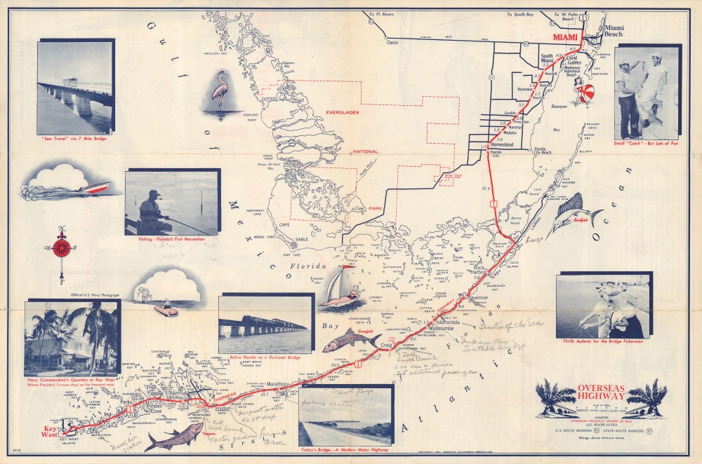
A charming 1950 American Automobile Association (AAA) map of Southern Florida highlighting the Overseas Highway (U.S. 1) running through the Florida Keys. Adorned with photographs and illustrations, it combines function and aesthetics, and highlights fishing in the region, one of the region's main attractions for tourists and residents alike.
The Overseas Highway is the southernmost portion of U.S. Route 1 running from Miami to Key Largo and through the Florida Keys. An impressive piece of engineering, the highway passes through more than a dozen keys, terminating at Key West, with intervening portions consisting of bridges (including the famous Seven Mile Bridge). It was constructed in the wake of the Florida Land Boom of the 1920s.
Originally meant to supplement the preexisting Overseas Railroad, which was unable to meet the demands of the growing population of the Keys, construction began in the mid-1920s on Key Largo. When the 'Labor Day Hurricane' of 1935 destroyed much of the railroad (and portions of the uncompleted highway), the Florida East Coast Railway sold the railroad's right of way to the state and the route of the Overseas Highway came to largely follow that of the earlier railroad. Railroad bridges were converted to automobile roadways and the entire route to Key West opened in 1938.
A Closer Look
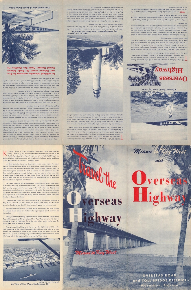
The scope of the map takes in the southernmost portion of Florida, with the route of U.S. 1 from Miami to Key West bolded. The individual keys are meticulously noted, while illustrations of major attractions surround the road map. A previous owner has added notations of other points of interest along or near the road, including the Naval Air Station, toll booths, bridges, and more. Text on the verso provides information about the history and financing of the highway, attractions along its route, and a section on Key West.The Overseas Highway is the southernmost portion of U.S. Route 1 running from Miami to Key Largo and through the Florida Keys. An impressive piece of engineering, the highway passes through more than a dozen keys, terminating at Key West, with intervening portions consisting of bridges (including the famous Seven Mile Bridge). It was constructed in the wake of the Florida Land Boom of the 1920s.
Originally meant to supplement the preexisting Overseas Railroad, which was unable to meet the demands of the growing population of the Keys, construction began in the mid-1920s on Key Largo. When the 'Labor Day Hurricane' of 1935 destroyed much of the railroad (and portions of the uncompleted highway), the Florida East Coast Railway sold the railroad's right of way to the state and the route of the Overseas Highway came to largely follow that of the earlier railroad. Railroad bridges were converted to automobile roadways and the entire route to Key West opened in 1938.
Publication History and Census
This map was produced by the American Automobile Association and the Overseas Road and Toll Bridge District, a state body designed to lobby for federal funds, in 1950. It is held by the University of Wisconsin-Milwaukee and the Newberry Library and is scarce to the market.Cartographer
The American Automobile Association (March 4, 1902 - present), better known as AAA ('Triple-A'), is a federations of motor clubs throughout America. A privately held national member association, AAA boasts over 58 million member in the United States and Canada. Founded on March 4, 1902 in Chicago, Illinois, AAA was originally created in response to a lack of roads and highways that were suitable for cars by nine individual motor clubs, including the Chicago Automobile Club, Automobile Club of America, and Automobile Club of New Jersey. AAA began publishing road maps in 1905 and hotel guides in 1917. More by this mapmaker...
Condition
Very good. Wear along fold lines and small areas of loss at fold intersections. Handwritten annotations.
References
OCLC 70159599.