
This item below is out of stock, but another example (left) is available. To view the available item, click "Details."
Details
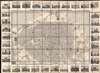
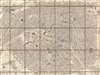
1844 Logerot Map of Paris w/ Vignettes and Fortifications
$950.00
1844 Logerot Map of Paris w/ Vignettes and Fortifications
Paris-logerot-1844$650.00

Title
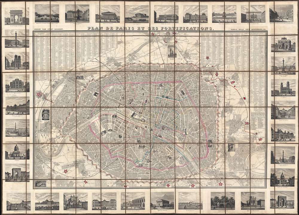
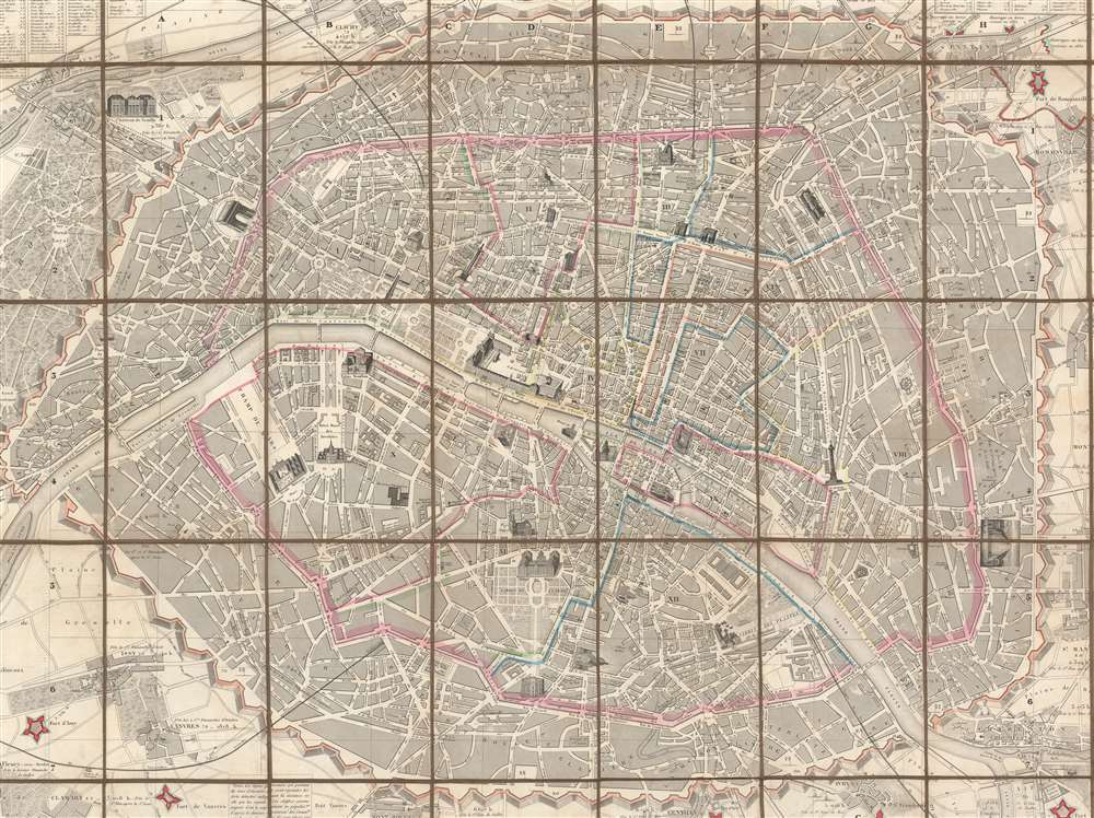
Plan de Paris et ses Fortifications.
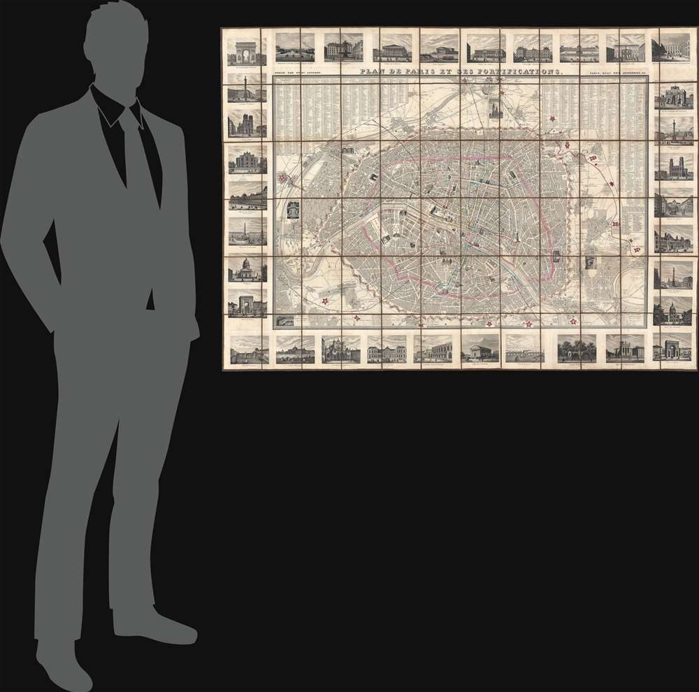
1844 (undated) 36 x 50 in (91.44 x 127 cm) 1 : 12500
1844 (undated) 36 x 50 in (91.44 x 127 cm) 1 : 12500
Description
This is a striking 1844 large-scale July Monarchy (1830 - 1848) map of Paris, France. The map is surrounded by 34 vignette illustrations of important sites - significant as the only edition of this map to feature these. The map predates the Haussmann Renovations (1853 - 1870) but celebrates the 1844 completion of the Thiers Wall and Ring Forts - likely the reason for this deluxe vingette edition. It additionally features profile and vignette illustrations of important sites throughout the map itself.
The Fortification of Paris
This map exhibits the Theirs Wall shortly after it was completed in 1844. Shocked by the seizure of Paris by foreign enemies during the 1814 Battle of Paris, the French King at the time, Louis-Philippe (1830 - 1848), conceived of a board network of walls and forts he believed would make Paris impregnable. The project was met with immediate opposition, some of which claimed that the walls were not defensive, but rather intended to control Parisians in the event of an anti-monarchal rebellion. Nonetheless, under a plan prepared by Marshal General Jean-de-Dieu Soult (1759 - 1861), construction began in 1841. The completed fortifications, named the Thiers Wall after the French Prime Minister at the time, Adolphe Theirs (1797 - 1877), were, at enormous expense, completed in 1844. The walls were 33 kilometers long and consisted of 94 bastions, 17 gates, 23 minor road crossings, and eight railroad gates. By 1919, advancements in military technology made the walls obsolete, leading them to be fully deconstructed by 1929 and replaced with the Boulevard Périphérique.Publication History and Census
This map was issued by Auguste Logerot c. 1844. We have seen other editions of the base map, some dated, some not, as early as 1843 and as late as 1847. We have never before seen an example with the surrounding pictorial vignettes - making this example both exceptionally beautiful and unique. Most catalogers attribute the engraving of this map to Charles Dyonnet and the vignettes to Maillard and A. Toussaint, but we see these names nowhere on this map.CartographerS
Auguste Logerot (fl. c. 1839 - c. 1880) was a French map and general interest publisher active throughout the mid to late 19th century. A. Logerot worked with other French publishers, cartographers and engravers of the period including Fremin, Dufour, Dyonnet, and Vuillemin. He published a large corpus of map and geographical atlases, though few of his map represented unique or exceptionally interesting work. This exception are his wonderful jigsaw puzzle maps - a style popular in 19th century France. Jigsaw puzzle maps are a kind of educational map printed on board and carved up in puzzle format. Logerot's imprint is frequently misprinted as Lagerot or Logeret. Logerot shared offices with several other publishers, printers and engravers at Quai des Augustins 55, Paris. Little else is known of Logerot's life and work. More by this mapmaker...
Charles Dyonnet (fl. c. 1822 - c. 1880) was an extremely active Paris based engraver working in the mid to late 19th century. From his offices at 220 Rue St. Jacques, Paris, Dyonnet engraved numerous maps for many of the most prominent 19th French cartographic publishers including Vuillemin, Dufour, Fremin and Duvotenay. From 1850-1861, he held the coveted position of "Graveur du Dépot de la Marine," and in this position engraved numerous French naval and military maps. Dyonnet had a detail oriented and aesthetically minded hand and is responsible from some of the most beautiful French maps to emerge during the 19th century. Learn More...
Condition
Very good. On original linen. Accompanied by original slipcase.