
1972 al-Ghouri Arabic Wall Map of the Persian / Arabian Gulf

This item has been sold.
الإمارات العربيّة المتّحدة / [The United Arab Emirates].
An Unusual Wall Map of the Gulf Region.
An Unusual Wall Map of the Gulf Region.
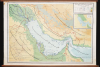
This is a rare c. 1972 wall map of the Persian / Arabian Gulf region by Ibrahim Hilmi al-Ghouri. Published by the Scientific Foundation for Educational Aids, it was likely intended for classroom use in the United Arab Emirates.A Closer Look
Although titled 'The United Arab Emirates,' the map covers the wider Gulf region (here called the 'Arabian Gulf' as is common in the Arab world), including Bahrain, Qatar, Kuwait, and portions of Oman, Saudi Arabia, Iran, and Iraq. International boundaries are traced, marked with a dashed line along the southern border of the U.A.E., reflecting unresolved territorial disputes with Saudi Arabia (in the west, the border of the U.A.E. reaches to Qatar, whereas the 1974 Treaty of Jeddah - only ratified much later - stipulated that a portion of Saudi Arabia lies between the U.A.E. and Qatar). The unusual border along the Iranian coast of the Persian Gulf demarcates the territory of 'Arabistan' (عربستان), easily the most unusual element of this map (discussed more below). Railways, paved and passable roads, oil basins and pipelines, waterways, salt flats, and elevation are also recorded throughout. An inset map below the title provides climatological data, using green color shading to indicate annual rainfall.'Arabistan'
This map includes a territory along the Iranian coast of the Gulf called 'Arabistan' (عربستان), stretching from Abadan and environs on the Iraqi border to past the Musandam Peninsula and the Strait of Hormuz. This is a historical term for a large portion of Khuzestan Province between Mesopotamia and the Zagros Mountains that was coined by the Safavids in the 17th century. In the 19th century, the Emirate of Muhammara operated autonomously of the central Qajar Iran government, but in the 20th century, the Pahlavi dynasty strove for central control and reunited Khuzestan, eliminating the use of the term or concept of Arabistan. But Khuzestan has since maintained a significant Arab minority (about one-third of the province's population), and in times of strife, Arab identity has become a means of opposing the central government. This was most obvious during and after the 1979 Iranian Revolution, when unrest eventually resulted in a local uprising against the Islamist revolutionary government, with the distinctly Shia identity of the new regime irritating the mostly secular or Sunni Arab population. During the Iran-Iraq war that followed, the Arabs of Khuzestan generally supported Iraq. In recent years, connected to wider unrest in the region but also driven by local grievances against the regime, a range of armed movements has operated a low-level insurgency in the region (generally replacing Arabistan with Ahvaz, another historical name for Khuzestan and the name of its provincial capital city). Here 'Arabistan' ranges far beyond the borders of Khuzestan along the Gulf coast, likely a reflection of ambitious Arab hopes for a friendly neighbor covering the Strait of Hormuz, the importance of which has been clearly demonstrated by recent events. The U.A.E. has also had territorial disputes with Iran over several islands in the Gulf since its independence in 1971.Publication History and Census
This map was prepared by Ibrahim Hilmi al-Ghouri with text by Muhammed Bashir al-Idlibi (محمد بشير الإدلبي), a well-known Syrian linguist and calligrapher, and was published by the Scientific Foundation for Educational Aids (المؤسسة العلمية للوسائل التعليمية). It is undated but was produced in the early years following the 1971 independence of the U.A.E. The only other known example of this wall map is held by the U.A.E. Federation Library in the Maps and Atlases Collection (no specific call number provided).Cartographers
Ibrahim Hilmi al-Ghouri (1925 - 2004; إبراهيم حلمي الغوري) was a Syrian geographer, cartographer, and astronomer. He was a prolific author, with major works including the Atlas of the Modern World (أطلس العالم الحديث), Natural Atlas of Syria (الأطلس الطبيعي لسورية), and the Natural and Human Atlas of the Arab World (الأطلس الطبيعي والبشري للوطن العربي), among others. Further Details...
Scientific Foundation for Educational Aids (المؤسسة العلمية للوسائل التعليمية; c. 1980 - present) is a publishing house and educational institution based in Aleppo, Syria, with offices in Beirut, Lebanon, specializing in the production of Arabic-language geographical and historical educational materials. The publishing house is particularly known for its atlases and maps, including wall maps intended for classroom use. Remarkably, the firm continued to operate to a degree during the Syrian Civil War, during which Aleppo was heavily damaged. Further Details...
Condition
Very good. Linen backed wall map on original rollers. Water stain upper left corner.