1916 Royal Geographical Society Map of Bolivia and Peru
PeruBoliviaBoundary-royalgeographical-1916$250.00

Title
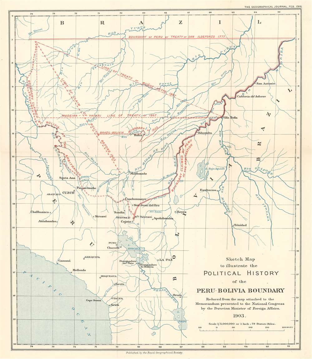
Sketch Map to illustrate the Political History of the Peru-Bolivia Boundary.
1916 (dated) 13.5 x 11.75 in (34.29 x 29.845 cm) 1 : 5000000
1916 (dated) 13.5 x 11.75 in (34.29 x 29.845 cm) 1 : 5000000
Description
This is a 1916 Royal Geographical Society map of Bolivia and Peru. Depicting the region from the Rio Ucayali to Brazil and from the Rio Yurua in Brazil to Lake Poopo and the Pacific coast. Red overprinting highlights the regional fluidity of national borders. Claims spanning from the late 18th into the early 20th century are traced by variously coded delimiters. Labels inform the viewer of the many claims and treaties, underscoring the region's complex diplomatic situation. Eventually, Bolivia and Brazil signed a treaty that set their mutual border. Bolivia and Peru, however, submitted their border dispute to international arbitration, ultimately conducted by the government of Argentina.
Publication History and Census
This map was reduced from a map 'Attached to the Memorandum presented to the National Congress by the Peruvian Minister of Foreign Affairs by the Royal Geographical Society for publication in the February 1916 edition of The Geographical Journal.' Two examples are cataloged in OCLC and are part of the institutional collections at Harvard College and Cambridge University.Cartographer
Royal Geographical Society (fl. 1830 - present) is a British Society established in 1830 to promote geographical science and exploration. Originally titled the "Geographical Society of London", the RGS received its royal charter from Queen Victoria in 1859 shortly after absorbing several similar but more regional societies including the African Association, the Raleigh Club and the Palestine Association. The RGS sponsored many of the most important and exciting voyages of exploration ever undertaken, including the exploration of Charles Darwin, David Livingstone, Robert Falcon Scott, Richard F. Burton, John Speke, George Hayward, H. M Stanley, Ernest Shackleton and Sir Edmond Hillary. Today, the RGS remains a leading global sponsor of geographical and scientific studies. The Society is based in Lowther Lodge, South Kensington, London. More by this mapmaker...
Source
Toppin, H.S., 'The Diplomatic History of the Peru-Bolivia Boundary.' The Geographical Journal Vol. 47, No. 2 (London: Royal Geographical Society) 1916.
Condition
Very good. Exhibits slight wear and toning along original fold lines. Blank on verso.
References
OCLC 904320081, 84983835.