
This item below is out of stock, but another example (left) is available. To view the available item, click "Details."
Details
1944 Army Map Service Road Map of the Central and Southern Philippines
1944 (dated) $300.00
1971 U.S. Army Topographic Command Topographic Map of the Philippines
Philippines-armytopo-1971$125.00

Title
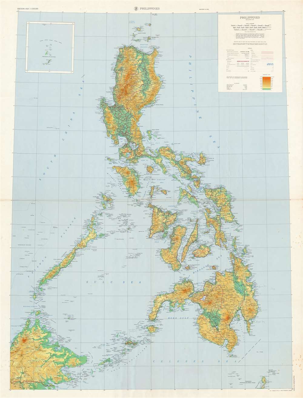
Philippines.
1971 (dated) 48.5 x 36 in (123.19 x 91.44 cm) 1 : 1500000
1971 (dated) 48.5 x 36 in (123.19 x 91.44 cm) 1 : 1500000
Description
This is a large 1971 U.S. Army Topographic Command topographic map of the Philippines. Depicting from the Babuyen Islands south to Borneo and Sulawesi, an incredible level of detail is present. Myriad cities, towns, and villages throughout the archipelago are labeled, along with innumerable coastal bays, gulfs, and points. The number of islands identified here is astounding, with each of the major islands, such as Luzon, Mindoro, Leyte, Samar, Panay, Mindanao, Negros, and Cebu all labeled, as well as hundreds of smaller islands. Seas and channels within the archipelago are labeled as well. Roads are illustrated in red and are differentiated between primary, secondary, and tracks or trails, as well as those under construction. Topography is indicated by gradient lines and colors.
Publication History and Census
This map was created and published by the U.S. Army Topographic Command in 1971. This map is well represented institutionally and is scarce on the private market.Cartographer
The Army Map Service (AMS) (1941 - 1968) was the military cartographic agency of the U.S. Department of Defense and part of the U.S. Army Corps of Engineers. The AMS compiled, published, and distributed military topographical maps and other related materials for use by the U.S. Armed Forces. They also prepared maps for space exploration, intelligence reports, and the establishment of world geodetic control networks. Formed during World War II, by the end of the war the Army Map Service had prepared 40,000 maps. 3,000 different maps were created for the Normandy invasion alone. The AMS was instrumental in the Korean War and the Vietnam War, and during all three of these conflicts distributed tens of millions of maps to U.S. servicemen. On September 1, 1968, the AMS was resdesignated the U.S. Army Topographic Command, and continued under this name as an independent organization until January 1, 1972 when it was merged with the new Defense Mapping Agency and renamed the DMA Topographic Center. The Defense Mapping Agency was added to the National Imagery and Mapping Agency on October 1, 1996, which was redesigned the National Geospatial-Intelligence Agency in 2003. More by this mapmaker...
Condition
Very good. Light wear along original fold lines. Exhibits foxing. Light soiling along fold lines. Blank on verso.
References
OCLC 221492423.