This item has been sold, but you can get on the Waitlist to be notified if another example becomes available, or purchase a digital scan.
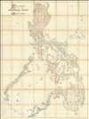
1897 Chofré Wall Map of the Philippines - only known example
Philippines-chofre-1897$22,500.00

Title
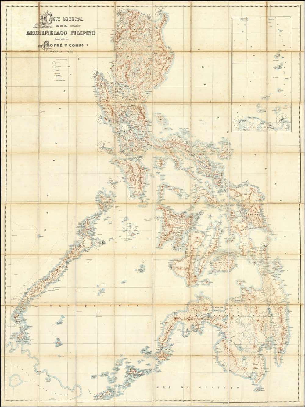
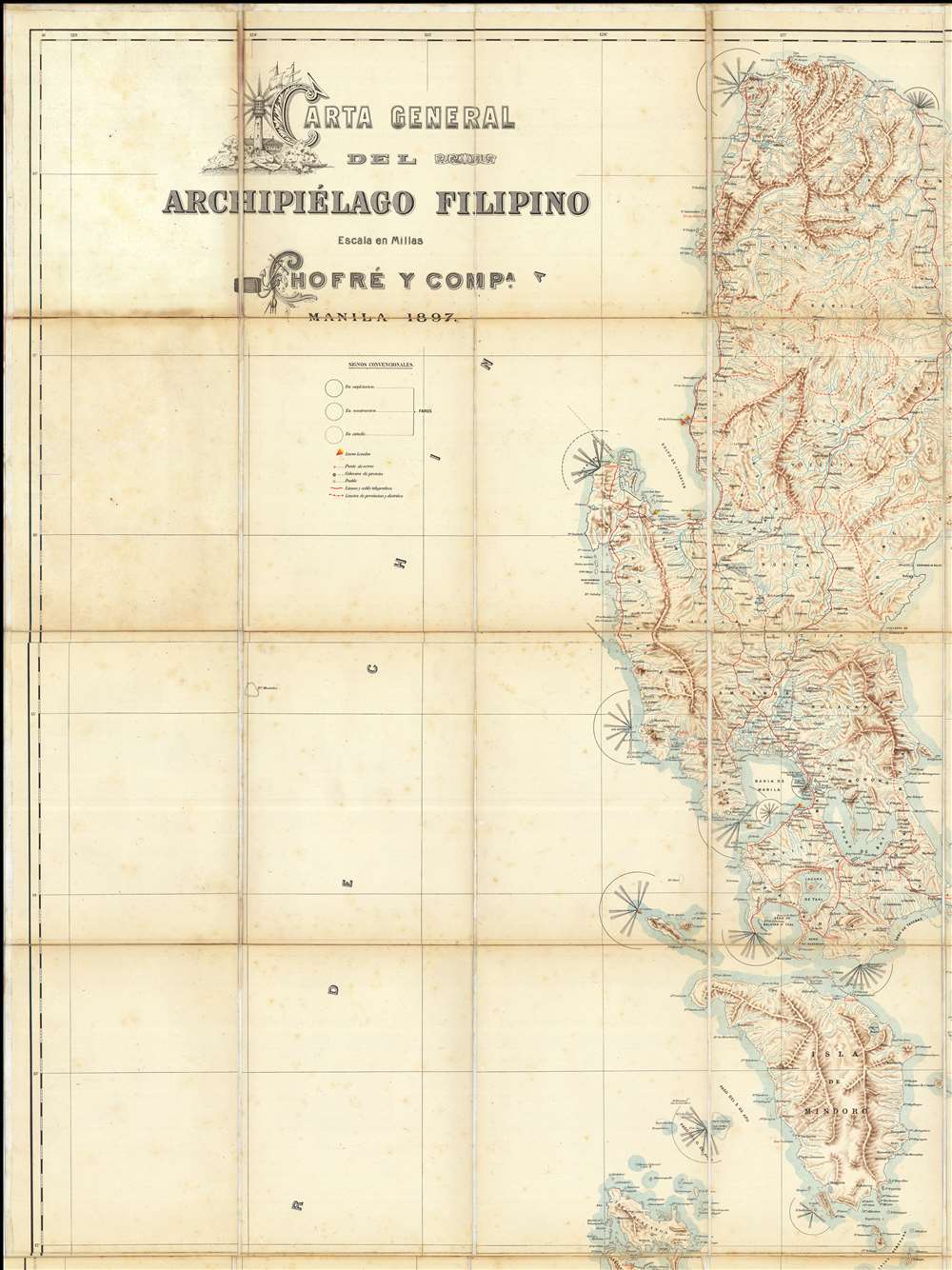
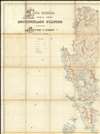
Carta General del Archipiélago Filipino.
1897 (dated) 80 x 60 in (203.2 x 152.4 cm)
1897 (dated) 80 x 60 in (203.2 x 152.4 cm)
Description
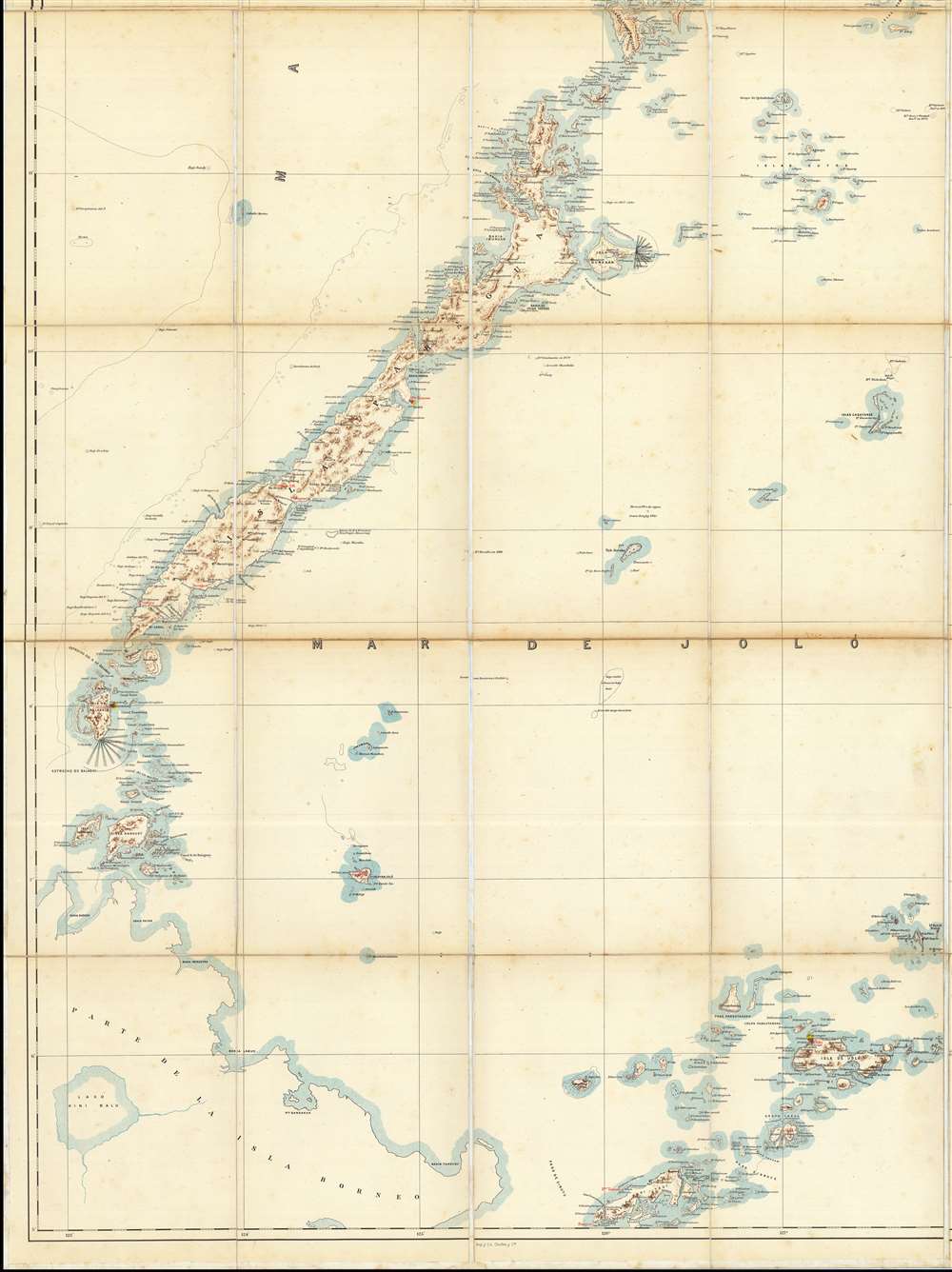
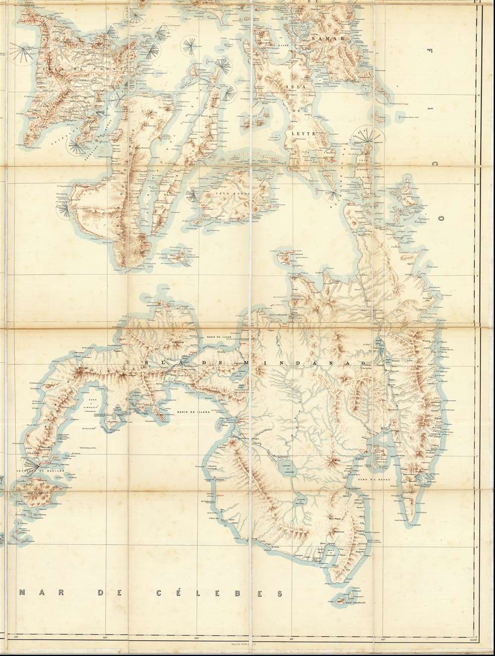
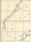
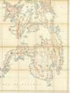
This is the only known example of Salvador Chofré's spectacular 1897 map of the Philippines - what must be considered the largest and most detailed Spanish map of the Philippines issued in the 19th century. The map was produced by Salvador Chofré, Manila's first lithographer at the height of his career, likely by government request in the face of the Philippine Revolution (1896 - 1898). The present example is likely a proof, as no other example or publishing history is known. What is known is that this example was acquired by American naval officer Henry Glass in 1898, when he participated in the invasion and surrender of Manila. The U.S. Navy reportedly reproduced it, very likely from this example, at a 50% reduced scale, although we have found no trace of said reproduction. The present map accompanied Glass when he returned to the United States, serving in San Francisco and attaining the rank of Rear Admiral, and was subsequently passed down through his family until we acquired it.
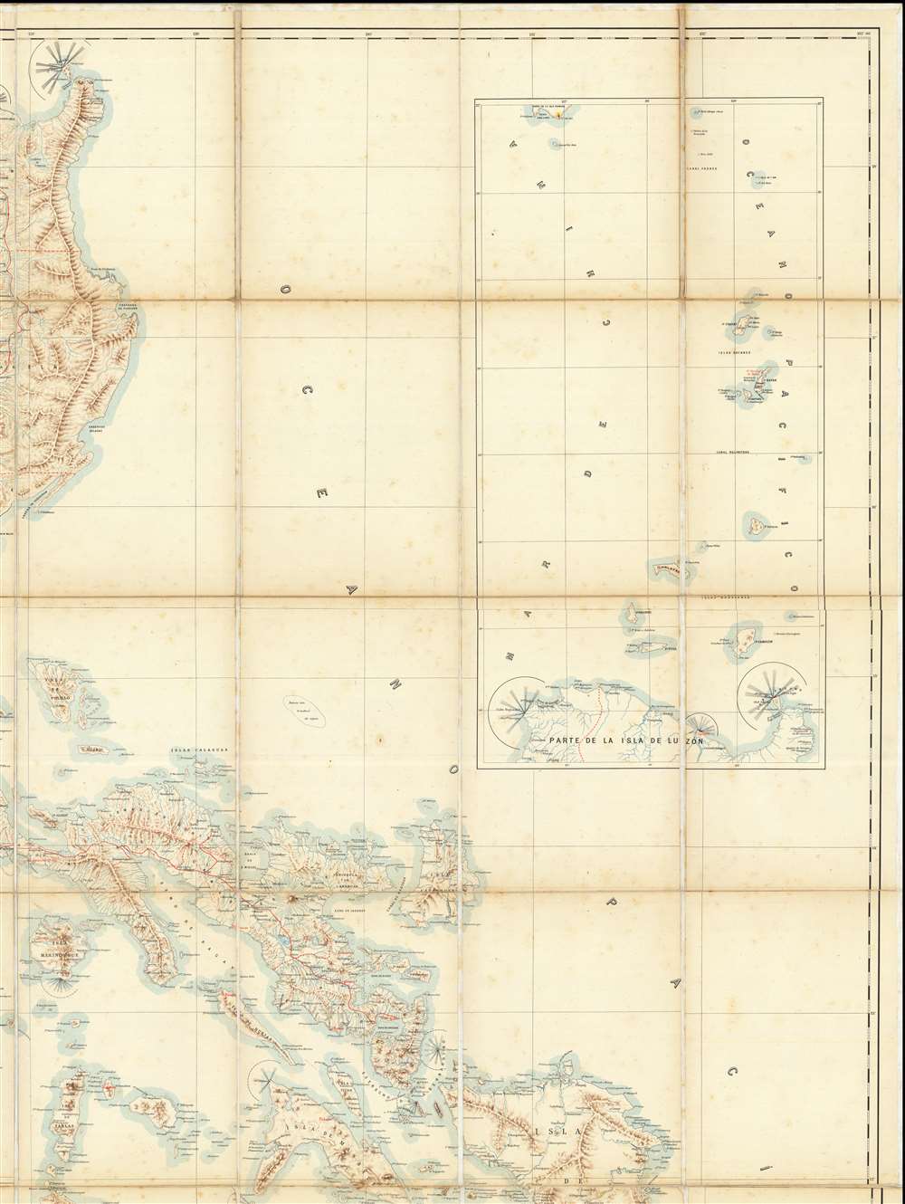
Along the coasts more than twenty lighthouses are noted - all of which employ a practical system of illustrating light-patters for easy identification. This technique, which involves coding the timing and color of light pulses, enables the mariner to roughly glean location based upon distinct patterns. This system was widely adopted by the pan-European navigational community but is most prevalent on British charts. While Chofré has provided no sources on this map, the presentation of lighthouse flash-patterns suggests British nautical charts were consulted.
A Closer Look
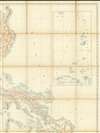
This enormous and expansive map covers all of the Philippine Islands and almost certainly represents the largest map of the archipelago to appear in the 19th century. It is printed via a four-color chromolithographic process with black indicating overall boundaries and titles, brown illustrating topography, blue denoting bodies of water, and red representing political boundaries and infrastructure. Towns and cities are labeled throughout, but most follow the coast or major river systems, with large swathes of the interior lacking data - underscoring both the challenging terrain and tenuous Spanish understanding of the archipelago even after some 300-plus years of colonial administration.Along the coasts more than twenty lighthouses are noted - all of which employ a practical system of illustrating light-patters for easy identification. This technique, which involves coding the timing and color of light pulses, enables the mariner to roughly glean location based upon distinct patterns. This system was widely adopted by the pan-European navigational community but is most prevalent on British charts. While Chofré has provided no sources on this map, the presentation of lighthouse flash-patterns suggests British nautical charts were consulted.
The Philippine Revolution
This map was published against the backdrop of the Philippine Revolution. The revolution began in 1896, when a series of Philippine nationalist quasi-religious secret societies, known collectively as the Katipunan, emerged in Luzon. While the Katipunan were not 'hidden', they were secretive and appealed primarily to the disenfranchised, and so went largely unnoticed by the Spanish elite. By the time violence broke out in 1896, membership numbered in the hundreds of thousands. After more than 300 years of Spanish colonial rule, the Katipunan-led revolution exposed the weakness of the Spanish administration. Fighting spread throughout the archipelago, with the revolutionaries enjoying significant early success. The Katipunan, nonetheless, soon began to lose ground and in 1898, a 'pact' ended most conflict, leaving the Spanish in charge. By this time, other factors had come into play. U.S. concerns over Cuban independence from Spain led to the sinking of the U.S.S. Maine and the Spanish-American War (April 21, 1898 – December 10, 1898). The war promptly extended beyond the Caribbean to Spanish colonies in the Pacific. The Spanish Philippine Navy had little chance against overwhelming U.S. Naval power and, their fleet destroyed, Manila promptly surrendered, ending some 333 years of Spanish rule and precipitating the Philippine-American War (1899 - 1902).A Distinguished Provenance: Henry Glass
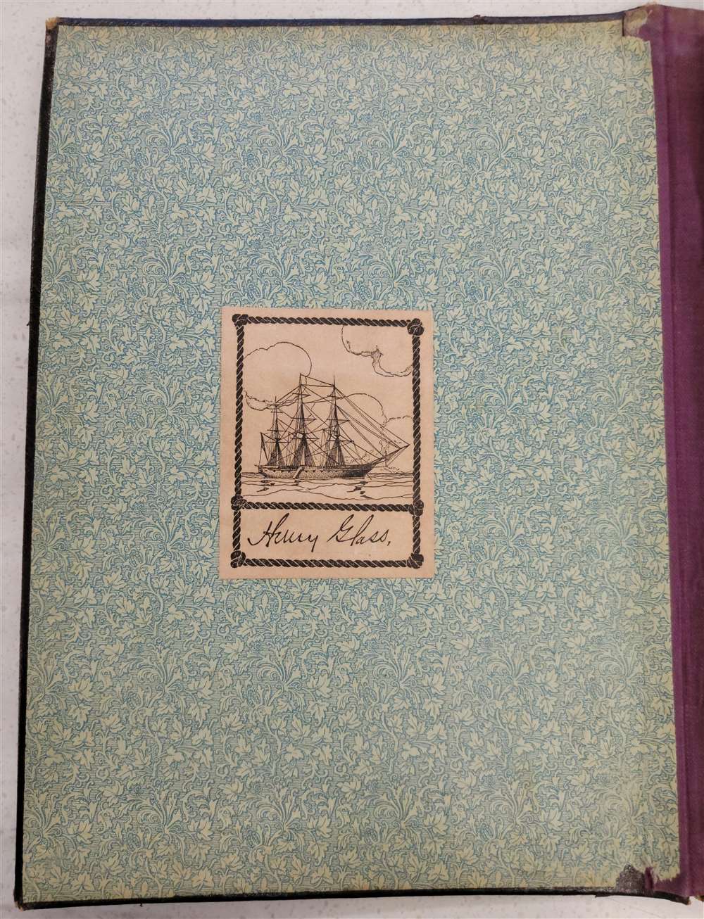
This map has a noteworthy provenance connecting it by descent to Henry Glass (1844 - 1908), an American naval officer active in the Philippines during the Spanish American War, where he was assigned to command the cruiser U.S.S. Charleston. He landed in Manila with three troop transports and participated in the August 1898 surrender of that city. After the Spanish American War, he took part in the Philippine-American War against Philippine insurgents against American rule. It was during this period that he acquired and reproduced the present map, on a significantly reduced scale, for use in planning counter-insurgency operations. Glass returned with the original Chofré map to San Francisco, California, on January 23, 1899. He was promoted to rear admiral in 1901 and served until retiring in 1906. The map was subsequently passed down within his family until we acquired it. Regarding the reduced copy purportedly created by the U.S. Signal Office, we find a couple surviving examples in institutional collections. This map is also described in the American Geographical Society Journal (1899, page 262),Our new possessions continue to furnish an impetus for mapmaking. The Signal Office of the War Department has republished, by photolithography, greatly reduced, a Spanish map of the Philippines, under the title 'Carta General del Archipiélago Filipino, Chofre y Comp'a, Manila, 1897'.
Chromolithography
Chromolithography, sometimes called oleography, is a color lithographic technique developed in the mid-19th century. The process involved using multiple lithographic stones, one for each color, to yield a rich composite effect. Oftentimes, the process would start with a black basecoat upon which subsequent colors were layered. Some chromolithographs used 30 or more separate lithographic stones to achieve the desired product. Chromolithograph color could also be effectively blended for even more dramatic results. The process became extremely popular in the late 19th and early 20th centuries, when it emerged as the dominant method of color printing. The vivid color chromolithography produced made it exceptionally effective for advertising and propaganda imagery.Publication History and Census
This map was printed in Manila by Typo-Lithografia Chofré in 1897 using a multi-color chromolithographic process. It is the largest map of the Philippines printed in the Philippines until the 20th century. The present map is the only known surviving example. Co-owned with Barry Lawrence Ruderman Rare Maps.Cartographer
Salvador Chofré (fl. c. 1880 - 1898) was a Spanish lithographic printer who established himself in Manila, Philippines. Chofré was born in Madrid, but of French descent.. It is unclear when he emigrated to Manila, but in 1880 he imported a lithographic press from Germany and established, 'Tipo-Litografia de Chofré y Compañía,' becoming the first lithographer in the Philippines. He worked broadly, issuing maps, sheet music, children’s publications, and government documents. By 1898, he ran the largest private printing house in Manila. His workshops were on Alix Street (no Lagarda), and his shop was located on L'Escolta. One of Salvador's sons, Francisco Chofré Olea (1873 - 1896), died in 1896, in the Philippine War (1896 - 1898), and in grief, the operations were crippled. In 1902 it was acquired by Alfredo Chicote, who continued to print under the Chofré imprint. In 1927, it was acquired by Jesus Cacho, who renamed it Cacho Hermanos, under which name it remains active to this day. A further Salvador Chofré, possibly another son, attempted to immigrate to the United States in the 1920s, citing unrest in the Philippines. Salvador's dates are unknown. More by this mapmaker...
Condition
Very good. Original linen backing. Some wear on old fold lines.