
1941 'Pictorial Review' Map of the Philippines, Eve of Pearl Harbor Attack, World War II

Philippines Need Fortification...
Prescient Warning Weeks before the Pearl Harbor Attack.
$750.00
Choose a Collection:
- Digital Map Information
- Suitable for large format printing
- Full resolution TIFF file
- ICC color profile embedded
- Delivered instantly via download link
This Item
Enquire
Prescient Warning Weeks before the Pearl Harbor Attack.
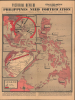
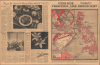
Published in the Herald-American Pictorial Review in late September 1941, this map of the Philippines is a prescient warning of the coming catastrophe. It portrays the Philippine Islands as dangerously unprepared for a foreign invasion, with Japan's threat looming over the archipelago. Less than three months later, those fears became reality: within hours of the Pearl Harbor Attack, Japanese forces struck the Philippines, beginning an invasion that would overwhelm the islands and inaugurate more than three years of brutal occupation.A Closer Look
The main map covers the Philippine Archipelago and a portion of Borneo, labeling islands and cities. Text boxes and annotations describe resources such as gold, teak, iron, and tobacco. Other text discusses military vulnerabilities and correctly predicts potential Japanese landing sites. An inset at the top left shows the wider Southeast Asia region, labeling Japanese-occupied areas in red and making similar remarks about resources and military preparedness, emphasizing that the Japanese would be well positioned to encircle and cut off the Philippines. A second inset illustrates a portion of the globe to present the wider Japanese plan to dominate the Pacific and threaten the United States.This map appeared in the Herald-American Pictorial Review, part of the newspaper empire of William Randolph Hearst (1863 - 1951), perhaps the most influential media figure in U.S. history. This article was correct about the Philippines being exposed. Hearst's suspicions of Japan and 'Asiatics' went back much further, with Hearst penning editorials against Asian immigration and the 'Yellow Peril' as far back as the 1890s, including warnings of a Japanese invasion of California in the 1910s. Despite being an isolationist regarding European geopolitics (and a supporter of Hitler until the U.S. entered the war), he saw a war with Japan as nearly inevitable in the years before U.S. entry into World War II. Unsurprisingly, in the wake of the Pearl Harbor attack, Hearst was a vocal proponent of the internment of Japanese Americans and used his media empire to shape public opinion and government policy via strident and venomous editorials.
Historical Context
On the eve of the Pearl Harbor attack in late 1941, military defense in the Philippines was in a precarious state of transition under General Douglas MacArthur, commander of the newly formed United States Army Forces in the Far East (USAFFE). MacArthur had departed from the traditional strategy, which dictated an immediate retreat to Bataan and Corregidor, in favor of an aggressive plan to stop an invading force at the landing beaches. However, the forces assigned to implement this strategy were severely unprepared; the newly mobilized Philippine Army consisted largely of under-equipped recruits lacking modern artillery, anti-tank weaponry, and adequate combat training. Although recently reinforced by the arrival of B-17 Flying Fortresses and P-40 Warhawks, critical radar networks, logistical stockpiles, and air defense infrastructure remained dangerously incomplete when war broke out. (Most American production of such equipment was earmarked for Europe via Lend-Lease, and military planners falsely believed Japan would not attack until 1942 or later.)The Japanese assault began on December 8, 1941, when land-based bombers caught a major portion of the Far East Air Force on the ground at Clark Field and Iba Airfield, destroying the majority of American regional air power. After some smaller, preliminary landings, Lieutenant General Masaharu Homma's 14th Army landed major invasion forces at Lingayen Gulf and Lamon Bay in late December, rapidly sweeping through thin beach defenses and forcing MacArthur to abandon his coastal strategy and order a retreat to Bataan. Allied troops executed a grueling fallback into the peninsula while declaring Manila an open city on December 26, mounting a desperate defense despite severe food shortages, rampant malaria, and a complete lack of naval reinforcement. By March 1942, as the garrison continued to bog down the Japanese campaign timetable, MacArthur was ordered to evacuate to Australia, leaving Major General Jonathan Wainwright to command the besieged forces until Bataan's fall in April and Corregidor's final surrender in May.
Publication History and Census
This map appeared in the September 21, 1941, issue of the Herald-American Pictorial Review. We only note one cataloged example, part of the Braga Collection at the National Library of Australia, printed with an alternate color scheme and presumably derived from a different Hearst newspaper.Condition
Good. Newsprint. Verso repairs to fold separations and at fold intersections. Slight loss at some fold intersections. Closed edge tears professionally repaired on verso. Dimensions given are for the map only, not the entire sheet.
References
National Library of Australia, MAP Braga Collection Col./69 (alternate printing).