This item has been sold, but you can get on the Waitlist to be notified if another example becomes available, or purchase a digital scan.
1948 John Pictorial City Plan or Map of Miami, Florida
PictorialPlesurmapMiami-john-1948$150.00


Title
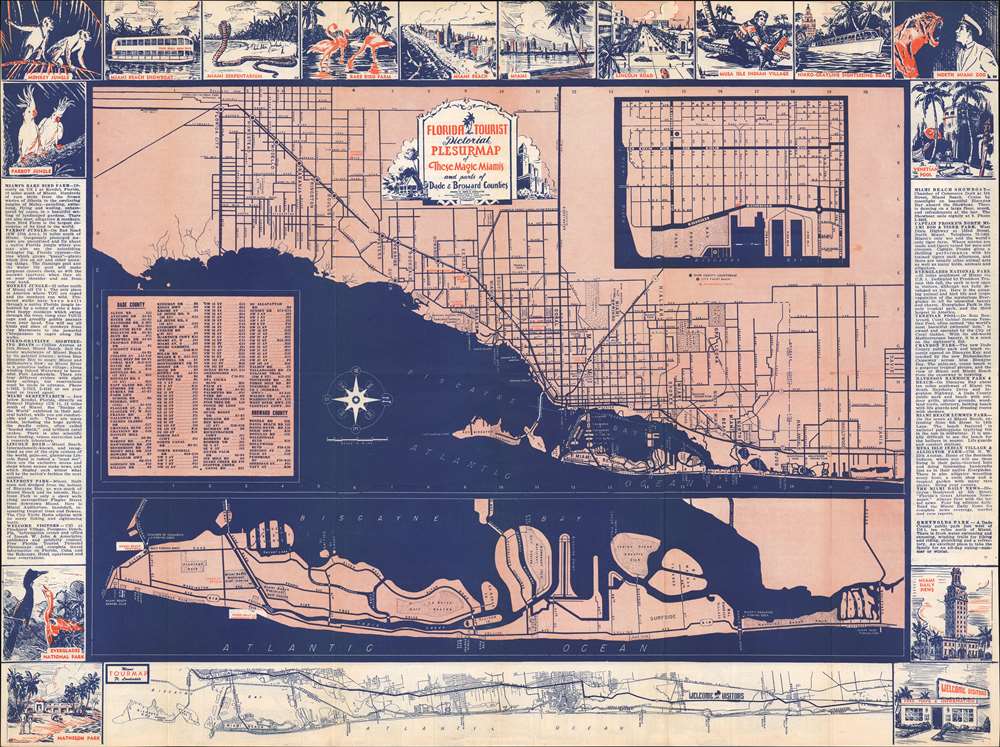
Florida Tourist Pictorial Plesurmap of These Magic Miamis and parts of Dade and Broward Counties.
1948 (undated) 18 x 24 in (45.72 x 60.96 cm) 1 : 38600
1948 (undated) 18 x 24 in (45.72 x 60.96 cm) 1 : 38600
Description
This is a c. 1948 'Joseph W. John and Associates' pictorial city plan or map of Miami, Florida. Oriented towards the west, the map depicts the Florida coast from Florida City north to Davie. Wonderful sketches promoting tourist attractions and local businesses create the border on both the recto and verso. Red text marks many of the promoted attractions, including the Parrot Jungle, the Rare Bird Farm, the Serpentarium, the Monkey Jungle, and Lincoln Road. A Dade County and Broward County road index appears on the lower left. A map of the Florida Coast from Miami to Boca Raton creates most of the bottom border.
Verso Content
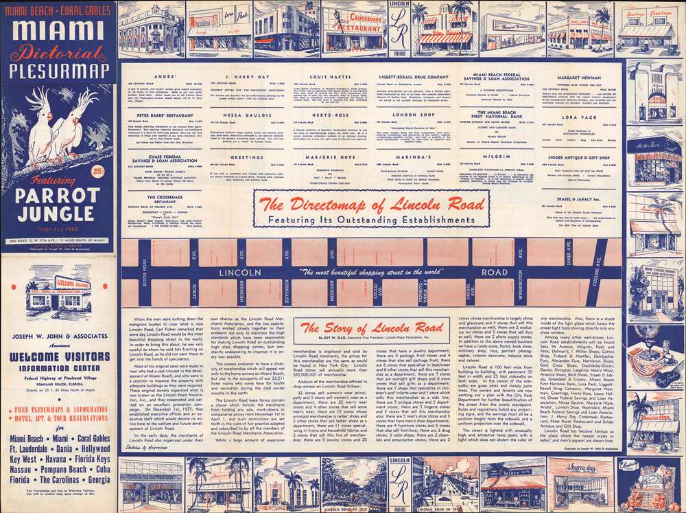
A map of Lincoln Road, 'the most beautiful shopping street in the world' occupies the verso along with a short history of the district. Advertisements for companies lining the road and sketches of many of the businesses appear as well.Dating the Map
While undated, context clues suggest 1948. The text describing Everglades National Park references that it will be 'dedicated by President Truman this fall'. Everglades National Park was dedicated by President Truman on December 6, 1947. The map also highlights Crandon Park, 'the new Dade County public part and beach recently opened on Biscayne Key'. Crandon Park opened in the fall of 1947, after construction was delayed due to World War II.Publication History and Census
This map was created and published by Joseph W. John and Associates c. 1948. This is the only known surviving example.Cartographer
Joseph William John (1892 - 1948 or 1949) was an American mapmaker and publisher. Born in Alabama, John owned a mapmaking and printing firm called Joseph W. John and Associates in Miami in the 1940s. John sued the Greater Miami Apartment House and the Advance Press, Inc. in 1943 for copyright infringement. The suit included $200,000 in damages. The case was settled out of court and the settlement amount was not published. John also sued the Overseas Highway Commission and Monroe County for similar copyright infringement concerning a map of Key West. More by this mapmaker...
Condition
Very good. Exhibits light wear along original fold lines. Text, printed images, and map of Lincoln Road on verso.