
1939 World War II Era Manuscript Map of Nightlife Sites in Pimlico, London

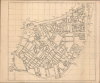

[Pimlico, London.]
Pimlico's social geography at the outset of WWII.
$3,500.00
Choose a Collection:
- Digital Map Information
- Suitable for large format printing
- Full resolution TIFF file
- ICC color profile embedded
- Delivered instantly via download link
This Item
Enquire
Pimlico's social geography at the outset of WWII.
This is an exceptional c. 1939 manuscript map of Pimlico, London, capturing the social geography of wartime London just before the Blitz, German aerial bombing campaign against London and the rest of the United Kingdom. Uniquely, rather than emphasizing civil defense, it meticulously identifies the pubs, clubs, theaters, and nightlife that sustained morale in the shadow of grim war. The map's remarkable precision, suggestive of a military hand, leads us to believe it was prepared as a recreation guide for soldiers on leave, preserving a vibrant urban landscape that would soon be devastated during the Blitz of 1940-1941.A Closer Look
The map is entirely in manuscript, executed by an experienced hand - likely someone with military training. Centered on Vauxhall Bridge Road, coverage extends from Buckingham Palace Road to Millbank and from Victoria Street to Grosvenor Road. Coverage thus includes Westminster Abby, Westminster Cathedral, the Houses of Parliament, and Victoria Station. The area of greatest detail appears in the upper right, across from the Houses of Parliament and around Dean's Yard. Throughout, the map names important public buildings, religious buildings, streets, and key historical sites; though by far, the most comprehensive coverage centers around social clubs, pubs, theaters, and nightclubs. It is through these that we are somewhat able to date the map, as many of the locations here were destroyed by or closed due to the Blitz, suggesting a likely date of 1939.Pimlico before the Blitz
In the early months of World War II, before the Blitz, Pimlico occupied a strategically important position at the heart of wartime London. Situated just south of Victoria Station and within walking distance of Buckingham Palace, Whitehall, and the Houses of Parliament, the neighborhood found itself at the center of London's military and governmental activity. Its streets bustled with soldiers, civil servants, evacuees, and wartime traffic as Britain prepared for the conflict under blackout regulations and the constant expectation of air raids. Those fears were realized during the Blitz, beginning in September 1940, when German bombing inflicted heavy damage across Pimlico, destroying homes, businesses, and public buildings, permanently reshaping the district.Publication History and Census
This is a unique manuscript. It is undated and unsigned. No other known examples.Condition
Very good. Manuscript pen and ink on paper. Even toning. Pinholes in corners. Some soiling. Wear along old fold lines.