1858 Walling Wall Map of Piscataquis County, Maine
PiscataquisCountyME-walling-1858$2,500.00


Title
Map of Piscataquis County Maine.
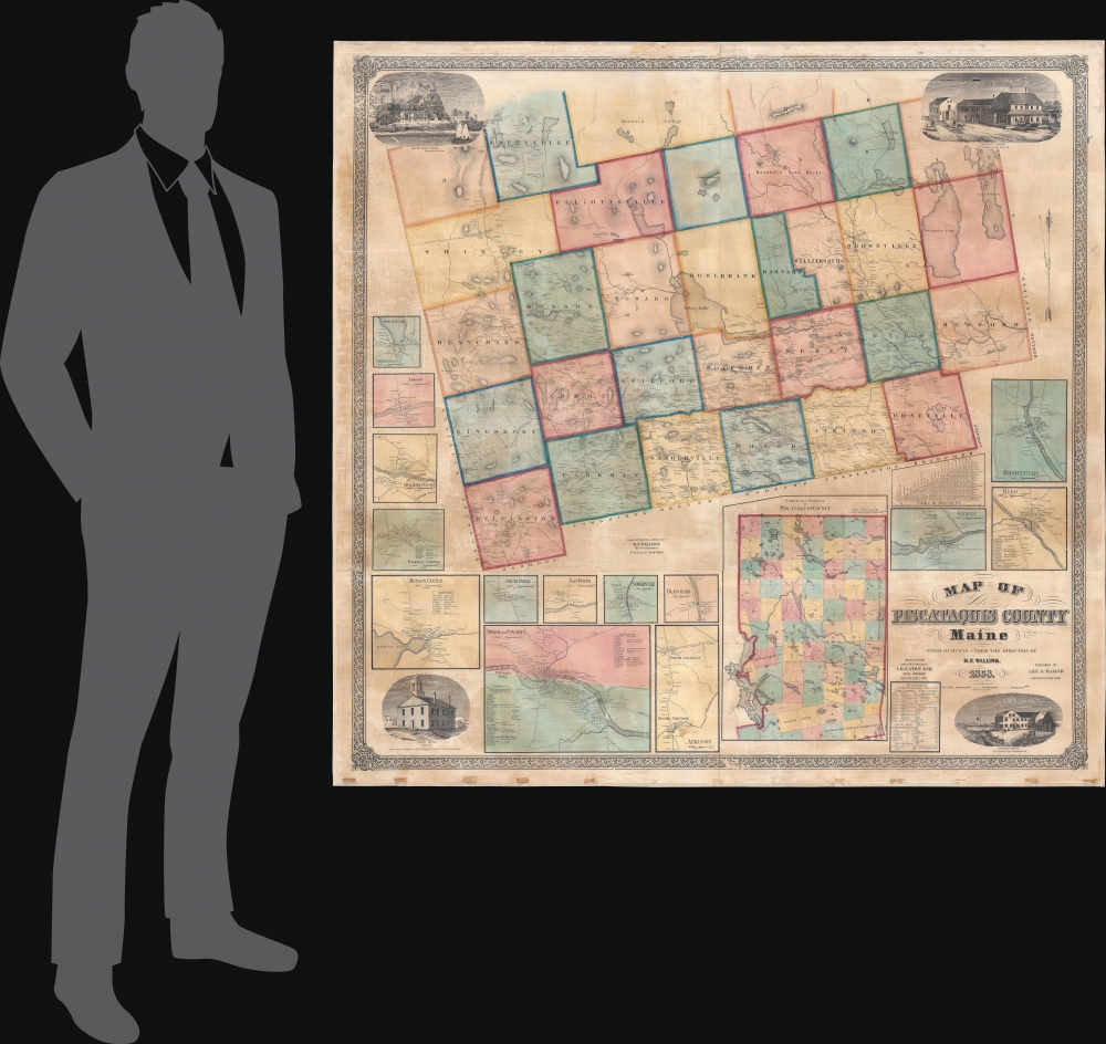
1858 (dated) 54.25 x 56 in (137.795 x 142.24 cm) 1 : 63360
1858 (dated) 54.25 x 56 in (137.795 x 142.24 cm) 1 : 63360
Description
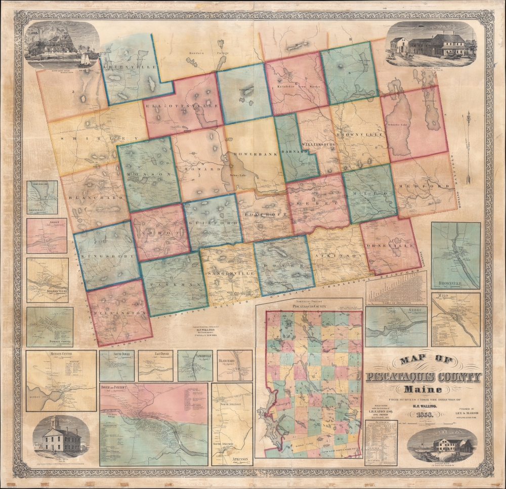
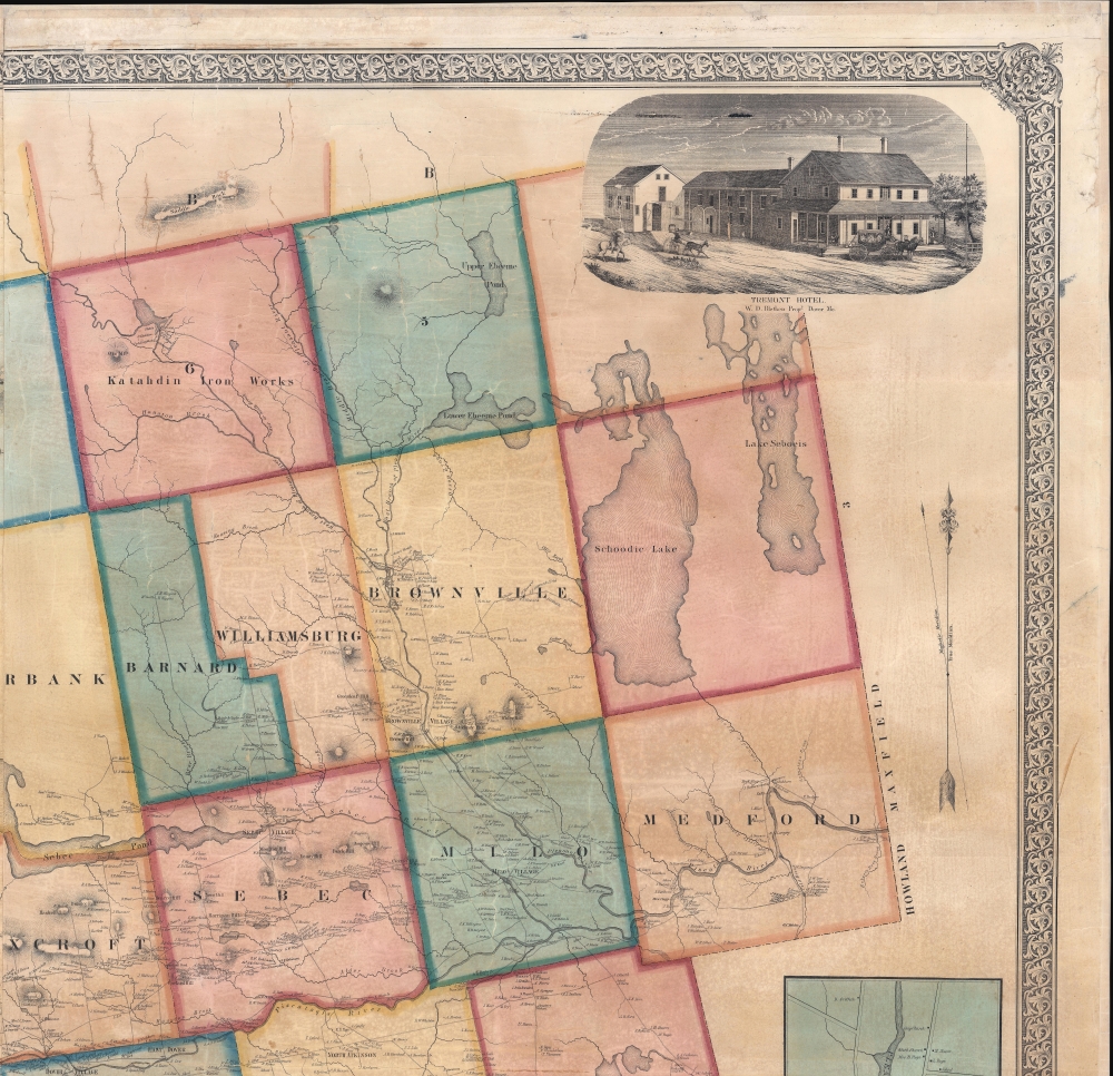
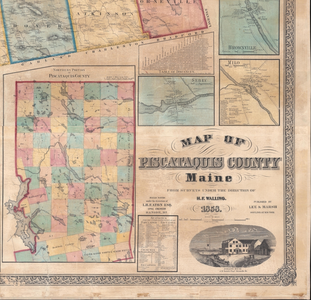
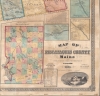
This is an 1858 Henry Francis Walling wall map of Piscataquis County, Maine. The map includes Moosehead Lake, Mount Katahdin (a very serious climb), and lands granted to Bowdoin College. The Katahdin Iron Works is labeled despite the fact that it ceased production one year earlier in 1857 (it would resume with the Civil War in 1861).
A Closer Look
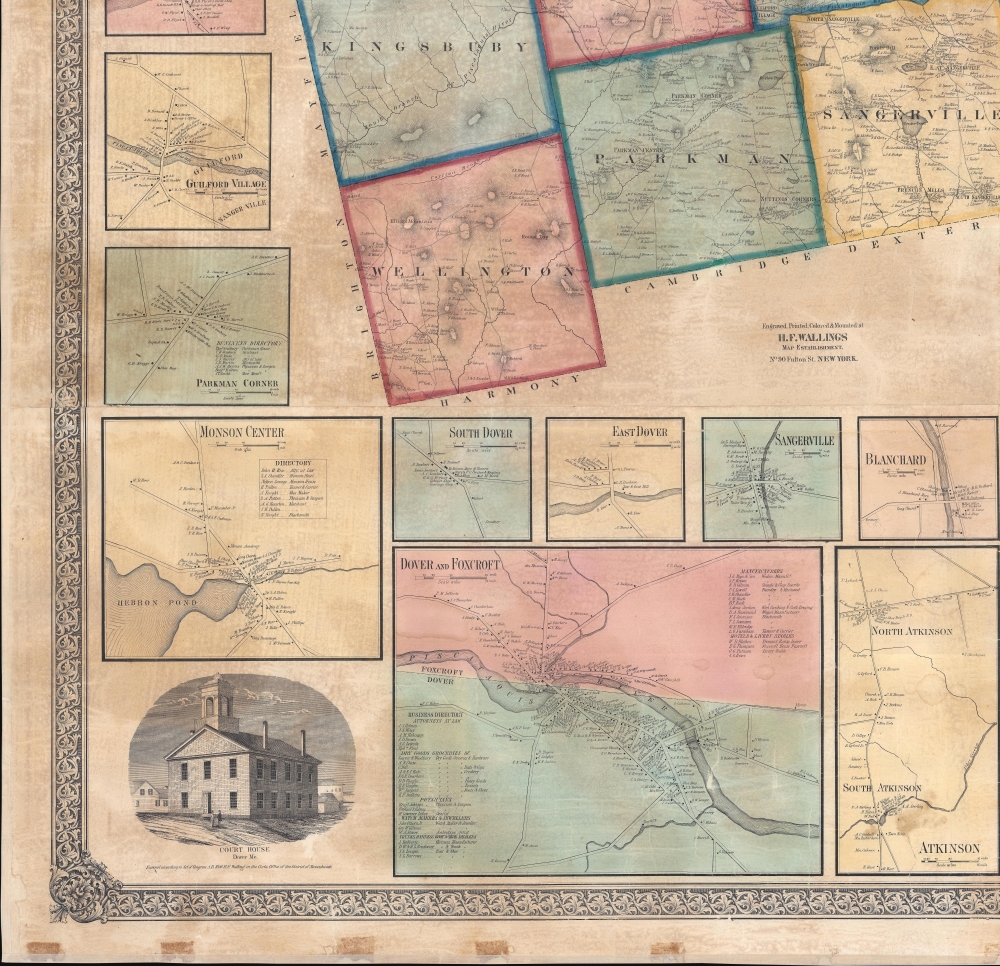
Townships throughout are illustrated, identified, and shaded for differentiation. Towns and villages are labeled, but the most striking aspect of this piece (as with all Walling maps) is the attention paid to individual property owners and businesses. Individual houses are noted across the county by the owner's last name. The county's mountains, rivers, and lakes are illustrated in detail.Insets and Views
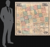
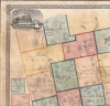
Fifteen inset maps appear below the map and along the left and right sides. The largest of these depicts the northern portion of Piscataquis County, including the land given to Bowdoin College and the Days Academy. Moosehead Lake is depicted as well. No settlements are noted north of the Days Academy. The remaining insets focus on cities and towns. Proceeding clockwise these are: Brownville, Milo, Sebec, Atkinson, Blanchard, Sangerville, East Dover, South Dover, Dover and Foxcroft, Monson Center, Parkman Corner, Guilford Village, Abbot, and Greenville (at the southern edge of Moosehead Lake). Individual residences are noted by the owner's name in each town, along with shops, churches, mills, schools, and other locations. A view occupies each of the map's corners: the Tremont Hotel in Dover, the Eveleth House in Greenville, the Court House in Dover, and the Mount Kineo House on Moosehead Lake.Publication History and Census
This map was created from field notes taken under the direction of Luther H. Eaton, engraved and printed by H.F. Walling's Map Establishment, and published by Lee and Marsh in 1858. We note seven examples cataloged in OCLC: Osher Map Library at the University of Southern Maine, the University of Maine at Orono, the Maine State Library, the Library of Congress, the Boston Athenaeum, Harvard University, and the American Antiquarian Society. An example is also part of the collection of the Norman B. Leventhal Map Center at the Boston Public Library.CartographerS
Henry Francis Walling (June 11, 1825 - April 8, 1889) was an American civil engineer, cartographer, surveyor, and map publisher active from the middle to late 19th century. Walling was born in Providence, Rhode Island. He studied/worked at the Providence Athenaeum before discovering a talent for mathematics and surveying. Walling took a position with Samuel Barrett Cushing (1846 - 1888), a Providence-based civil engineer with whom he issued in 1846 a revision of James Steven's Topographical Map of the State of Rhode-Island. Walling established himself independently around 1850 and immediately began preparing a series of town plans focusing on Bristol County, near Providence. Buoyed by widespread interest in his plans, Walling expanded his operations to Massachusetts, where, by 1857, he had produced no less than 50 town plans. Apparently, Walling's business model involved a contract with town officials to produce a certain number of maps, after which he acquired the right to print and sell additional copies on his own account. This work eventually led to Walling's appointment as Massachusetts "Superintendent of the State Map", a designation that began appearing on his maps around 1855. While Walling's work focused heavily on city and county maps, he successfully published three scarce state maps: Maine, Vermont, and Rhode Island. In 1856, Walling relocated his headquarters to New York City, where he had better access to quality lithographers. The Civil War (1861 - 1865) proved difficult for Walling, and diminished sales may have forced him into a partnership with Ormando W. Gray, with whom he published numerous state, county, and national atlases in the 1860s and 1870s. Around 1880, Walling took a post with the U.S. Coast Survey, with whom he worked on various charts until requesting a transfer in 1883 to the newly formed U.S. Geological Survey. Walling remained with the Geological Survey until his untimely death of a heart attack in April 1889. More by this mapmaker...
Luther Holland Eaton (October 23, 1821 - January 17, 1878) was an American civil engineer. Born in Maine, Eaton appears to have spent most, possibly all, of his life in Maine. He became a well-respected member of the community in Bangor, Maine. He served as the engineer on the Bangor Water Board and oversaw the Water Works, which he described in an article for Scientific American in 1877. He married Lydia Gale in 1854, with whom he had one son, Samuel, who died at the age of two. Learn More...
Condition
Very good. Full professional restoration. Some cracking and small areas of loss. Light soiling.
References
Boston Public Library Leventhal Map Center G3733.P5 1858 .W35. OCLC 191912740.