
Walling, Henry Francis

Henry Francis Walling (June 11, 1825 - April 8, 1889) was an American civil engineer, cartographer, surveyor, and map publisher active from the middle to late 19th century. Walling was born in Providence, Rhode Island. He studied/worked at the Providence Athenaeum before discovering a talent for mathematics and surveying. Walling took a position with Samuel Barrett Cushing (1846 - 1888), a Providence-based civil engineer with whom he issued in 1846 a revision of James Steven's Topographical Map of the State of Rhode-Island. Walling established himself independently around 1850 and immediately began preparing a series of town plans focusing on Bristol County, near Providence. Buoyed by widespread interest in his plans, Walling expanded his operations to Massachusetts, where, by 1857, he had produced no less than 50 town plans. Apparently, Walling's business model involved a contract with town officials to produce a certain number of maps, after which he acquired the right to print and sell additional copies on his own account. This work eventually led to Walling's appointment as Massachusetts "Superintendent of the State Map", a designation that began appearing on his maps around 1855. While Walling's work focused heavily on city and county maps, he successfully published three scarce state maps: Maine, Vermont, and Rhode Island. In 1856, Walling relocated his headquarters to New York City, where he had better access to quality lithographers. The Civil War (1861 - 1865) proved difficult for Walling, and diminished sales may have forced him into a partnership with Ormando W. Gray, with whom he published numerous state, county, and national atlases in the 1860s and 1870s. Around 1880, Walling took a post with the U.S. Coast Survey, with whom he worked on various charts until requesting a transfer in 1883 to the newly formed U.S. Geological Survey. Walling remained with the Geological Survey until his untimely death of a heart attack in April 1889.
Individual residences in and around Portsmouth.
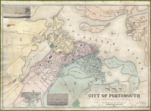
Map of the City of Portsmouth N. H. From Original Surveys Under the Direction of H. F. Walling, Civil Engineer.
$2,750.00
Acquire
- Digital Map Information
- Suitable for large format printing
- Full resolution TIFF file
- ICC color profile embedded
- Delivered instantly via download link
A scarce 1850 Henry Francis Walling map of Portsmouth, New Hampshire, and Kittery, Maine. Walling began publishing separately issued town plans on his own account in 1850, making this one of his earliest maps. Moreover, of Walling's nearly 150 separately issued town plans, this is one of the largest scale and most highly detailed. (more details)
Andover, educational Mecca.
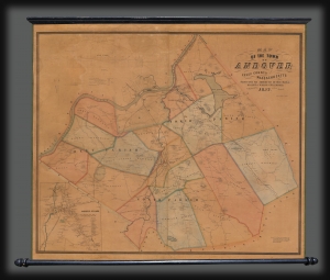
Map of the Town of Andover, Essex County, Massachusetts.
$2,000.00
Acquire
- Digital Map Information
- Suitable for large format printing
- Full resolution TIFF file
- ICC color profile embedded
- Delivered instantly via download link
This is a scarce 1852 Henry F. Walling wall map of Andover and North Andover, Massachusetts. Like most Walling town maps, the cartographer has taken great pains to identify the homes of individual families and landowners, as well as important roads, rail lines, municipal buildings, and businesses. Walling sold his maps by subscription, often going door to door, so the presence of individual property owners was doubtless intended as an enticement to buyers. Both Phillips Andover Academy and the Andover Theological Seminary are identified in the inset in the lower left. (more details)
Rangeley Lakes Region.
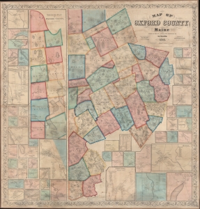
Map of Oxford County Maine.
$2,750.00
Acquire
- Digital Map Information
- Suitable for large format printing
- File Size: 500.18 MB
- File Type: ZIP / TIFF
- ICC color profile embedded
- Delivered instantly via download link
A superb example of H. F. Walling's 1858 wall map of Oxford County Maine. Composed of much of Maine's western border, the map embraces parts of the beautiful Rangeley Lakes Region, including Mooselookmeguntic Lake and the adjacent Richardson Lakes. (more details)
Moosehead Lake, Mount Katahdin, and lands given to Bowdoin College.
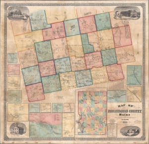
Map of Piscataquis County Maine.
$2,500.00
Acquire
- Digital Map Information
- Suitable for large format printing
- Full resolution TIFF file
- ICC color profile embedded
- Delivered instantly via download link
This is an 1858 Henry Francis Walling wall map of Piscataquis County, Maine. The map includes Moosehead Lake, Mount Katahdin (a very serious climb), and lands granted to Bowdoin College. The Katahdin Iron Works is labeled despite the fact that it ceased production one year earlier in 1857 (it would resume with the Civil War in 1861). (more details)
Source of a cartographic feud.
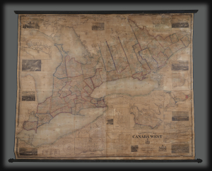
Tackabury's Map of Canada West, drawn from Government and special Local Surveys by H.F. Walling.
$4,500.00
Acquire
This is Henry Francis Walling's very large-format 1862 wall map of Canada West (formerly Upper Canada and subsequently Ontario), published by Robert M. Tackabury and George N. Tackabury. In addition to its size and magnificent level of detail, it is also significant for capturing this region in a period of political and social transformation, driven by railways, immigration, and moves towards greater political union and autonomy. (more details)
First large scale map of the state to be issued after the Greenleaf third edition of 1844. - Rumsey
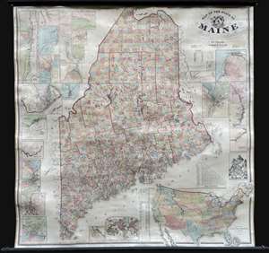
Map of the State of Maine.
$3,000.00
Acquire
- Digital Map Information
- Suitable for large format printing
- Full resolution TIFF file
- ICC color profile embedded
- Delivered instantly via download link
An impressive large-scale 1862 Civil War era wall map of Maine by Henry Francis Walling and Jacob Chace Jr. This the first major map of Maine to follow the 1844 map of Jeremiah Greenleaf. The map represents the culmination of Walling and Chace's decades of work in Maine. For years, they compiled and published Maine city and county maps, giving them access to unprecedented up-to-date cartographic data, all of which is represented here. (more details)
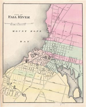
City of Fall River.
$150.00
Acquire
- Digital Map Information
- Suitable for large format printing
- File Size: 6.03 MB
- File Type: ZIP / TIFF
- ICC color profile embedded
- Delivered instantly via download link
This is an attractive 1871 map of the city of Fall River, Massachusetts, issued by H. F. Walling and O. W. Gray. It covers the city from Ferry Lane south as far as Six Road Way. Color coded according to wards, the map notes several important buildings, rivers, ... (more details)
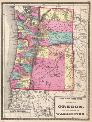
Oregon, and the Territory of Washington.
$175.00
Acquire
- Digital Map Information
- Suitable for large format printing
- File Size: 7.43 MB
- File Type: ZIP / TIFF
- ICC color profile embedded
- Delivered instantly via download link
This is Walling and Grey's 1872 map of Washington and Oregon. Shows both the state of Oregon and the territory of Washington in full with vivid hand coloring at the county level. Show various American Indian Nation ... (more details)