This item has been sold, but you can get on the Waitlist to be notified if another example becomes available, or purchase a digital scan.
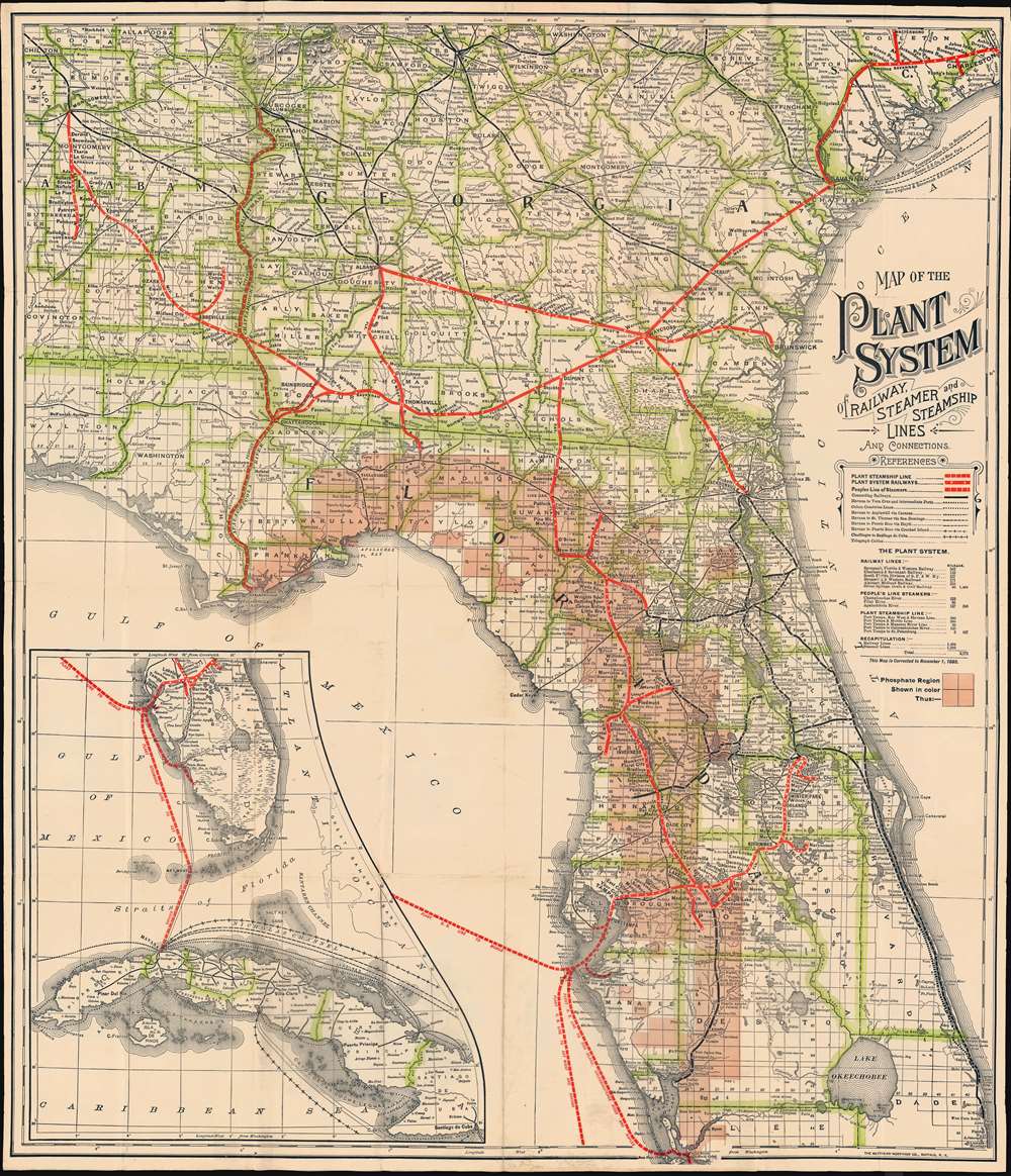
1893 Plant System Railroad Map of Northern Florida
PlantSystem-matthewsnorthrup-1893$250.00

Title
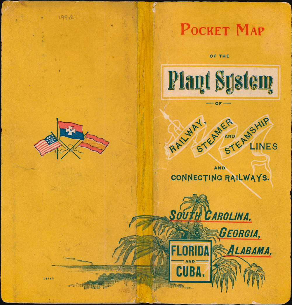
Map of the Plant System of Railway, Steamer and Steamship Lines and Connections.
1893 (dated) 22.5 x 19.5 in (57.15 x 49.53 cm)
1893 (dated) 22.5 x 19.5 in (57.15 x 49.53 cm)
Description
A striking 1893 map of Florida, Georgia, and Alabama, illustrating the extent of the Plant system, a Tampa-based network of railroads and steamers traveling throughout the southeastern United States. The map also highlights Florida's rich phosphate mining region - a major source of revenue for the Plant system which was ideally suited to transport the valuable mineral.
The Plant System
The Plant System named after its owner, Henry B. Plant, was a system of railroads and steamboats in the U.S. Southeast. After the Atlantic and Gulf Railroad went bankrupt, Plant bought the railroad and reorganized it as the Savannah, Florida and Western Railway. The Savannah, Florida, and Western, which operated across southern Georgia, served as the original line for the Plant System. Plant continued to form and purchase railroads, expanding the network into Florida and South Carolina. The Plant Investment Company was formed in 1882 to lease or buy other railroads, among them the Charleston Railroad and the Brunswick and Western Railroad. It also began acquiring steamship lines, expanding coverage from Tampa to Cuba, Key West, and other points. The Plant system was competition to Henry Flagler's Florida East Coast Railroad. It was taken over by the Atlantic Coast Line Railroad in 1902.Phosphate Mining in Florida
This map is striking for its depiction of Florida's rich Phosphate deposits, first discovered in Florida around when this map was issued. Here the entire phosphate region is highlighted in a broad crescent embracing much of western peninsular Florida. At the time, this area was swampy, threaded with rivers and estuaries, that locked lock organic materials into the ground, creating one of the nation’s richest reserves of phosphate. Today Florida's phosphate fuels the American farming and fertilizer industry.Publication History and Census
This map was issued on November 1, 1893. It was published by the Matthews Northrup Company of Buffalo, New York for the Plant System Railroad. Scarce.Cartographer
Matthews-Northrup Works (fl. c. 1895 - 1930) were a Buffalo, New York based, in their own words, "writing, designing, engraving, printing, [and] binding" firm. The firm was founded by James Newson Matthews (November 21, 1828 - December 20, 1888) as the J. N. Matthews Company. William Phelps Northrup (April 2, 1850 - February 2, 1929) later joined the company as an apprentice and then partner, at which point the firm was reincorporated as the Matthews-Northrup Works. The Matthews-Northrup Works rose to prominence as publishers and printers of railroad maps, with dozens to their credit. When James died, his shares were inhered by George Edward Matthews (1855 - 1910), who ran the business until his death in 1910. Also in 1910, they famously redesigned the cover of National Geographic Magazine. Despite some six previous cover changes in just 21 years, the Matthews-Northrup layout proved so popular that it was used for nearly 50 years. The firm can also take credit for the Winchell typeface, designed in 1903 under E. E. Winchell's tenure as art director. Curiously, the partners of Matthews-Northrup maintained an unusual affectation in which only the officers of the company could wear beards or mustaches. In this same spirit, the firm also had its own private social club, the Fellowcraft Club, where the all-male employees could relax, play pool, drink and dine. Matthews-Northrup maintained offices on Washington Street, Buffalo, where they were based, as well as Madison Square, New York City, Garden Tower, Boston, and the Citizens Building in Cleveland. More by this mapmaker...
Condition
Very good.