
This item below is out of stock, but another example (left) is available. To view the available item, click "Details."
Details
1925 Routledge View Map of the Columbia River Highway, Oregon
1925 (dated) $750.00
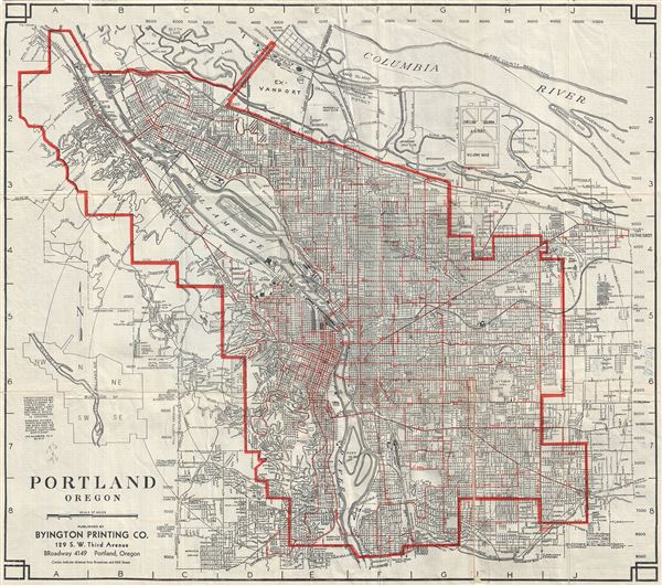
1950 Byington Printing Co. Street Map of Portland, Oregon
Portland-byington-1950$125.00

Title
Portland Oregon.
1950 (dated) 21 x 24 in (53.34 x 60.96 cm) 1 : 40000
1950 (dated) 21 x 24 in (53.34 x 60.96 cm) 1 : 40000
Description
This is a scarce 1950 map of the city of Portland, Oregon published by the Byington Printing Company. It covers the city of Portland in its entirety from the Columbia River south to the Riverview Cemetery and from Lincoln Park east to 117th Avenue. The map details streets, rivers, piers, parks, and other geographical details. Features the location of all streets and avenues of Portland, with the house numbers at street intersections. The various methods of street transportation are geographically illustrated on the map. Verso features a street directory, a zonal map and information regarding street transportation, parks and playgrounds, and points of interests. This map was published by the Byington Printing Company.
Condition
Very good. Minor wear and toning along original fold lines. Minor spotting. Professionally flattened and backed with archival tissue.