
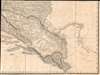
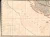
1812 Palma Map of the Illyrian Provinces: Slovenia, Croatia, Bosnia-Herzegovina, and Montenegro

This item has been sold.
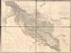
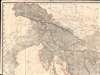
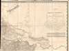
Carte des Provinces Illyriennes Comprenant La Bosnie L'Herzegovine le Monténéro et quelques pays adjacens.
First scientific map of Slovenia, Croatia, Bosnia-Herzegovina, and Montenegro.
- Digital Map Information
- Suitable for large format printing
- Full resolution TIFF file
- ICC color profile embedded
- Delivered instantly via download link
First scientific map of Slovenia, Croatia, Bosnia-Herzegovina, and Montenegro.
This detailed and expansive 1812 Gaetan Palma map of the short-lived Illyrian Provinces, a Napoleonic subordinate state embracing modern day Slovenia, Croatia, Bosnia-Herzegovina, and Montenegro. Coverage extends along the Adriatic from Venice to Albania and inland as far as Serbia and Hungary. It is the first specific map of this region to be compiled based on a detailed trigonometrical survey. The map is one of two commissioned by Marshal August de Marmont (1774 - 1852), first Governor-General of the Illyrian Provinces, in anticipation of a Napoleonic invasion of the Ottoman Empire.A Steppingstone to the Ottoman Empire
When Gaetan Palma issued this map, in 1812, the Napoleonic Empire was at its apogee. Napoleon had conquered most of continental Europe and his attentions turned eastward to the crumbling Ottoman Empire. Greece, the Balkans, and the Dalmatian coast were essential steppingstones. August de Marmont (1774 - 1852), sent Palma to Trieste to produce two maps, first a general map entitled Carte de la plus Grande Partie de la Turquie d'Europe, and second this more specific map of the Dalmatian Coast, an area recently suborned into the First French Empire (1804 - 1814).The Illyrian Provinces
The Illyrian Provinces were created by the October 14, 1809 Treaty of Schönbrunn after Napoleon's Grande Armeé defeated the Austrian Empire at the July 6, 1809 Battle of Wagram, War of the Fifth Coalition. The Austrian Empire ceded the territories of western Carinthia with Lienz (East Tyrol), Carniola, Gorizia, and Gradisca, the Imperial Free City of Trieste, the March of Istria, and the Croatian lands southwest of the river Sava to the French Empire. The capital was Laybach (Ljubljana, Slovenia). This map follows the April 1811 division of the Illyrian Provinces into seer sub-provinces or intendancies, with capitals in Laybach (Ljubljana), Karlstadt (Karlovac), Trieste (Trst), and Zara (Zadar), Raguse (Dubrovnik), Segna (Senj), and Willach (Lienz). The Illyrian Provinces lasted until 1814 when Austria declared war on France and invaded. Croats and Slovenes conscripted into the French army mutinied and, after a lengthy siege at Zadar, surrendered.French rule in the Illyrian Provinces was short-lived and unpopular. Nonetheless, it significantly contributed to greater national self-confidence and awareness of freedoms, especially in the Slovene lands. This exceptional map was one result of that rule - the basis for most subsequent maps of the region well into the mid-19th century. Attitudes towards Napoleon's rule of the Illyrian Provinces changed significantly at the end of the 19th century, when liberal Croatian and Slovene intellectuals began to praise the French for liberation from autocratic Austrian rule.
Publication History and Census
This map was made at the Grande Armée's headquarters in Trieste by Gaetan Palma. It was likely engraved by several military engravers under Palma's supervision. Although made for and by military cartographers, the map was sold commercially, price at 15 Francs (about 30 USD today). There is only one edition, but in 2012, a facsimile was issued by scholars in Ljubljana. That reissue represents most cataloged examples. Of this first edition, we note only 4 cataloged holdings: the David Rumsey Collection, the British Library, the Bibliothèque Nationale de France, and the Zagreb Library. Rare.Cartographer
Gaetan Palma (17?? - 18??), or Gaetano di Palma, was a military engineer and cartographer who served in the French army during the Napoleonic Wars. He is credited with just 2 known maps, both of important and of exceptional quality. These, covering Greece and the Illyrian Provinces, were issued in Trieste under the auspices of the French Grande Armée and Marshal August de Marmont (1774 - 1852), first Governor-General of the Illyrian Provinces. Little is known of his life, although some scholarship suggest he may have been of Italian origins Further Details...
Condition
Very good. Light edge wear and foxing. Four Individual sections measuring 18.5 x 25 inches, each of which is dissected and mounted on linen in 7 panels. Total 37 x 50 in.
References
OCLC 494176890. Rumsey 10625.000.