1862 Colton Railroad Tourist Pocket Map of New England
RailroadNewEngland-colton-1862$900.00
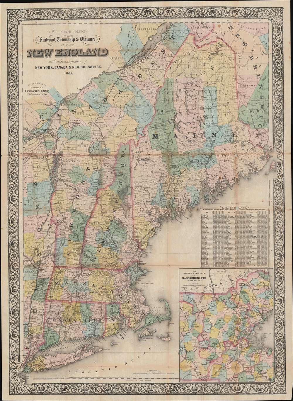


Title
G. Woolworth Colton's Railroad, Township and Distance Map of New England with adjacent portions of New York, Canada and New Brunswick.
1862 (dated) 38.5 x 28 in (97.79 x 71.12 cm) 1 : 900000
1862 (dated) 38.5 x 28 in (97.79 x 71.12 cm) 1 : 900000
Description
This is an 1862 George Woolworth and Charles B. Colton railroad pocket map of New England - illustrating a period of brisk industrialization, railroad construction, and democratization of travel.
A Closer Look
The map details the expanding New England railroad network extending from Maine and Quebec to Long Island. Towns and villages along the railroad lines are identified, with mileage provided. An inset in the lower right focuses on the busy eastern Massachusetts corridor between Boston and Worcester. A table above the inset contains distances by rail from nearly 200 towns to New York, Hartford, Providence, Boston, Montpelier, Concord, and Augusta.Railroads of New England
In 1862, New England railroads were experiencing rapid growth and played a vital role in the region’s economy and transportation network. The rail lines connected major cities such as Boston, Providence, and Hartford, and extended into rural areas, facilitating the movement of goods, people, and raw materials, particularly during the ongoing Civil War. Railroads like the Boston and Maine, the New York, New Haven, and Hartford Railroad, and the Vermont Central were instrumental in transporting manufactured goods, agricultural products, and coal, which was crucial for the industrial operations in New England’s factories and mills. Despite the challenging terrain, including mountains and rivers, the development of extensive rail infrastructure helped knit together the region’s economy, supported the Union war effort, and laid the foundation for future industrial expansion.Publication History and Census
This map was created by George Woolworth and Charles B. Colton. It bears a copyright of 1861, but is also dated in the title to 1862, this example representing the second edition. Multiple subsequent editions followed to about 1886. While published in quantity, early editions are scarce to the market. We do not see an OCLC reference for the 1861 edition, as here.Cartographer
Joseph Hutchins Colton (July 5, 1800 - July 29, 1893), often publishing as J. H. Colton, was an important American map and atlas publisher active from 1833 to 1897. Colton's firm arose from humble beginnings when he moved to New York in 1831 and befriended the established engraver, Samuel Stiles. He worked under Stiles as the 'Co.' in Stiles and Co. from 1833 to 1836. Colton quickly recognized an emerging market in railroad maps and immigrant guides. Not a cartographer or engraver himself, Colton's initial business practice mostly involved purchasing the copyrights of other cartographers, most notably David H. Burr, and reissuing them with updated engraving and border work. His first maps, produced in 1833, were based on earlier Burr maps and depicted New York State and New York City. Between 1833 and 1855, Colton proceeded to publish a large corpus of guidebooks and railroad maps, which proved popular. In the early 1850s, Colton brought his two sons, George Woolworth Colton (1827 - 1901) and Charles B. Colton (1832 - 1916), into the map business. G. W. Colton, trained as a cartographer and engraver, was particularly inspired by the idea of creating a large and detailed world atlas to compete with established European firms for the U.S. market. In 1855, G.W. Colton issued volume one of the impressive two-volume Colton's Atlas of the World. Volume two followed a year later. Possibly because of the expense of purchasing a two-volume atlas set, the sales of the Atlas of the World did not meet Colton's expectations, and so, in 1856, the firm also issued the atlas as a single volume. The maps contained in this superb work were all original engravings, and most bear an 1855 copyright. All of the maps were surrounded by an attractive spiral motif border that would become a hallmark of Colton's atlas maps well into the 1880s. In 1857, the slightly smaller Colton's General Atlas replaced the Atlas of the World. Most early editions of the General Atlas published from 1857 to 1859 do not have the trademark Colton spiral border, which was removed to allow the maps to fit into a smaller format volume. Their customers must have missed the border because it was reinstated in 1860 and remained in all subsequent publications of the atlas. There were also darker times ahead; in 1858, Colton was commissioned at a sum of 25,000 USD by the government of Bolivia to produce and deliver 10,000 copies of a large format map of that country. Although Colton completed the contract in good faith, delivering the maps at his own expense, he was never paid by Bolivia, which was at the time in the midst of a series of national revolutions. Colton would spend the remainder of his days fighting with the Bolivian and Peruvian governments over this payment, and in the end, after a congressional intervention, he received as much as 100,000 USD in compensation. Nonetheless, at the time, it was a disastrous blow. J. H. Colton and Company is listed as one of New York's failed companies in the postal record of 1859. This led Colton into the arms of Alvin Jewett Johnson and Ross C. Browning. The 1859 edition of Colton's General Atlas lists Johnson and Browning as the 'Successor's to J. H. Colton' suggesting an outright buyout, but given that both companies continued to publish separately, the reality is likely more complex. Whatever the case may have been, this arrangement gave Johnson and Browning access to many of Colton's map plates and gave birth to Johnson's New Illustrated (Steel Plate) Family Atlas. The Johnson's Atlas was published parallel to Colton's atlases well into the 1880s. The Colton firm itself subsequently published several other atlases including an Atlas of America, the Illustrated Cabinet Atlas, the Octavo Atlas of the Union, and Colton's Quarto Atlas of the World. They also published a large corpus of wall maps, pocket maps, and guides. The last known publications of the Colton firm date to 1897 and include a map and a view, both issued in association with the Merchant's Association of New York. Alice M. Colton married August R. Ohman (May 3, 1859 - April 22, 1934) on January 5, 1897. In 1898, Ohman joined the Colton firm, which continued to publish as Colton, Ohman & Co. until 1901. More by this mapmaker...
Condition
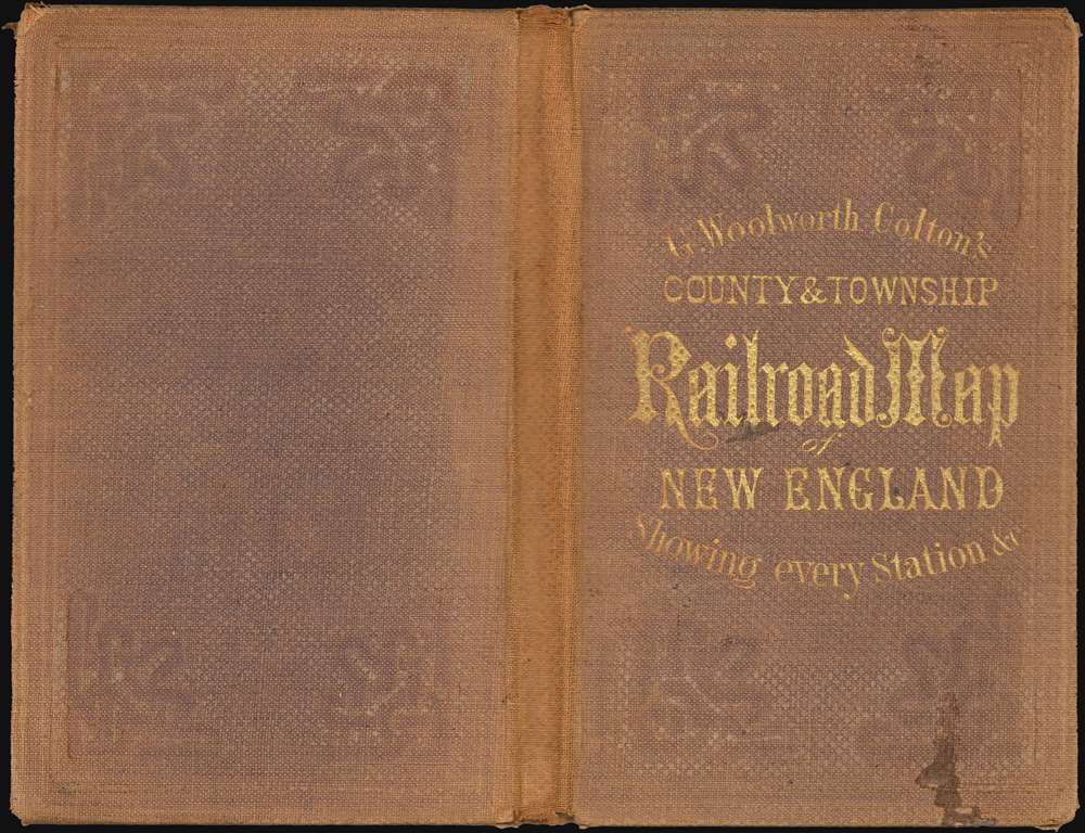
Very good. Exhibits wear along original fold lines. Laid down on archival tissue. Exhibits minor loss at a handful of fold intersections. Accompanies original gilt-stamped linen binder.