
1862 - 1868 Mouchez Chart of the Rio de la Plata

This item has been sold.
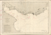
Carte du Rio de la Plata (Amérique Méridionale) Dressée d'aprés les documents les plus récens et les travaux faits à bord du Bisson (en 1857-58 et 59) Par Mr. E. Mouchez, Capitaine de Frégate Publiée par ordre de L'Empereur, Sous le Ministère de Son Excellence Mr. le Cte. de Chasseloup-Laurat...
State-of-the-art charting of the Plata at the outbreak of war.
- Digital Map Information
- Suitable for large format printing
- Full resolution TIFF file
- ICC color profile embedded
- Delivered instantly via download link
State-of-the-art charting of the Plata at the outbreak of war.
This is a large French nautical chart of the Rio de la Plata charted by French naval officer, hydrographer, and spy Ernest Amédée Barthélemy Mouchez (1821 - 1892). This state-of-the-art chart was issued in 1862, and would be regularly updated in the following decade, a period characterized by local political turmoil and international efforts to control it.A Closer Look
The map depicts the mouth of the Río de la Plata from Cape St. Antonio in the south to just beyond Cape Polonio in the north; the Plata is surveyed beyond Martin Garcia Island, reaching up into the Paraná Guazu and into the Uruguay River. The approaches to both Buenos Aires and Montevideo are well detailed. The chart records numerous soundings and shoals, with many notes on the consistency of the river floor and prevailing winds. Lighthouses are marked and highlighted with hand color. Distinct from any other editions of this chart we have seen, there are red notations indicating the distance at which specific lighthouses can be seen and their rotation frequency. These are not done in manuscript, but are overprinted on the chart.In addition there are, mainly in red ink but also in pencil, an array of undated manuscript corrections to the chart.
War in La Plata
Mouchez undertook the surveys underpinning this chart during his 1857-1859 expedition aboard the steam frigate Bisson during which he also explored the Uruguay River and the Paraná, and recorded his observations of the political situation in Paraguay under that country's dictator, Carlos Antonio López Ynsfrán (1792 - 1862). The publication of the chart coincided with the death of Carlos and the succession of his disastrous son, Francisco Solano López Carrillo. (1827 - 1870).Uruguay's Great War (1839 - 1852) had attracted the attention of both Great Britain and France, who both would continue to pursue political and trade interests in the region; it was service to these interests that initiated Mouchez's expedition, especially insofar as Paraguay's growing assertiveness promised to further destabilize the theater. In 1864 and 1865, Uruguay would be wracked by civil war, in large part fueled by the efforts of both Brazil and Argentina to prop up the Colorado faction; Paraguay would intervene in support of the Blanco faction by attacking Brazilian and Argentine territories. This was a fateful choice for Paraguay: Uruguay, now under the Colorados, would in 1865 join Brazil and Argentina to wage the War of the Triple Alliance against Paraguay, resulting in five years of unmitigated disaster for that nation. The war would end with massive Paraguayan casualties, and the 1870 death of Francisco Solano López.
The 1862 completion of this chart made it the most accurate, up-to-date chart of the region's most important waterway at the outbreak of the War of the Triple Alliance. Its importance and utility are emphasized by the rapidity and frequency with which it was updated: its recorded improvements are dated 1864, 1866, 1867, and 1868; we are aware of at least one later state of the chart with additional improvements to 1869 and 1872.
On the present, 1868 revision, the most visible change from the 1862 is the stippled shading of the land regions. An 1864 note explains that since the chart was produced, the longitude of Rio de Janeiro had been corrected by three degrees, and that consequently all charts whose latitude was based on that measurement had been corrected. A note marks the location of the British warship Bombay, which burned and sank in 1865. But overall, surprisingly few changes were made to the chart's original soundings, a testimony to the authoritative work that went into it initially.
Manuscript Corrections
The chart includes four corrections added by hand, pointing out specific errors or changes not recorded on the chart. For example, the depth of the Banc de St. Lucia is given on the chart as four meters; a notation indicates a corrected depth of two; new sandbanks are pointed out within the Grand Bank d'Ortiz; and it is noted that the position of the floating light at Banco Chico has changed. In the shallows south of Colonia, a note indicates that islands appear at that location close to shore at low tide. None of these notations are signed; all appear to be in the same hand.Publication History and Census
This chart, based on Mouchez' surveys, was engraved by Charles Dyonnet and published by the Dépôt des Cartes et Plans de la Marine in 1862; based on the revisions recorded on the chart, this example was printed in 1868. We note two examples of the 1862 cataloged in the British Library and the Bibliothèque Nationale de France. We are aware of two later examples (neither earlier than 1872) that have reached the market. We see no other examples of this edition on the market or in institutional collections. Further, we see no other examples exhibiting the red overprinting seen here.Cartographers
Ernest Amédée Barthélemy Mouchez (1821 – 1892) was a French naval officer and hydrographer. Mouchez was born in Madrid, but started his career with the French Navy in 1843. Although he was famed for his heroic defense of the port of Le Havre during the Franco-Prussian war, his experience with the navy was primarily one of exploration, rather than warfare. He served on surveys of the coasts of Algeria, Korea, and China, but most particularly South America; he would publish in 1868 Positions géographiques des principaux points de la cote orientale de l'Amérique du Sud comprise entre la Guyane française et le Paraguay d'après les campagnes du Bisson, du D'Entrecasteaux et du Lamotte-Piquet, de 1856 a 1866, a gazeteer of the latitudes and longitudes of points along the South American coast; his surveys also informed navigational manuals of the Rio de la Plata, and a detailed map of the Paraná province. From 1857 to 1859 he executed extensive surveys of the Paraguay River, and several maps and charts of Paraguay and the Plata region cite his efforts. He appears to have engaged in an in-depth study also of Paraguay under the leadership of the dictatorial President Carlos Antonio López Ynsfrán (1792-1862). His efforts apparently earned him the ire of that President, and what appear to have been completely justified accusations of espionage. A detailed manuscript study of Portugal under Lopez survives, but was never published: Mouchez's surveys and astronomical efforts were well-published so it appears likely that if he had wished to publish the Paraguay survey, he could well have done: after all, just a few years later under Lopez's son Paraguay would be embroiled in the notorious war of the Triple Alliance. It may be that Mouchez's study was meant for the eyes of the French Government, rather than general publication.
Mouchez's efforts in the realm of navigation and astronomy were well regarded. He contributed new techniques for surveying at sea and precisely determining longitude. In 1873 he was elected to the Bureau des Longitudes. in 1874 he was sponsored by the Académie des sciences to observe the transit of Venus from St. Paul Island in the Indian Ocean, resulting in a remarkable photographic record of the transit. By 1875 he was a member of the astronomy section of the Académie. Appointed in 1778 director, and tasked with the reconstruction of the Paris Observatory, which had become ruined during the course of the 1870 war and the 1871 Paris Commune. Late in life he collaborated with Sir David Gill to produce a photographic celestial atlas, the Carte du Ciel, a project which stalled and faded as it became superceded. Further Details...
Charles Dyonnet (fl. c. 1822 - c. 1880) was an extremely active Paris based engraver working in the mid to late 19th century. From his offices at 220 Rue St. Jacques, Paris, Dyonnet engraved numerous maps for many of the most prominent 19th French cartographic publishers including Vuillemin, Dufour, Fremin and Duvotenay. From 1850-1861, he held the coveted position of "Graveur du Dépot de la Marine," and in this position engraved numerous French naval and military maps. Dyonnet had a detail oriented and aesthetically minded hand and is responsible from some of the most beautiful French maps to emerge during the 19th century. Further Details...
Condition
Excellent. Manuscript notations; generous margins and no mends.
References
OCLC 1176600957. (1862)