
This item below is out of stock, but another example (left) is available. To view the available item, click "Details."
Details
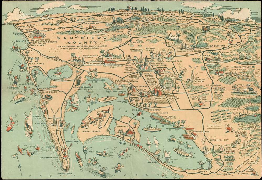
1935 Jones Pictorial View of San Diego County, California
$200.00
1940 Jones Pictorial Map of San Diego County
SanDiegoCounty-jones-1940$75.00

Title
Map of San Diego California Citiy and County.
1935 (undated) 11 x 15.75 in (27.94 x 40.005 cm)
1935 (undated) 11 x 15.75 in (27.94 x 40.005 cm)
Description
This humorous pictorial map of San Diego was prepared for Lowell E. Jones in 1935. The map covers San Diego county, from Oceanside to Descanso and from Palomar Observatory to Palm City and Point Loma. The map features numerus pictorial vignettes illustrating the cultural, military, and sporting life of the Dan Diego Bay area. The map was prepared as part of a pamphlet commissioned by Lowell. E. Jones to promote tourism to the San Diego area. There are at least two states of the map, one with the title Recreational Map of San Diego City and County and another, the present example, lacking the title. It is unclear which is earlier
Cartographer
Lowell E. Jones (fl. c. 1935 - 1957) was a Los Angeles graphic artist. He drew pictorial maps and sold them at tourist locations around Los Angeles for twenty-five cents each. More by this mapmaker...
Condition
Good. A few verso reinforcements. Original fold lines. Promotional content on verso.