
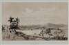
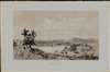
1846 Cierci View of Singapore City Chinese Campong

This item has been sold.
Rade de Sincapour Prise de la maison du Gouverneur. (Malaisie).
Singapore's Chinatown.
- Digital Map Information
- Suitable for large format printing
- Full resolution TIFF file
- ICC color profile embedded
- Delivered instantly via download link
Singapore's Chinatown.
One of the earliest obtainable views of Singapore, this is Eugène Cicéri's 1846 view of Singapore drawn from original sketches and maps compiled during Jules Sébastien César Dumont d'Urville's (1790 - 1842) circumnavigation of the globe. The source sketches were created when d'Urville's ships, Astrolabe and Zélée, were at Singapore between June 27 and July 2, 1839.Understanding the View
The view looks southward from Government Hill (Fort Canning Park) towards Singapore's Chinatown, the Chinese Campong, and the harbor. The widening of the Singapore River at its mouth is the large body of water in the mid-ground. In the distance, Thian Hock Keng Temple (天福宮, dedicated to Mazu, a Chinese sea goddess) notable for its bi-level hipped roof, is recognizable - although the temple was still under construction when d'Urville visited.Singapore's Chinese Campong
When Stamford Raffles laid out the plan for Singapore in 1822, known as the Master Plan, he allocated the lands west of the Singapore River to serve as a Chinese community - known as the Chinese Campong (Kampong). The land was desirable, with good access to the port, and room to expand. Raffles correctly recognized that Chinese citizens would, in time, comprise the bulk of Singapore's population. The Campong was initially subdivided by Chinese immigrants according to dialect and provincial origin, but these later blended. The area began rapid development in the 1830s and 1840s, with the construction of the impressive Thian Hock Keng Temple, as well as new streets and businesses. Today it remains a crowded vibrant neighborhood.D'Urville's Third Expedition of 1837 - 1840
Scarcely back from his Second Voyage, Jules Sébastien César Dumont d'Urville (1790 - 1842) immediately began canvassing for a third voyage - this time to the southern latitudes. Although he hoped to explore in the tropics (don't we all), King Louis-Phillipe was keen for a French voyage of discovery capable of rivaling Cook's achievements in the Antarctic. He was commanded to place the French flag as far south as possible in the Antarctic Waddell Sea. The crew was even promised a bonus of 100 francs when 75° South was attained. His two ships (Astrolabe under d'Urville and the Zélée under Charles Jacquinot) set sail from Toulon in September 1837. Along the way they visited New Zealand, Singapore, Australia, Chile, Brazil, Tenerife, the Cape of Good Hope, and more. They crossed the Antarctic Convergence on January 16, 1840, and two days later found themselves in the middle of an ice sea. Pressing on, they hoisted the Tricolor at Cape Geodesie and the voyage hydrographer, Clément Adrien Vincendon-Dumoulin (1811 - 1858) prepared an impressively accurate map of the coast. There, they met the even more ambitious U.S. Exploring Expedition commanded by Charles Wilkes (1798 - 1877). Turning north again, the crew celebrated, popping champagne when they crossed the Antarctic Circle and sailed into warmer climes. Back in France, d'Urville was celebrated, promoted to rear-admiral, and awarded the gold medallion of the Société de Géographie - their highest honor. Two years later d'Urville and his family died in a tragic train derailment - France's first - on their way from Versailles to Paris.Publication History and Census
This view was drawn by the Paris artist Étienne Eugène Cicéri based upon the original sketches compiled by the d'Urville Expedition (1837 - 1840) in 1839. It was engraved and printed by Thierry Frères in Paris for publication by Gide in d'Urville's Voyage au pole sud et dans l'Océanie sur les corvettes l'Astrolabe et la Zélée. Both the atlas volume of d'Urville's narrative (Atlas Pittoresque) and the separate views are extremely scarce. We have identified an institutional example in poor condition in the National Library of Australia, and another at the Library Board of Singapore.Cartographers
Étienne Eugène Cicéri (January 27, 1813 - April 20, 1890) was a French painter, illustrator, engraver, and theater designer active in the middle part of the 19th century. Cicéri was born in Paris, the son and pupil of the painter and scenographer Pierre-Luc-Charles Cicéri (1782 - 1868). His instruction. In art began as a child under his father and uncle, Eugène Isabey (1803 - 1886). Influence by the Barbizon School of landscape art, he rose to prominence as a landscape pater and watercolorist, working at Fontainebleau, the Alps, and the Pyrenees. He exhibited at the Paris Salon for the first time in 1851 continued to exhibit until at least 1886. He also issued North African landscapes and painted scenes to illustrate the travels of Jules Sébastien César Dumont d'Urville's (1790 - 1842) circumnavigation - all of which earned him a place among the orientalists. Further Details...
Thierry Frères (fl. 1834 - c. 1850) was a French lithographic printing and publishing firm based at 1 Cité Bergère, Paris, active during the middle decades of the 19th century. The firm succeeded the Paris establishment of Godefroy Engelmann (1788 - 1839) around 1834-35 and produced maps, scientific illustrations, topographical views, and portraits. Its cartographic work included the lithographic printing of Agustín Codazzi's (1793 - 1859) Atlas físico y político de la República de Venezuela, dated Caracas, 1840, but printed in Paris. The atlas combined historical, physical, and administrative mapping, including maps of Venezuela's provinces, comparative mountain and river diagrams, and representations of the campaigns of independence; most of its maps bear the Thierry Frères imprint. The firm's name also appears among the lithographic contributors to the atlas accompanying the historical account of the Russian circumnavigation aboard the corvette Séniavine, published in Paris in 1835-36. Alongside these geographical and scientific commissions, Thierry Frères printed architectural and landscape subjects, including illustrations for Voyages pittoresques et romantiques dans l'ancienne France, and numerous portraits. Surviving impressions document work for different publishers rather than a business confined to issuing its own publications. The house continued producing topographical lithographs around 1850, including plates for Souvenirs des Pyrénées. Further Details...
Source
D'Urville, J. D. and Vincendon-Dumoulin, C. A., Voyage au Pôle Sud et dans l'Océanie sur les corvettes L'Astrolabe et La Zélée exécuté par ordre du Roi Pendant les Années 1837-1838-1839-1840 sous le commandement de M. Dumont-d'Urville. Atlas pittoresque. (Pairs: Gide) 1846.
Condition
Very good. Wide clean margins.