1925 Gordon Pocket Map of the South Wales Coal Fields
SouthWalesCoalfield-gordon-1925$600.00


Title
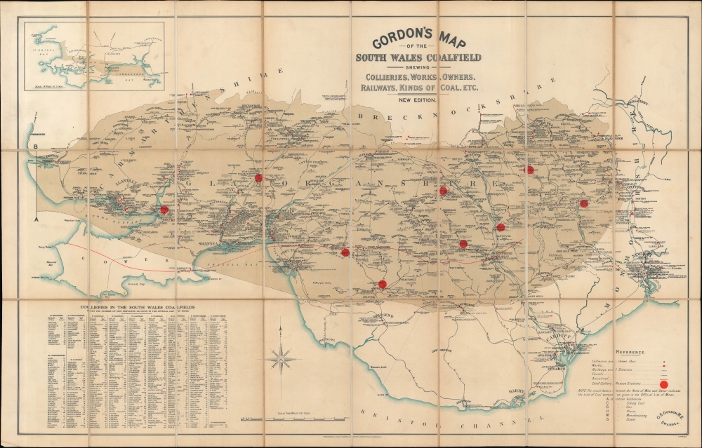
Gordon's Map of the South Wales Coalfield shewing Collieries, Works, Owners, Railways, Kinds of Coal, etc. New Edition.
1925 (undated) 22 x 34.5 in (55.88 x 87.63 cm) 1 : 126720
1925 (undated) 22 x 34.5 in (55.88 x 87.63 cm) 1 : 126720
Description
A comprehensive c. 1925 map of the coalfields and coal mining operations in South Wales, prepared by mining engineer George Edward Gordon and published by Waterlow. At this time, South Wales was one of the most (if not the most) prolific coal producing regions on the planet.
A Closer Look
Ranging from Kidwelly to Newport, and taking in Swansea and Cardiff, the map covers South Wales, including the counties of Carmarthenshire, Glamorganshire, Monmouthshire, and Brecknockshire in whole or part. The titular coalfield is indicated with dark brown shading covering much of the map. Cities, towns, railways, and other features are labeled throughout. Collieries are marked with black circles and industrial works of various sorts with red rectangles. Both list the name of the enterprise and its owner(s), and the type of mine is recorded according to the legend at bottom-right. Colliery rescue stations, created in response to the constant, acute danger of fires, are marked with large red circles. A red line running across the map represents an anticline, a convex fold in the region's rock beds. An inset map at top-left displays a wider map of South Wales, while a table at bottom-left lists the collieries in South Wales along with the number of men employed at each.Historical Context
In the decades before World War I (1914 - 1918) and into the Interwar Period, South Wales was a global center for coal production and export. Beginning in the late 18th century, coal deposits discovered in southern Wales were exploited using new technologies of the early Industrial Revolution. The coal dug there fueled further industrialization throughout Britain and beyond. The population of the region exploded, due to both increasing wealth and immigration, with the population of Wales as a whole quadrupling between the early 19th and early 20th centuries. The first decade of the 20th century saw the population of Wales grow at over 20 percent, driven by the expansion of the coal industry. Cardiff, Swansea, and Newport all developed into major cities of over 100,000 inhabitants. These drastic changes had social, cultural, and political ramifications, including labor unrest, democratization, and the relative decline in the use of the Welsh language in public life.Publication History and Census
This map was prepared by mining engineer George Edward Gordon and published by Waterlow and Sons. It is undated, but the phrase 'new edition' in the title indicates that it represents the edition tentatively dated 1925 in the OCLC. Earlier editions, which were dated, were published in 1913, 1901, and 1897, though the earliest two may be lost now. The map is quite rare in any edition, with the present edition listed among the holdings of the National Library of Wales, Swansea University, Cardiff University, Brunel University London, and the Staatsbibliothek zu Berlin.CartographerS
George Edward Gordon (c. 1856 - 1929) was a Welsh mining engineer based in Swansea. Little is known about the details of his life and work aside from his production of a highly detailed map of coal mines and associated facilities in Wales, published in several editions in the late 19th and early 20th centuries. According to an 1897 newspaper article, he had been manager at the Llanmorlais Colliery, but had left the position by that time. He also looks to have served in politics, as Chairman of the Gower Rural District Council. More by this mapmaker...
Waterlow and Sons (1810 - 1961) was a British engraving and printing concern active in London specializing in currency, postage stamps, bond certificates, and occasionally maps. The firm was founded by James Waterlow (1790 - 1876) in 1810 on Birchin Lane, London, as a legal document printer and copyist. By 1852, they had expanded into stamps and his sons, Albert, Alfred, Sydney, and Walter joined the business. One year after James Waterlow's death, in 1877, infighting among the sons led Alfred Waterlow to split off, forming Waterlow Brothers and Layton. The rift was settled by 1920, and the two firms once again merged under the Waterlow and Sons imprint. They were involved in the Portuguese Bank Note Affair of 1925, wherein the Portuguese fraudster Artur Virgílio Alves Reis convinced the firm to print 200,000 banknotes of 500 Portuguese Escudos each, amounting to roughly 88% of Portugal's GDP. The affair was settled in court with a ruling against Waterlow. In 1928, Waterlow lost its most lucrative contract, printing English banknotes, and began to fall into decline. In 1961, they were acquired by Purnell and Sons who, shortly afterwards, sold the firm to De La Rue. Ironically, De La Rue acquired the contract to print Bank of England banknotes again in 2003 – 75 years after Waterlow lost it! Learn More...
Condition
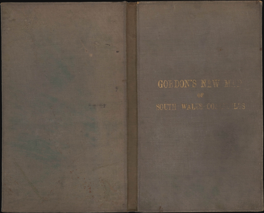
Very good. Dissected and mounted on linen in 24 panels. Light toning.
References
OCLC 1183791239.