This item has been sold, but you can get on the Waitlist to be notified if another example becomes available, or purchase a digital scan.
1909 Robinson Pictorial 'Aeroplane' Map of Sydney, Australia
SydneyAeroplaneMap-robinson-1909$900.00

Title
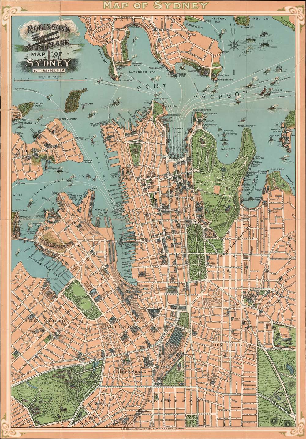
Robinson's Aeroplane Map of Sydney Port Jackson, N.S.W.
1909 (undated) 30.75 x 21.5 in (78.105 x 54.61 cm) 1 : 7000
1909 (undated) 30.75 x 21.5 in (78.105 x 54.61 cm) 1 : 7000
Description
An interesting early aviation piece, this is Robinson's c. 1909 chromolithograph 'aeroplane' map of Sydney. Centered on the Sydney Town Hall, the map covers from Lavender Street in North Sydney to Victoria Park, and from Elizabeth Island to Potts Point. The map follows in the tradition of similar maps issued of Paris, London, and Rome around the same period, known collectively as 'monumental maps' wherein important buildings and monuments are illustrated in profile against an otherwise simple background. This technique was developed with tourism in mind, to make it easily to navigate to 'must see' sights without the distractions of an otherwise over dense map. The map is surrounded by a striking art nouveau style border. No doubt Robinson, an aviation enthusiast, hope to capitalize on the global fascination with the potential of air travel following the Wright brothers' ground-breaking flight.
This map is very rare. We are aware of only a single other example, at the Library of Congress. In so much as we can tell, all other references for this map are merely partnerships to copy the LOC digital example. The present example is in vastly superior condition to the LOC version.
Plane Crazy in Australia
The Wright brothers made their historic first flight in Kitty Hawk on December 17, 1903. From that point on, aviation developed at a breakneck pace. In Australia, with its vast distances and (at the time) limited road infrastructure, the advantages of the aviation were instantly and abundantly clear. Although not universally recognized, it is generally agreed that the English aviation enthusiast Colin Defries (1884 - 1963) made his first powered flight over Australia on December 9, 1909, using a Wright Model A, achieving approximately 100 yards. Rival claims were put forward by Frederic Custance (1896 - 1922), who made a flight using a Bleriot monplane in South Australia in March 1910; and escape artist Harry Houdini, who also made a highly publicized Marchy flight using a Voisin biplane over Diggers Rest, Victoria. Regardless of who made that historic flight, aviation took Australia by storm, with Qantas, the country's first commercial airline, founded just 10 years later in 1920.Publication History and Census
This map is undated, so there is some confusion regarding its publication, with the Library of Congress citing 1909 and other archives dating it as late as 1922. The '41 Philip Street' address suggests it must have been issued during Robinson's tenure at that address - between 1906 and 1913. The map illustrates wharves between Miller's Point and Gasworks which were under construction 1909 - 10. Finger wharf, completed 1915, does not appear. The aeroplane image is also distinctive and can only be the Wright-model plane of Colin Defries', who made the first powered flight in Australia in December of 1909.This map is very rare. We are aware of only a single other example, at the Library of Congress. In so much as we can tell, all other references for this map are merely partnerships to copy the LOC digital example. The present example is in vastly superior condition to the LOC version.
Cartographer
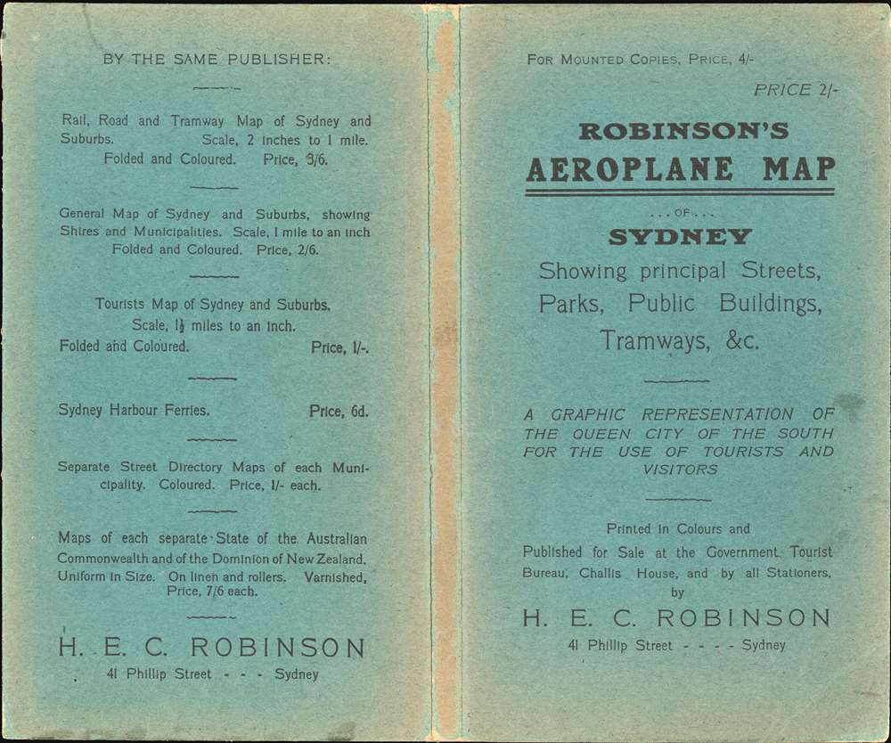
Herbert Edward Cooper Robinson (November 18, 1856 - January 17, 1933) was a Sydney based Australian cartographer active in the late 19th and early 20th centuries. Cooper was born in Winchester, England and emigrated to Australia with his family, settling in Geelong, Victoria. At around 20 - 25 years of age, Robinson moved to Sydney to join the public service, where he mastered cartographic draftsmanship at the Lands Department. In 1882 he left the Lands Office to found a private firm with the Messrs. Higginbotham and Harris, under the imprint of 'Messrs. Higginbotham, Robinson, and Harris.' Within 2 years, both Higginbotham and Harris left the firm, driving it into bankruptcy and leaving Robinson on his own. In 1895, Robinson set up his own map publishing business at Wentworth Court, moving in 1906 to Phillip Street, and in 1913 to permanent location at 221-223 George Street, Sydney. In 1917, the firm formally incorporated as 'H. E. C. Robinson Ltd.' Although based in Sydney, the firm received multiple government contracts and opened annex firms in the Canberra. Robinson is best known for Australian city and regional guides, but he also published Sir Edgeworth David’s gigantic 1932 Geological Map of the Commonwealth of Australia and Donald Mackay's 1930+ aerial surveys of Australia. In addition to his printing work, in 1885, he became a founding member of the Geographical Society of Australasia. He became a fellow of the Royal Geographical Society in the late 1920s. Robinson had two children, Cecil Robinson and Eileen Robinson Brooks, both of whom emigrated to America. His daughter, Eileen, became a famous American stage actress. More by this mapmaker...
Condition
Good. Laid on archival tissued. wear on old fold lines. Repairs to split seams near title.
References
Library of Congress, G8964.S9 1909 .H4.