This item has been sold, but you can get on the Waitlist to be notified if another example becomes available.
1979 Dolph Map of Tallahassee, Florida
Tallahassee-dolph-1979$100.00


Title
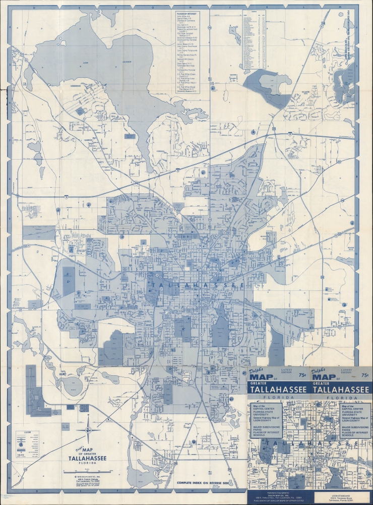
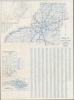
Dolph's Map of Greater Tallahassee Florida.
1979 (dated) 30.75 x 22.5 in (78.105 x 57.15 cm) 1 : 22000
1979 (dated) 30.75 x 22.5 in (78.105 x 57.15 cm) 1 : 22000
Description
A detailed 1979 Dolph Map Company city map of Tallahassee, Florida. It presents the city during a period of growth and dynamism, punctuated by the new state capitol, constructed in 1977.
A Closer Look
Tallahassee's city center is presented with surrounding neighborhoods. A grid surrounds the map, corresponding to a detailed street index on the verso. Streets, highways, railroads, schools (listed in an index at top), parks, golf courses, and other features, including 'places of interest' (also listed in an index at top), are labeled. Florida State University sits near the center, while Florida A and M (Agricultural and Mechanical) University is just south, and Tallahassee Community College to its west. The Tallahassee Municipal Airport (now Tallahassee International Airport) is situated towards bottom-left.Verso Content
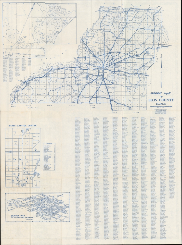
The verso includes a highway map of Leon County, a map presenting a continuation of Killearn Estates from the recto (this neighborhood in the city's northeast was its first planned community, built in the mid-1960s), and a view of the Florida State University Campus, with buildings labeled. This map was published soon after Bobby Bowden had become the head coach of the Seminoles' football team, beginning one of the most successful coaching runs in college football history.New Capitol Building
Also on the verso is an inset of the state capitol center with individual buildings numbered, corresponding to an adjacent index. A new capitol building (number 17), constructed in 1977, was unusual in being a high-rise (22 stories and 345 feet tall) and is still one of the tallest state capitol buildings in the country. The adjacent old capitol building (constructed in 1845) was initially planned to be demolished but was saved and converted into a museum. Prior to the construction of the new capitol building, there was discussion of relocating Florida's capitol further south, closer to the state's geographic center and the bulk of its population, but the new building cemented Tallahassee's role as the state's administrative and legislative center.Publication History and Census
This map was prepared and published by the Dolph Map Co. in 1979. Maps published by Dolph with this title date from between 1962 and 1997, but we are unable to locate any examples of this edition in the OCLC or in institutional collections.Cartographer
Frank B. Dolph (October 3, 1897 - November 26, 1975) was an American businessman and map publisher. Born in Great Neck, Long Island, New York, Dolph served as a Navy storekeeper during World War I. He began selling maps in 1919 after returning from England, likely for the George F. Cram Company, where he ultimately became an administrative aide. He also worked for the Rand McNally Company for some time before he founded his own map publishing firm, Dolph and Stewart, with his friend, sometime in the 1920s. Dolph and Stewart made maps throughout the 1920s and 1930s until they sold the firm in 1945 when Dolph decided to return to Florida. Dolph opened a new map publishing business, the Frank B. Dolph Map Co. in Ft. Lauderdale and published city plans of cities throughout the United States. Many of his maps were distributed by Chambers of Commerce or sold at newsstands. Real estate developers greatly appreciated his maps, those published by both the Dolph and Stewart Company and the Frank B. Dolph Company. Dolph retired as president of his firm around 1965, when he handed the business off to his son, Frank B. Dolph, Jr. Dolph worked with cartographer Theodore M. Politano for decades while operating the Frank B. Dolph Map Company. More by this mapmaker...
Condition
Good. Light wear and toning along fold lines.
References
OCLC 1009617524 (1984 ed.).