1961 General Drafting Pictorial Map of Tampa and St. Petersburg, Florida
TampaStPetersburg-generaldrafting-1961$125.00


Title
Florida West Coast Ft. Petersburg, Tampa Map and Visitor's Guide.
1961 (dated) 24 x 16.75 in (60.96 x 42.545 cm) 1 : 142000
1961 (dated) 24 x 16.75 in (60.96 x 42.545 cm) 1 : 142000
Description
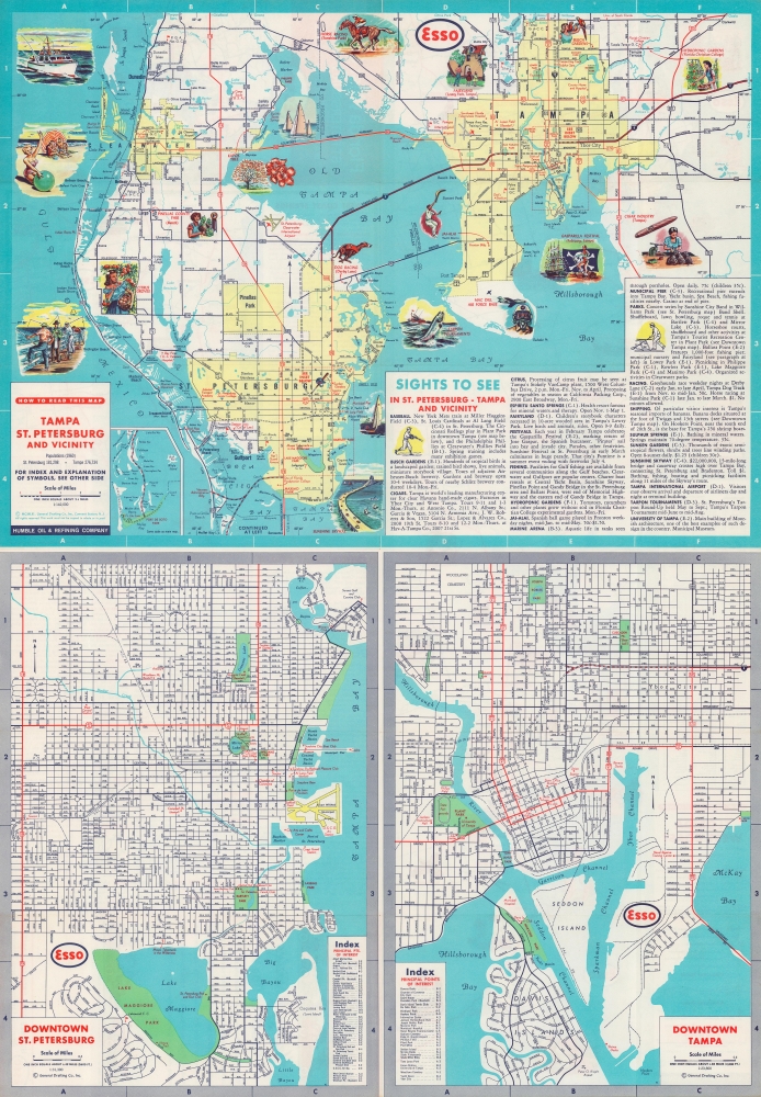
This is a 1961 General Drafting Company pictorial map of Tampa and St. Petersburg and vicinity.
Maps of downtown St. Petersburg and Tampa appear on the bottom half of the sheet. Streets, parks, and other important buildings are labeled. Indexes of points of interest are provided.
A Closer Look
A pictorial map of Tampa and St. Petersburg occupies the top half of the sheet. Pictorial vignettes highlight sites and local culture: Busch Gardens, the hydroponic gardens, Fairyland, and MacDill Air Force Base, the Gasparilla Festival, the Pinellas County Fair, and the local cigar industry. Horse and dog racing, fishing, baseball, sunbathing, and sailing are also pictured, emphasizing Florida's famous leisure culture. An inset in the lower left highlights Fort De Soto Park and its vicinity.Maps of downtown St. Petersburg and Tampa appear on the bottom half of the sheet. Streets, parks, and other important buildings are labeled. Indexes of points of interest are provided.
Verso Content
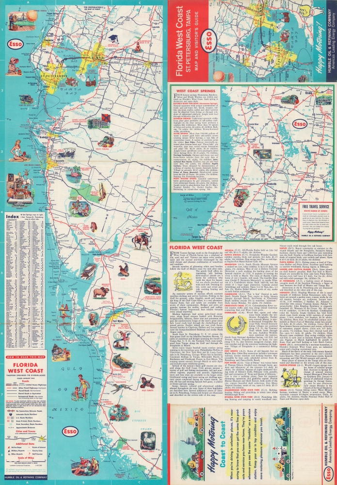
Two maps are included on the verso along with travel information. Depicting the west coast of Florida from Tarpon Springs south to the Everglades, pictorial vignettes similar to those on the recto promote sites to visit and Florida's incredible wildlife. The second smaller map covers from Ocala to Tarpon Springs.Publication History and Census
This map was created and published by the General Drafting Company and distributed by the Humble Oil and Refining Company to promote their Esso gasoline. We note two examples cataloged in OCLC: University of Wisconsin Milwaukee and Stanford University. A second OCLC entry attributes the map of the Standard Oil Company, which the company rebranded to in 1972, and states that the University of Michigan and the Jacksonville Public Library hold examples of this edition (which we believe likely to be identical).Cartographer
General Drafting Corporation (1909 - 1992) was one of the 'Big Three' publishers of road maps between 1930 and 1970, along with H. M. Gousha and Rand McNally. Founded in 1909, Otto G. Lindberg, an immigrant from Finland and the company's founder, began his business with a borrowed drafting board and a $500 loan from his father. At the time only twenty-three years old, Lindberg advertised his business as 'any and all general drafting' and was based out of 170 Broadway in New York City. Only two years later, in 1911, the firm secured its first contract from the American Automobile Association to make 'road maps'. Lindberg incorporated his business in 1914 and became its first Chairman of the Board, a position he held until his death in 1968. Lindberg persuaded Standard Oil of New Jersey to let him draw the 'best' road map of the state that they had ever seen, and Standard Oil would distribute it for free. Sufficiently impressed with the finished product, Standard contracted General Drafting to make all their road maps - a relationship that lasted another six decades. This relationship allowed General Drafting to work exclusively for Standard Oil, but when oil companies stopped providing free maps, General Drafting was in a bind. The company tried to expand into the retail map market, and it of course continued creating maps for Exxon (the new name for Standard Oil) to sell, but its returns continued to decline. The firm was purchased in 1992 by Langenscheidt and subsequently absorbed into the American Map Company. General Drafting's state maps became this company's 'Travelvision' lineup. More by this mapmaker...
Condition
Very good. Light wear along original fold lines. Map of the west coast of Florida on verso.
References
OCLC 70716233, 956508423.