This item has been sold, but you can get on the Waitlist to be notified if another example becomes available, or purchase a digital scan.
1901 Bartholomew Wall Map of Palestine
TopoPhysicalPalestine-bartholomew-1901$375.00


Title
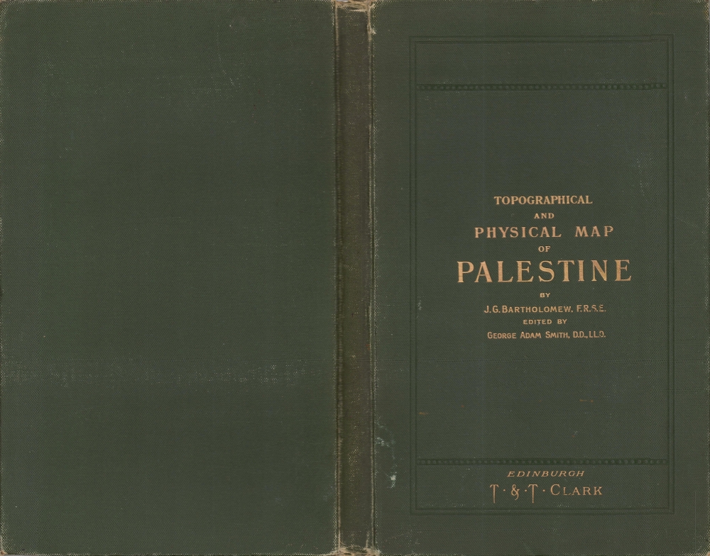
Topographical and Physical Map of Palestine.
1901 (dated) 55 x 36 in (139.7 x 91.44 cm) 1 : 253440
1901 (dated) 55 x 36 in (139.7 x 91.44 cm) 1 : 253440
Description
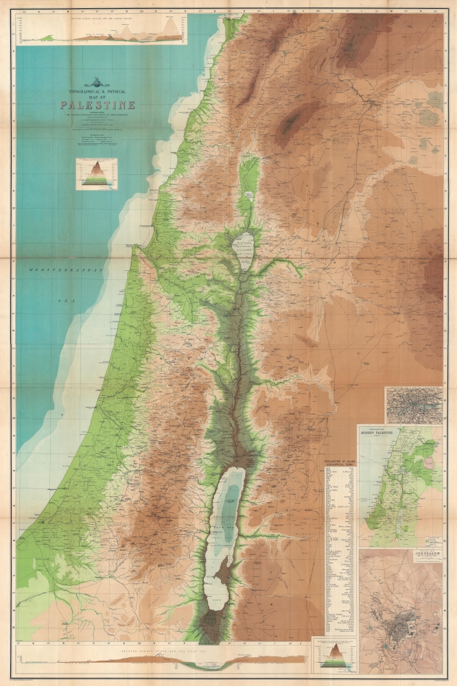
This is John Bartholomew and George Adam Smith 1901 wall map of Palestine featuring both biblical and contemporary content.
A Closer Look
Coverage extends from Beirut to the Dead Sea and from the Mediterranean Sea to just east of Damascus. Biblical and ancient place names are provided in bold lettering, while small hairline italics provide modern place toponymy. The lowest elevations are colored shades of green, while shades of brown highlights higher elevations. River systems and road networks appear in detail, with historic pilgrimage routes illustrated, including the route to Mecca. Telegraph lines connect Damascus with Haifa. A railway runs from Beirut to Damascus and south to Casphor or Caspin (also labeled as el Mezeirib). Insets contain a map London on the same scale as the large central map (4 miles to an inch), a vegetation map of modern Palestine, and a plan of Jerusalem. A profile illustrates elevation change from the Mediterranean Sea across the Mountains of Judea (including Jerusalem) to the Dead Sea and the Plateau of Moab. An explanation of Arabic geographical terms appears to the right of the inset vegetation map and the plan of Jerusalem.Publication History and Census
This map was compiled from the Palestine Exploration Fund Surveys and other authorities under the direction of John George Bartholomew, edited by George Adam Smith, and published by T and T Clark in 1901. This map is well represented in institutional collections.CartographerS
The Bartholomew Family (fl. c. 1810 - 1920) is clan of map publishers active in London through the 19th century. They represent one of the great names in British cartography. The cartographic story of the Bartholomew family begins with George Bartholomew (January, 8 1784 - October 23, 1871, active from 1797), an engraver in the employ of the Daniel Lizars firm of Edinburgh. George was the first of six generations in the Bartholomew map-making dynasty. It was his son, John Bartholomew Sr. (1805 - April 9, 1861) who ultimately founded John Bartholomew and Sons in 1828. The John Bartholomew firm produced thousands of maps and rose to become one of the largest and most prolific cartography firms in Scotland. John Sr. was succeeded by his son, also John Bartholomew Jr. (1831-93). John George Bartholomew (1860-1920), son of John Bartholomew (1831-93) took control of the firm at its height. John George was a charter member of the Royal Scottish Geographical Society and supported the creation of a National Institute of Geography - a good idea that never took off. John George is also reliably attributed to be the first to bring the term "Antarctica" into popular usage as a denominator for the Southern Continent. In recognition of his work, John George was awarded a warrant from the king and often used the title "Cartographer to the King" on his imprint. Among his friends and admirers he was referred to as the "Prince of Cartography". John (Ian) Bartholomew (1890 - 1962) continued the family business and oversaw publication of the Times Survey Atlas of the World in 1922 and the Mid Century Edition of the Time Atlas of the World from 1955 - 1960. John Christoper Bartholomew (1923 - 2008) continued the family business into a fifth generation and was fascinated by the natural sciences. He spearheaded the publication of many of the most detailed and popular maps of the last century. His brother Robert, a trained printer, became production director. Another brother, Peter, an accountant, started as a managing director and eventually became executive chairman. The John Bartholomew firm has been part of the HarperCollins family of publishers since 1989. The vast archive of maps and atlases produced by the Bartholomew family has since been transferred to the National Library of Scotland where it is currently in the cataloguing process. More by this mapmaker...
George Adam Smith (October 19, 1856 - March 3, 1942) was a Scottish theologian, educator, and minister. Born in Calcutta, where his father was the Principal of the Doveton College, Smith and his family had returned to Scotland by 1870. Smith attended the Royal High School in Edinburgh and then went to the University of Edinburgh where he studied Divinity, and finally New College, where he earned an M.A. in 1875. He spent summer semester at the University of Tübingen (1876) and the University of Leipzig (1878) as a postgraduate and traveled to Syria and Egypt. In 1882 he was ordained into the Free Church of Scotland. He was appointed Professor of Hebrew and Old Testament subjects at the Free Church College (Trinity College) in Glasgow in 1892. He moved to the United Free Church of Scotland in 1900 (the year of its creation). He was appointed Principal and Vice Chancellor of the University of Aberdeen in 1909 and held the position until he retired in 1935. Over the course of his career, Smith published nearly two dozen works on biblical subjects, including historical geographies of the Holy Land. Smith married Alice Lillian Buchanana (1886 - 1949) in 1889, and they had seven children. Learn More...
Condition
Average. Mounted on linen. Wear and soiling along original fold lines. Slight loss at several fold intersections. Accompanied by original binder.
References
OCLC 703838254.