This item has been sold, but you can get on the Waitlist to be notified if another example becomes available, or purchase a digital scan.
1850 Reynolds Map of the Solar System (w/ transparency)
TransparentSolarSystem-reynolds-1850$450.00

Title
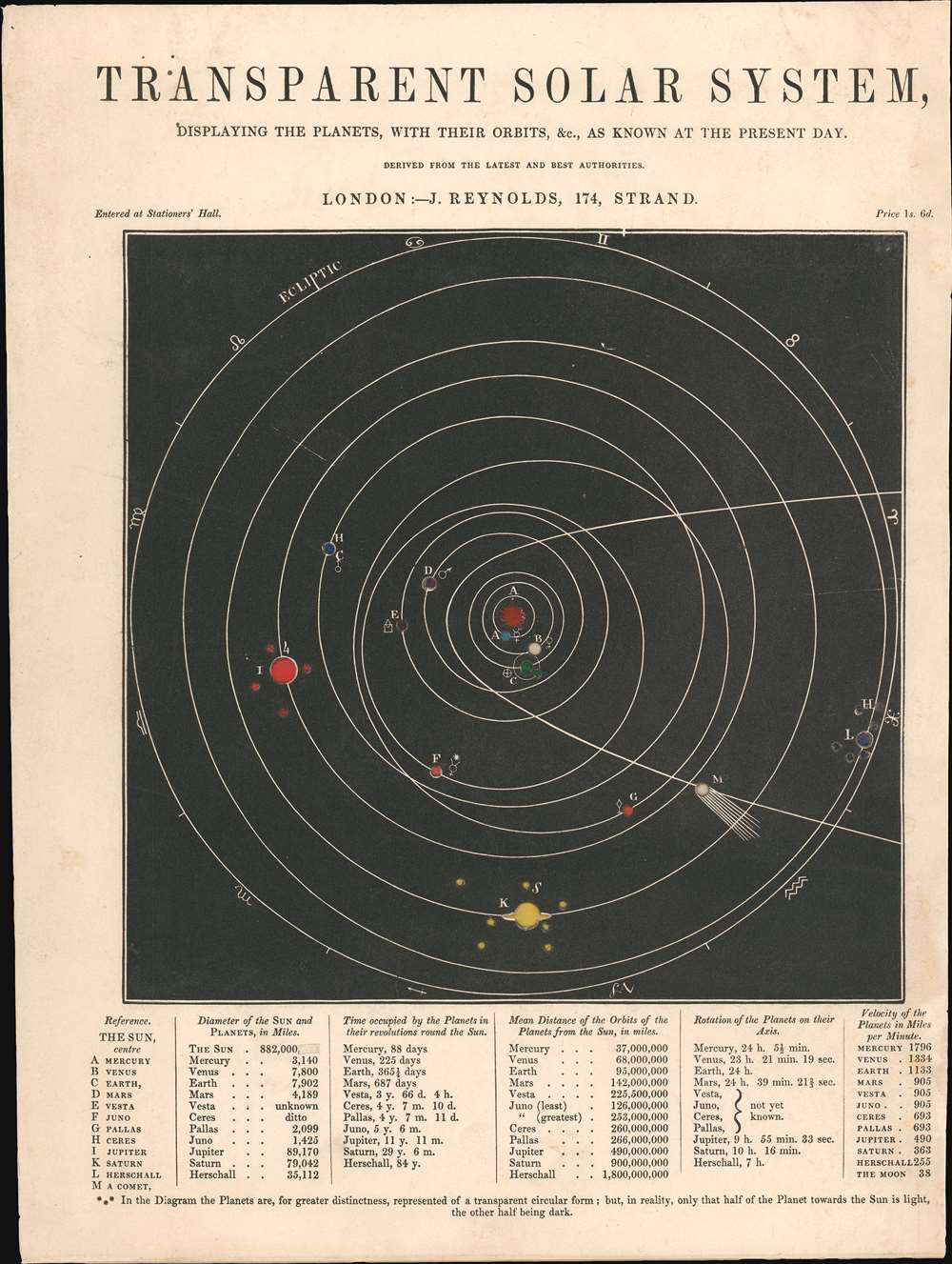
Transparent Solar System, Displaying the Planets, with Their Orbits, etc., as Known at the Present Day.
1850 (undated) 11.75 x 8.875 in (29.845 x 22.5425 cm)
1850 (undated) 11.75 x 8.875 in (29.845 x 22.5425 cm)
Description
This is an 1850 James Reynolds map of the Solar System. Consisting of thick cardstock with translucent colored paper mounted on the back, the planets, moons, and other celestial objects can be illuminated from behind. The Sun is at the center, with the planets alphabetically identified and corresponding to a reference in the lower-left corner. Along with the planets, the four largest asteroids in the asteroid belt, Vesta, Juno, Pallas, and Ceres, are identified. Planet 'L' (Uranus but referred to here as 'Herschall') is named in honor of the legendary British astronomer William Herschel, who discovered it in 1781. The smaller circles mark moons discovered up to that point and 'M' highlights a comet, likely Halley's Comet, since that is the one referenced on other states of this piece. The signs of the zodiac appear along the outermost ecliptic.
Publication History and Census
This map was published by James Reynolds c. 1850. This is the only known surviving example of this state. We have been able to locate three other states of this map, two of which are in the David Rumsey Map Collection, and the other is part of the collection at the Royal Museums Greenwich.Cartographer
James Reynolds (1817-1876) was a London based map and chart publisher active in the mid-19th century. Reynolds produced numerous maps and tourist guides of London and the surrounding areas as well as various astronomical and scientific charts. After Reynolds retired his sons, William Henry and Frederick, took over his business, updating and reprinting many of his maps and charts before selling the firm to Charles Smith in the late 19th century. Reynolds operated out of office at 174 Strand Street, London. More by this mapmaker...
Condition
Very good. Slight edge wear.
References
Royal Museums Greenwich AST0007 (alternate state).