
1944 U.S. Navy WWII Joint Intelligence Pacific Ocean Areas Maps of Truk Atoll

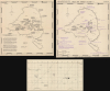
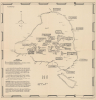
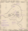
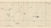
Truk Atoll. Major Fortifications. / Truk - Air Target Folder II. Truk Islands. Target Area Map - Truk Islands. / [Untitled Aviation Chart of the East Caroline Islands.]
Planning Operation Hailstone - the World War II U.S. Navy attack on Truk Atoll.
$3,500.00
Choose a Collection:
- Digital Map Information
- Suitable for large format printing
- Full resolution TIFF file
- ICC color profile embedded
- Delivered instantly via download link
This Item
Enquire
Planning Operation Hailstone - the World War II U.S. Navy attack on Truk Atoll.
This important archive, compiled days after the World War II Battle of Kwajalein and weeks before Operation Hailstone, includes three 1944 U.S Navy maps of Truk Atoll (Chuuk Lagoon, Micronesia): two 1944 Joint Intelligence Center Pacific Ocean Areas (JICPOA) maps of Truk Atoll, and an aviation chart of the same. The map archive offers unique insights into the U.S. Navy's preparations to assault one of Japan's most formidable bases in the South Pacific. Truk Atoll was Imperial Japan's main naval base in the South Pacific, considered the 'Gibraltar of the Pacific'.A Closer Look
The archive breaks down as follows:- Map 1: Truk Atoll - Major Fortifications. February 3, 1944
The first map in the archive highlights gun positions throughout the atoll, with islands identified and gun positions marked with an X. Text boxes note artillery type, number, and caliber. Borders around each caption are single-, double-, or triple-lined, indicating the level of confidence in the reconnaissance: triple lines indicate known positions, double lines information based on substantial evidence, and single lines unconfirmed positions. When referring to known positions, the type of gun, caliber, and number is provided. Unconfirmed positions usually give caliber but often include the annotation 'number unknown' or 'exact location unknown'. Gun positions, passes through the reefs, and islets are identified along the atoll's outer ring. Text in the lower-left discusses gun positions, searchlights, and electric generators. - Map 2: Truk Air Target Folder II. Target Area Map - Truk Islands. February 4, 1944
The second map highlights Japanese anchorages, airfields, docks, and other installations, often with purple text. Areas used by the Imperial Japanese Navy as anchorages for aircraft carriers, battleships, destroyers, cruisers, cargo ships, tenders, and submarines are marked by diagonal purple lines. 'X' marks fortified positions on the islands and islets. Passes through the reefs that ring the central lagoon are labeled, with those most used by the Japanese highlighted. A note in the lower-right states the seaplane bases are 'located along [the] south shore of Dublon Island and on [the] south tip of Moen Island. - Map 3: [Untitled Aviation Chart of the East Caroline Islands.]
The third map is an untitled aviation chart of the eastern Caroline Islands. Coverage embraces from Mager Island to Ujolong Atoll and from Ujolong Atoll to Satawan Island. Truck Island (as it is labeled here) appears on the left, not far from the edge. Part of the atoll is marked with an X and labeled 'JRT'.
Truk Atoll - 'The Gibraltar of the Pacific' and Operation Hailstone
By the winter of 1943-1944, American naval personnel considered Truk to be a near-impregnable fortress. The Japanese had based resupply efforts during the Battle of Guadalcanal out of Truk Atoll - thousands of American sailors perished in naval battles in the Solomons before the Japanese finally relinquished Guadalcanal. This formidable reputation led Allied planners to prioritize neutralizing Truk as a Japanese base of operations. Two U.S. Marine Corps PBY-1s flew over Truk on February 4 (the day one of these maps was compiled), producing an aerial photo reconnaissance of defenses. Likely recognizing the fly-overs presaged a large-scale invasion, the Japanese Navy withdrew the Combined Fleet to nearby Palau.U.S. Navy Task Force 58 attacked with three of its carrier groups on February 17. The operation, which spanned two days, was deemed a success. Airstrikes destroyed tons of stored fuel and cargo. Ten naval vessels, 31 merchant ships were sunk, and 270 Japanese aircraft destroyed. At that point in the war, Japanese industry could not replace these losses, making Hailstone a crippling blow to Japan's war machine.
The U.S. never invaded Truk. It 'leapfrogged' the atoll and instead focused on the Northern Mariana Islands, invading Saipan in June and Guam and Tinian a month later. Japanese forces on Truk were cut off from resupply, ran low on all provisions, and suffered starvation, forcing a formal surrender on September 2, 1945, the same day as the general Japanese surrender ended the Pacific War. Today, Truk Atoll is known as Chuuk Lagoon, Federated States of Micronesia.
Publication History and Census
The two maps of Truk Atoll were compiled by the Joint Intelligence Center Pacific Operations Areas (JICPOA) in February 1944. These are the only known surviving examples. The accompanying aviation chart is undated but contemporaneous.Condition
Very good. Light wear along original fold lines on all 3 sheets. Both maps of Truk Atoll are 17 x 16 inches. The untitled aviation chart is 8.5 x 16.25 inches.
References
Young, E.M., 'A Hard Rain', The Aviation Historian Issue 13.