This item has been sold, but you can get on the Waitlist to be notified if another example becomes available, or purchase a digital scan.
1650 Jansson Map of Ulster, Ireland
UlsterIreland-jansson-1650$300.00

Title
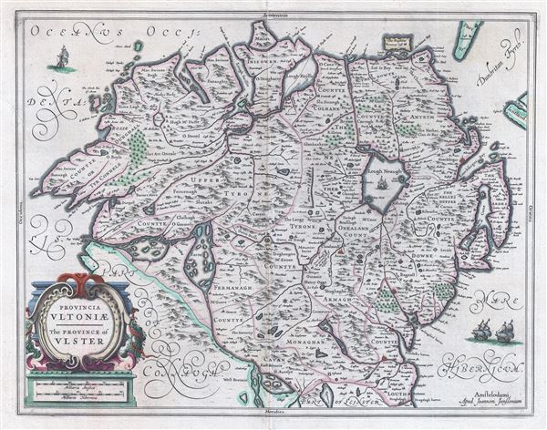
Provencia Ultoniae. The Province of Uslter.
1650 (undated) 15 x 19.5 in (38.1 x 49.53 cm) 1 : 500000
1650 (undated) 15 x 19.5 in (38.1 x 49.53 cm) 1 : 500000
Description
An attractive c. 1650 map of Ulster province, Northern Ireland, by the Dutch cartographer Johannes Jansson (Janssonius). The map covers from the Atlantic to the Irish Sea and from Cardonagh to Connaught and Leinster. Includes Belfast. Beautifully engraved with fine hand color. French text on verso. Title in both English and Latin. Today this region is administered by the United Kingdom and though a significant portion of the population is eager to politically leave the UK and rejoin Ireland. This map was originally published by Jansson, as in the present example. A later edition was issued by Schenck and Valk c. 1700.
Cartographer
Jan Jansson or Johannes Janssonius (1588 - 1664) was born in Arnhem, Holland. He was the son of a printer and bookseller and in 1612 married into the cartographically prominent Hondius family. Following his marriage he moved to Amsterdam where he worked as a book publisher. It was not until 1616 that Jansson produced his first maps, most of which were heavily influenced by Blaeu. In the mid 1630s Jansson partnered with his brother-in-law, Henricus Hondius, to produce his important work, the eleven volume Atlas Major. About this time, Jansson's name also begins to appear on Hondius reissues of notable Mercator/Hondius atlases. Jansson's last major work was his issue of the 1646 full edition of Jansson's English Country Maps. Following Jansson's death in 1664 the company was taken over by Jansson's brother-in-law Johannes Waesberger. Waesberger adopted the name of Jansonius and published a new Atlas Contractus in two volumes with Jansson's other son-in-law Elizée Weyerstraet with the imprint 'Joannis Janssonii haeredes' in 1666. These maps also refer to the firm of Janssonius-Waesbergius. The name of Moses Pitt, an English map publisher, was added to the Janssonius-Waesbergius imprint for maps printed in England for use in Pitt's English Atlas. More by this mapmaker...
Source
Jansson, J. Atlas Novus, (Amsterdam) c. 1650.
Condition
Very good. Original platemark visible. French text on verso. Original centerfold exhibits some damage at center and typical wear. Repair to border and margin, left side about 5 inches above cartouche. Backed with archival Japanese tissue.
References
OCLC: 834826755.