
Jansson, Jan (Johannes Janssonius, Johannes Jansson, Joannis Janssonii Haeredes)
Jan Jansson or Johannes Janssonius (1588 - 1664) was born in Arnhem, Holland. He was the son of a printer and bookseller and in 1612 married into the cartographically prominent Hondius family. Following his marriage, he moved to Amsterdam, where he worked as a book publisher. It was not until 1616 that Jansson produced his first maps, most of which were heavily influenced by Blaeu. In the mid-1630s, Jansson partnered with his brother-in-law, Henricus Hondius, to produce his important work, the eleven-volume Atlas Major. About this time, Jansson's name also begins to appear on Hondius reissues of notable Mercator/Hondius atlases. Jansson's last major work was his issue of the 1646 full edition of Jansson's English Country Maps. Following Jansson's death in 1664, the company was taken over by Jansson's brother-in-law Johannes Waesberger. Waesberger adopted the name of Jansonius and published a new Atlas Contractus in two volumes with Jansson's other son-in-law, Elizée Weyerstraet, with the imprint 'Joannis Janssonii Haeredes' in 1666. These maps also refer to the firm of Janssonius-Waesbergius. The name of Moses Pitt, an English map publisher, was added to the Janssonius-Waesbergius imprint for maps printed in England for use in Pitt's English Atlas.
AKA: Johannes Janssonius, Johannes Jansson, Joannis Janssonii Haeredes
First authenticated European Contact with Australia; best Philippine Mapping to date.
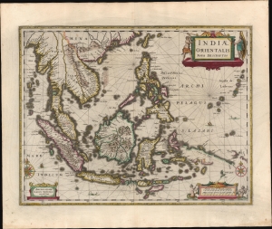
Indiae Orientalis Nova Descriptio.
$3,000.00
Acquire
- Digital Map Information
- Suitable for large format printing
- Full resolution TIFF file
- ICC color profile embedded
- Delivered instantly via download link
This is a gorgeous, original color example of Jan Jansson's 1630 map of the East Indies - the first printed map to present Willem Janszoon's 1606 contact with Australia. It also represents a milestone in the mapping of the Philippines, containing a markedly more precise depiction of the archipelago than any prior printed map. (more details)
Classic Dutch Golden Age map of Continental Africa.
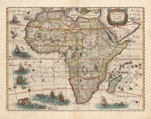
Africae nova Tabula Auct. Hen. Hondio.
$1,800.00
Acquire
- Digital Map Information
- Suitable for large format printing
- DPI: 600
- File Size: 20.33 MB
- File Type: ZIP / TIFF
- ICC color profile embedded
- Delivered instantly via download link
This is an attractive example of the Hondius map of Africa. It is a classic of Dutch decorative cartography. The map is embellished with lions, zebras, elephants, ostriches, and monkeys, while the oceans display seven sailing ships menaced by sea monsters. Flying fish skim the waters west of Guinea. A merman and mermaid embrace in the southern Atlantic - a recurring image in Hondius' maps (the identical couple appears in at least one other, Hondius' 1631 map of Italy.) (more details)
Estonia and Latvia as the Swedish Frontier
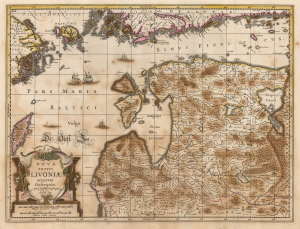
Nova Totius Livoniae accurata Descriptio. Apud Janssonio Waesbergios et Mosem Pitt.
$750.00
Acquire
- Digital Map Information
- Suitable for large format printing
- Full resolution TIFF file
- ICC color profile embedded
- Delivered instantly via download link
A beautifully engraved map of Livonia and the Duchy of Estonia - encompassing much of modern Latvia and Estonia - originally published in Jan Jansson's Atlas and revised for inclusion in Moses Pitt's rare 1680 English Atlas. Derived from Anders Bure's seminal map of the Swedish Empire, it depicts the region during Swedish rule following Sweden's victories over the Polish-Lithuanian Commonwealth. Sweden retained Estonia and Livonia until its defeat by Russia in the Great Northern War (1700 - 1721). (more details)
A Likely Appendix Issue of a Richly Decorative Dutch Map of Asia Minor and Cyprus
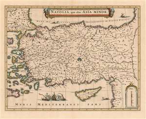
Natolia, quae olim Asia Minor.
$750.00
Acquire
- Digital Map Information
- Suitable for large format printing
- DPI: 600
- File Size: 19.92 MB
- File Type: ZIP / TIFF
- ICC color profile embedded
- Delivered instantly via download link
This 1636 map of Asia Minor and Cyprus was engraved by Jansson in 1636 for inclusion in his business partner Henry Hondius's atlases. This example, lacking verso text and exhibiting a bold, sharp strike, was probably an early appendix issue intended for distribution to previous subscribers to Hondius' atlas. The map depicts the region from the Aegean Sea to the Euphrates River, and from the Black Sea to Cyprus and the Mediterranean Sea. The beautifully engraved map is embellished with an evocative cartouche flanked by two turbaned putti. West of Cyprus, two Ottoman triremes blast away at a square-rigged ship, alluding to the long contention between Turkish and Christian European powers over the region. Hondius and Jansson produced this map quite shortly after fellow Amsterdam mapmaker Blaeu produced a virtually identical map in 1634. Despite the heated competition evident between the two mapmaking giants, the map's geographical data was not strictly fresh - the 16th century cartographic giant, Gastaldi, remained authoritative with respect to this region. (more details)
Insular Korea.
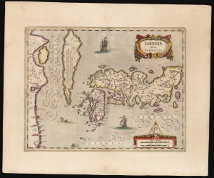
Japoniae nova Descriptio.
$2,500.00
Acquire
- Digital Map Information
- Suitable for large format printing
- Full resolution TIFF file
- ICC color profile embedded
- Delivered instantly via download link
This is a scarce. original-color example of Jan Jansson's map of Japan and Korea, featuring an insular Korea. The map follows the model of Luís Teixeira, the 16th-century court cartographer to the King of Spain. (more details)
Classic Dutch Map of the Caribbean.
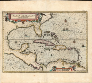
Insulae Americanae in Oceano Septentrionali cum Terris adiacentibus.
$3,000.00
Acquire
- Digital Map Information
- Suitable for large format printing
- Full resolution TIFF file
- ICC color profile embedded
- Delivered instantly via download link
This is a beautiful 1637 example of Jan Jansson's 1636 map of the Caribbean Islands and the adjacent coastlines of North and South America. It is among the most beautiful maps of the region produced in the first half of the 17th century. Moreover, the present example is in superb condition with gorgeous, bright original color. (more details)
Dutch Golden Age map of the Czech Republic.
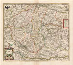
Bohemia.
$650.00
Acquire
- Digital Map Information
- Suitable for large format printing
- DPI: 600
- File Size: 18.62 MB
- File Type: ZIP / TIFF
- ICC color profile embedded
- Delivered instantly via download link
This is a beautiful, original-color 1680 example of Jan Jansson's map of Bohemia, the modern-day Czech Republic, and parts of neighboring Austria, Bavaria, Germany, Poland, and Moravia. (more details)
The dominant 17th century depiction of the American Southeast.
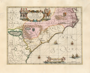
Virginiae Partis australis, et Floridae partis orientalis, interjacentiumque regionum Nova Descriptio.
$1,800.00
Acquire
- Digital Map Information
- Suitable for large format printing
- Full resolution TIFF file
- ICC color profile embedded
- Delivered instantly via download link
This is Jan Jansson's beautiful map of Virginia and Florida, engraved in 1639, appearing here in an attractive example of its c. 1694 restrike under the imprint of Gerard Valk and Peter Schenk. This classic Dutch map, encompassing the Carolinas and what would become Georgia and part of Florida, was derived from that of Willem Blaeu, which has been called 'the most correct map of this area yet to appear' (Cumming). Blaeu's map was sufficiently authoritative for Jansson to make an extremely faithful copy. Both cartographers' maps would have a long print life. (more details)
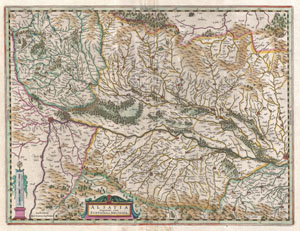
Alsatia Superior cum Svntgoia et Brisgolia.
$450.00
Acquire
- Digital Map Information
- Suitable for large format printing
- DPI: 300
- File Size: 12.27 MB
- File Type: ZIP / TIFF
- ICC color profile embedded
- Delivered instantly via download link
A beautiful example of Jansson's 1644 map of upper Alsace, France. Oriented to the west, this map covers the Rhine valley from Basel to Strasbourg. Shows numerous towns, villages, forests, and river tributaries. Topography and major cities are shown in profile. ... (more details)
Conflicting French and English claims to the Carolina, Georgia, and Florida seaboard.
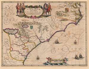
Virginiae Partis australis, et Floridae partis orientalis, interjacentiumque regionum Nova Descriptio.
$2,000.00
Acquire
- Digital Map Information
- Suitable for large format printing
- Full resolution TIFF file
- ICC color profile embedded
- Delivered instantly via download link
This is a beautiful c. 1644 Jan Jansson map of Virginia and Florida. This classic Dutch map, encompassing the Carolinas and the area that would become Georgia and part of Florida, was derived from that of Willem Blaeu, which has been called 'the most correct map of this area yet to appear' (Cumming). Blaeu's map was sufficiently authoritative for Jansson to make an extremely faithful copy. Both cartographers' maps would enjoy a long print life. (more details)
Insular Korea and is the first map to show the discoveries of Vries and Coen.
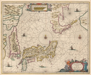
Nova et Accurata Japoniae Terrae Esonis ac Insularum adjacentium.
$1,900.00
Acquire
- Digital Map Information
- Suitable for large format printing
- DPI: 600
- File Size: 48.8 MB
- File Type: ZIP / TIFF
- ICC color profile embedded
- Delivered instantly via download link
An attractive old color example of the 1644 Johannes Janssonius map of Japan and the surrounding lands, including an exceptional insular Korea. Jansson's map is significant on many levels, including being the first printed map to include cartography from the Maarten de Vries manuscript, a fascinating rendering of the Kuril Islands, the joining of Hokkaido (Eso) and Sakhalin, and the presentation of Korea as an island. (more details)
Beautifully Engraved Chart of the Atlantic.
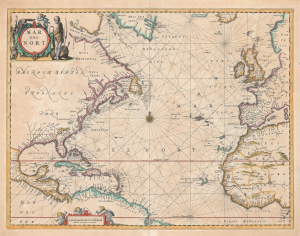
Mar del Nort.
$1,500.00
Acquire
- Digital Map Information
- Suitable for large format printing
- Full resolution TIFF file
- ICC color profile embedded
- Delivered instantly via download link
This is Johannes Janssonius's 1650 Mar del Nort, a decorative sea chart of the North Atlantic. Covering from Dutch New Netherland to the Caribbean and the shores of Europe and Africa, the map presents the ocean at the center of an expanding maritime world. Elaborate cartouches, a dense network of rhumb lines, and the phantom islands of Brasil and Buss combine the elegance of Dutch Golden Age engraving with the uncertainties of early oceanic exploration. (more details)
Dutch Designs on a Potential Northeast Passage.
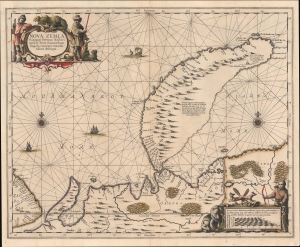
Nova Zemla, Waygats, Fretum Nassovicum, et Terra Samoiedum singula omnium emendatissimè descripta.
$1,000.00
Acquire
- Digital Map Information
- Suitable for large format printing
- File Size: 16.92 MB
- File Type: ZIP / TIFF
- ICC color profile embedded
- Delivered instantly via download link
This is an old color example of Jan Jansson's c. 1650 map and nautical chart of Novaya Zemlya in the Russian Far North, which appeared in the fifth volume of his Atlas Novus, also known as the 'Water World' atlas, the first true sea atlas. When this was issued, Novaya Zemlya was as hot in the European imagination as it was cold in fact. The archipelago was seen as a hopeful waypoint on the long-sought Northeastern Passage to Asia and was becoming increasingly popular with whalers. (more details)
Most detailed atlas map of China and Korea to date.
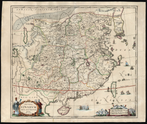
Imperii Sinarum Nova Descriptio.
$900.00
Acquire
- Digital Map Information
- Suitable for large format printing
- Full resolution TIFF file
- ICC color profile embedded
- Delivered instantly via download link
This is Jan Jansson and Jan van Loon's c. 1660 map of China and Korea: the earliest acquirable map to focus on China and Korea. It is among the most richly detailed early atlas maps of China, including the Great Wall, the legendary lake Chimay, and an early reference to Tibet. (more details)
Finest 17th century large-scale map of the Holy Land.
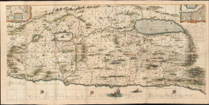
[Situs Terrae Promissionis.]
$6,500.00
Acquire
- Digital Map Information
- Suitable for large format printing
- File Size: 118.78 MB
- File Type: ZIP / TIFF
- ICC color profile embedded
- Delivered instantly via download link
Commonly known as the 'Hornius Map', this is the 1662 Johannes Jansson and Georgius Hornius 6-sheet map of the Holy Land in a beautifully colored, joined example. This map is an expansion on the allegorical Holy Land cartography pioneered by Christian van Adrichem around 1590. Jansson expanded and embellished Adrichem's map to illustrate the text composed by Georgius Hornius (George Horn) for volume six of his Novus Atlas, Accuratissimia Orbis Antiqui Delineatio. (more details)
France during the Roman Era.
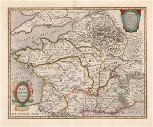
Galliae Veteris Typus.
$650.00
Acquire
- Digital Map Information
- Suitable for large format printing
- Full resolution TIFF file
- ICC color profile embedded
- Delivered instantly via download link
This is a beautiful example of Jan Jansson's map of France, known as Gaul during the Roman era. It is derived from Abraham Ortelius' map of the same title. The map thus combines the late sixteenth century mapping of France's physical geography with classical toponymy, drawn from the first century writing of the historian Strabo, supplemented by the work of Pliny, Virgil, Caesar, and others. Ortelius, a historian as well as a mapmaker, had included the map in his Parergon, the historical supplement to his Theatrum Orbis Terrarum. Jansson, with an eye for quality, was faithful to his source, including not only the place names but Ortelius' copious historical notations. (more details)
Time, Travel, and Light.
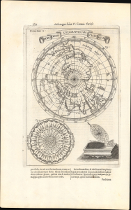
Horoscopium Geographicum Sciatericum.
$1,200.00
Acquire
- Digital Map Information
- Suitable for large format printing
- Full resolution TIFF file
- ICC color profile embedded
- Delivered instantly via download link
This is an absorbing 1671 Athanasius Kircher map and representation of his concept of a 'sciatericum,' a sundial-like device that could be used for both geographic and astrological purposes. The work is characteristic of the thought of Kircher, one of the most original and prolific philosophers of his day, in that it draws on a range of traditions and influences, including mysticism, numerology, and what today would be called astrology. (more details)
A gorgeous 17th century map of an important artery in the fur trade.
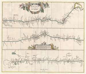
Dwinae Fluvii nova descriptio.
$450.00
Acquire
- Digital Map Information
- Suitable for large format printing
- DPI: 300
- File Size: 7.74 MB
- File Type: ZIP / TIFF
- ICC color profile embedded
- Delivered instantly via download link
This is a 1680 Jan Jansson map of the Northern Dvina River in northern Russia. The map, divided into three sections, follows the course of the river from its source in Vologod Province as it empties into Dvina Bay of the White Sea near Archangel (Arkhangelsk). Several smaller tributaries and towns are identified along the river's banks. (more details)
Trading centers on Borneo.
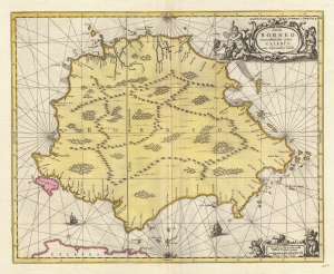
Insula BORNEO et occidentalis pars CELEBIS cum adjacentibus Infulis.
$1,300.00
Acquire
- Digital Map Information
- Suitable for large format printing
- DPI: 300
- File Size: 9.53 MB
- File Type: ZIP / TIFF
- ICC color profile embedded
- Delivered instantly via download link
A stunning full-color c. 1710 map of Borneo by Gerard Valk and Petrus Schenk under the imprint of Valk and Schenk. The map reflects tenuous knowledge of the island in the early days of VOC activity in the region. (more details)
Dutch interest in Sumatra and Malaya.
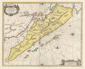
Sumatrae et Insularum Locorum que Nonnull Orum Circumiacentium Tabula Noua.
$1,300.00
Acquire
- Digital Map Information
- Suitable for large format printing
- DPI: 300
- File Size: 9.55 MB
- File Type: ZIP / TIFF
- ICC color profile embedded
- Delivered instantly via download link
A stunning full-color c. 1710 map of Sumatra, Malay, the straits of Malacca, and Singapore by Gerard Valk and Petrus Schenk under the imprint of Valk and Schenk. (more details)
One of the few views of to show a walled New York.
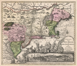
Recens Edita Totius Novi Belgii, in America Septentrionali siti, delineatio cura et sumtibus Tob. Conr. Lotteri, Sac. Caes. Maj. Geographi August. Vind.
$3,500.00
Acquire
- Digital Map Information
- Suitable for large format printing
- DPI: 600
- File Size: 74.88 MB
- File Type: ZIP / TIFF
- ICC color profile embedded
- Delivered instantly via download link
This is Conrad Tobias Lotter's 1757 map of New York, New England, and the mid-Atlantic colonies. It represents the final map in the Jansson-Visscher series. Despite the map's cartography being over a century old, this map continued to capture the idea of this part of the world for Europeans in general and a German audience in particular. (more details)