
1846 Ensign Map of the United States (Texas at fullest)

This item has been sold.
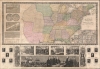
Ensign's Travellers' Guide, and Map of the United States, containing the Roads, Distances, Steam Boat and Canal Routes.
Texas at its fullest - months after joining the United States.
- Digital Map Information
- Suitable for large format printing
- Full resolution TIFF file
- ICC color profile embedded
- Delivered instantly via download link
Texas at its fullest - months after joining the United States.
A scarce Mexican-American War (1846 - 1848) variant edition of Ensign and Thayer's series of United States wall maps. This map, dated 1846, is the first edition to show Texas after joining the United States - with its fullest borders extending north as far as modern-day Wyoming and including New Mexico.A Closer Look
It illustrates the Republic of Texas according to its early proclaimed borders, names Austin's colony, and identifies Austin as the capital. In addition, the map features a large Missouri Territory. Small mountains and rivers charts on the Bulla / Darton model appear in the upper left quadrant. The bottom of the map features a large panorama of the Signing of the Declaration of Independence as well as various scenes from American History. To either side are illustrations of Metacom, the Pokunoket Sachem called 'King Philip' and James Polk, who had just been elected 11th president of the United States. Portraits of other former presidents fan out on either side of the panorama.The Mexican-American War
The Mexican-American War was fought between Mexico and the United States over Texas from 1846 to 1848. The Republic of Texas was a short-lived nation established in March of 1836 when it seceded from Mexico. Following the independence of Mexico from Spain, the American Stephen Fuller Austin led a group of 300 Empresarios to settle Texas, near Austin, where they received a grant from the Mexican government. As more Americans moved to Texas, resentment and strife began to build between the American settlers and Mexican authorities. This and other factors ultimately led to the Texan Revolution in 1835 and the declaration of Texan independence in 1836. Texas remained an independent republic until it joined the United States 10 years later in 1846. The annexation incited Mexican authorities, who considered Texas their sovereign territory. Mexico marched against Texas, and, in the aftermath, the U.S. landed forces at Veracruz and marched on Mexico City. The army, after a series of one-sided battles, captured Mexico City, forcing the Mexican government to sue for peace. In the subsequent Treaty of Guadeloupe Hidalgo, United States gained most of the southwestern United States, including Texas, Arizona, New Mexico, California, Utah, and Nevada. In exchange, the U.S. paid Mexico $15 million and assumed $3.5 million in debt the U.S. claimed the Mexican government owed to American citizens.Republic of Texas
The Republic of Texas was a short-lived nation established in March of 1836 when it seceded from Mexico. Following the independence of Mexico from Spain, the American Stephen Fuller Austin led a group of 300 Empresarios to settle Texas, near Austin, where they received a grant from the Mexican government. As more Americans moved to Texas, resentment and strife began to build between the American settlers and Mexican authorities. This and other factors ultimately led to the Texan Revolution in 1835 and the declaration of Texan independence in 1836. Texas remained an independent republic until it joined the United States ten years later in 1846.Texas Borders
The borders of the Republic of Texas were in dispute from the earliest days of the Texan Revolution. The Republic-claimed borders followed the Treaties of Velasco between the newly created Texas Republic and Mexican leader, Antonio López de Santa Anna. These treaties adhered to the 1819 Adams-Onís Treaty between the United States and Spain, which established the Sabine River as the eastern boundary of Spanish Texas and the western boundary of the Missouri Territory. The Republic's southern and western boundary with Mexico was more nuanced. Texas claimed the Rio Grande del Norte as its western and southernmost border, while Mexico argued for a boundary much further east at the Nueces River. When Texas was annexed into the United States, the expansionist Polk regime followed the Republic claimed boundary, thus absorbing Mexican-claimed territory as far west as Santa Fe. This escalated already existing tensions between the United States, the former Republic of Texas, and Mexico, ultimately triggering for the Mexican-American War (1846 - 1848).Publication History and Census
Phelps and Ensign first issued a map of this title in 1839. That map terminated at the Mississippi. The present example, presaging the Mexican American War and Texas Annexation, is dramatically expanded to include the Rocky Mountains and additional illustrations. Various editions were issued in 1840, 1841, and, as above, 1845, when Thayer's imprint replaced that of Phelps. Additional publications with major revisions continued until about 1859. The entire series, one of the most decorative in the history of early American map publishing, follows the course of the Westward Expansion and the Mexican American War, and as such, is of the utmost interest to collectors and historians. While maps from this series do come to market from time to time, the individual states, especially the Republic of Texas and Mexican-American War editions, are exceedingly uncommon and poorly represented even in institutional collections.Cartographers
Edward Hooker Ensign (August 18, 1818 - July 10, 1871) was an American map, book, and print publisher based in New York City in the mid-19th century. Born in West Hartland, Connecticut in 1818, he was established in the New York publishing trade by 1839. His career developed through a succession of partnerships associated with travelers' guides, pocket maps, decorative wall maps, and historical prints. During the 1840s, he worked with Timothy Ensign under the imprint T. and E. H. Ensign and participated in the publishing enterprise Phelps, Ensigns and Thayer, whose partners included Humphrey Phelps (1799 - 1875) and Horace Thayer (b. 1811). Surviving publications demonstrate that these imprints overlapped rather than forming a simple chronological succession: an 1845 Phelps and Ensign guide, for example, accompanied a map bearing the T. and E. H. Ensign imprint. In 1851, Ensign and Thayer's travelers' guide to the western states advertised publishing addresses in both New York City and Buffalo. During the 1850s, Ensign became associated with Ensign, Bridgman and Fanning, whose partners included Thomas Coit Fanning (b. 1805). The 1857 New York directory lists both Edward H. Ensign and this firm as map dealers at 156 William Street. Its publications included state and railroad maps, illustrated geographical broadsides, and guides to western travel. At the beginning of the Civil War, the firm issued Our Nation's Camp Ground, combining maps of the mid-Atlantic region and Washington with explicitly pro-Union imagery. His various imprints include 'Phelps and Ensign' (1841-1844), 'T. and E. H. Ensign' (1844 - 1848), 'Ensign and Thayer' (1849), 'Ensign, Thayer, and Company' (1850 - 1851), 'Horace Thayer and Company' (1852), and 'Ensign, Bridgman and Fanning' (1854 - 1863). Further Details...
Horace Thayer (June 29, 1811 - March 15, 1875) was an American map publisher and lithographer active in New York City, Buffalo, and Warsaw, New York, during the middle of the 19th century. Born in Hartwick, New York, he married Harriet Margaret Dodge (1814 - 1870) on February 20, 1833. He moved from Warsaw to New York City in 1845 and entered a short-lived association with the Kellogg lithographers, publishing as Kelloggs and Thayer in 1846 - 1847. His cartographic business specialized in travel guides, wall maps, and pocket maps, often drawing upon existing cartographic compilations. During the 1840s and early 1850s he worked with Timothy Ensign (1795 - 1849) and Edward Hooker Ensign (1818 - 1871), whose changing partnerships produced the imprints Ensigns and Thayer, Ensign and Thayer, and Ensign, Thayer, and Company. He subsequently published as Horace Thayer and Company. His business combined map publishing with the manufacture of map rollers, the wooden fittings used to mount wall maps. He returned to Warsaw in the 1850s to establish a map-roller manufactory while continuing his connections with New York publishing. In the late 1850s and early 1860s, he collaborated with George Woolworth Colton (1827 - 1901), son of Joseph Hutchins Colton (1800 - 1893); their publications included maps bearing the Thayer and Colton imprint. His various imprints included Kelloggs and Thayer (1846 - 1847), Ensigns and Thayer (1848), Ensign and Thayer (1849 - 1850), and Ensign, Thayer, and Company (1850 - 1851), Phelps and Watson (1859), and Thayer and Colton (1859-186?). Thayer's New York business addresses included 50 Ann Street and 18 Beekman Street, the latter appearing on his 1861 village map of Warsaw. He also invested in Warsaw real estate, purchasing farmland in 1853 and a house in 1864, and later operated a map-roller establishment in nearby Johnsonburg. Following his first wife's death, he married Mary O. Tuttle on June 19, 1872. Thayer drowned in Tonawanda Creek on March 15, 1875. Further Details...
Joseph Wells (April 8, 1808 - October 5, 1874) was an English-American line and map engraver based in Brooklyn, New York, during the middle of the 19th century. Born in Birmingham, England, he learned line engraving before emigrating to the United States on August 28, 1837, and settling in Brooklyn. His cartographic work included steel-plate engraving for the New York publishers Phelps and Ensign. Their 1841 Phelps and Ensign's Travellers' Guide, and Map of the United States, Containing the Roads, Distances, Steam Boat and Canal Routes &c. explicitly credits J. Wells of Brooklyn with engraving the map on steel. This work documents his participation in the production of American transportation maps during the expansion of railroad, canal, and steamboat travel. The Brooklyn city directory for 1852 - 1853 lists Joseph Wells as an engraver on Navy Street near Myrtle Avenue. He continued working as an engraver until about 1870 and died on October 5, 1874. Further Details...
Condition
Very good. A few surface mends with virtually no loss. Mounted on linen and fully stabilized.
References
OCLC 777624706.