
Thayer, Horace

Horace Thayer (June 29, 1811 - March 15, 1875) was a New York based publisher and lithographer active in New York City and Buffalo, New York, during the middle part of the 19th century. Thayer's publications focused on travel guides, wall, and pocket maps - many of which were based on the works of other American cartographers including J. H. Colton and S. A. Mitchell. In the 1840s, he partnered with the Hartford, Connecticut publisher Timothy Ensign (1795 - 1849) and later his son, Edward Hooker Ensign (1818 - 1871). According to map historian Walter Ristow, J. H. Colton's older son, George Washington Colton, partnered with Thayer in the late 1850s and early 1860s, possibly in order to learn Thayer's lithography techniques. Certainly a number of maps emerged bearing a 'Thayer and Colton' imprint. At various points Thayer also published with other prominent publishers and printmakers, publishing as Kelloggs and Thayer (1846 - 1847), Ensigns and Thayer (1848), Ensign and Thayer (1849 - 1850), and Ensign, Thayer, and Company (1850 - 1851), Phelps and Watson (1859), and Thayer and Colton (1859-186?). Thayer seems to have moved frequently and had offices at 50 Ann Street, 156 William Street, and at 18 Beekman Street, all in New York City.
Map of the United States just prior to the Mexican American War. Shows the Republic of Texas.
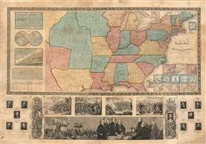
Ensign's Travellers' Guide, and Map of the United States, containing the Roads, Distances, Steam Boat and Canal Routes etc.
$4,000.00
Acquire
- Digital Map Information
- Suitable for large format printing
- Full resolution TIFF file
- ICC color profile embedded
- Delivered instantly via download link
An extremely scarce variant on Ensign and Thayer's series of highly decorative United States wall maps. This map, dated 1845, predates the annexation of Texas and the Mexican-American War by one year. It illustrates the Republic of Texas according to its early proclaimed borders, names Austin's colony, and identifies Austin as the capital. In addition, the map features a large Missouri Territory. Small mountains and rivers charts on the Bulla / Darton model appear in the upper left quadrant. The bottom of the map features a large panorama of the Signing of the Declaration of Independence as well as various scenes from American History. To either side are illustrations of Metacom, the Pokunoket Sachem called 'King Philip' and James Polk, who had just been elected 11th president of the United Sates. Portraits of other former presidents fan out on either side of the panorama. (more details)
John Hancock and the Boston Tea Party.
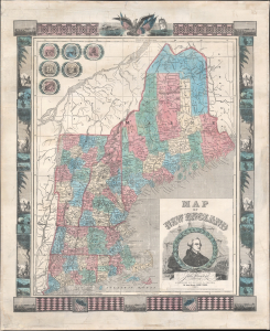
Map of New England.
$1,500.00
Acquire
- Digital Map Information
- Suitable for large format printing
- Full resolution TIFF file
- ICC color profile embedded
- Delivered instantly via download link
This is an 1847 Ensigns and Thayer map of New England: Connecticut, Rhode Island, Massachusetts, Vermont, New Hampshire, and Maine. (more details)
Pushing Manhattan's urbanization northward.
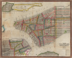
Map of the City of New York, with the Adjacent Cities of Brooklyn and Jersey City, and the Village of Williamsburg.
$1,200.00
Acquire
- Digital Map Information
- Suitable for large format printing
- Full resolution TIFF file
- ICC color profile embedded
- Delivered instantly via download link
This is a striking 1848 Ensigns and Thayer pocket map of New York City. It illustrates the city just as massive redistricting, leveling, and gridding were beginning to push urbanization into central and upper Manhattan. (more details)
Westward Expansion.
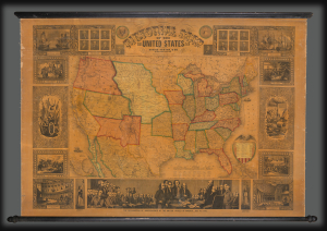
Pictorial Map of the United States.
$3,000.00
Acquire
- Digital Map Information
- Suitable for large format printing
- DPI: 600
- File Size: 1802.6 MB
- File Type: ZIP / TIFF
- ICC color profile embedded
- Delivered instantly via download link
A highly decorative 1853 wall map of the United States is published by Horace Thayer and engraved by J. M. Atwood. This map was published in editions from 1847 - 58, covering thus the critical moments of the American westward expansion, with each edition being significantly updated to reflect the rapid changes endemic to that heady period. The present 4th edition example reveals major developments following the 1849 Gold Rush. (more details)
Evolving Geography of a Metropolis.
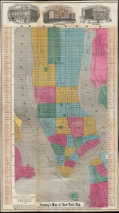
Fanning's Map of New-York City.
$1,500.00
Acquire
- Digital Map Information
- Suitable for large format printing
- File Size: 27.12 MB
- File Type: ZIP / TIFF
- ICC color profile embedded
- Delivered instantly via download link
An example of Thomas Fanning's 1855 map of New York City. Among several interesting features, it is most notable for including presumed future development, including in the central part of Uptown Manhattan, some of which in the process of being designated for Central Park. (more details)