1909 Ottoman Turkish Mehmet Eşref Map of Uskudar
Uskudar-esref-1909$350.00

Title
(Turkish Plan of Üsküdar)
1909 (undated) 5.25 x 3.75 in (13.335 x 9.525 cm) 1 : 52637
1909 (undated) 5.25 x 3.75 in (13.335 x 9.525 cm) 1 : 52637
Description
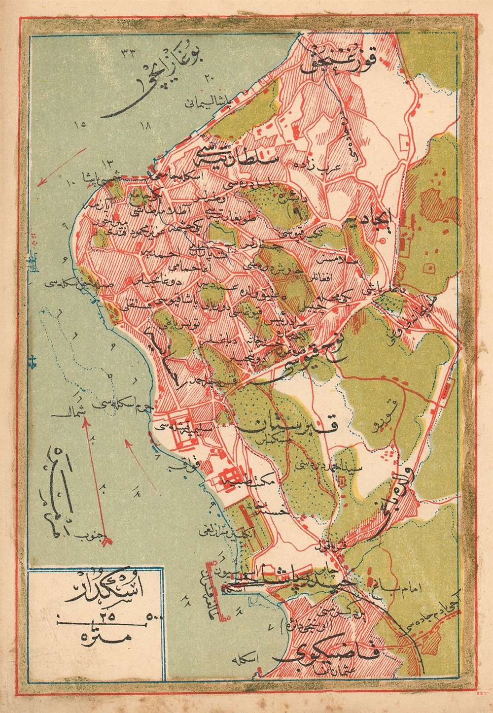
This is a 1909 Turkish plan of Üsküdar, produced by the Turkish educator and publisher Mehmet Eşref. It is one of the earliest, if not the only early Turkish printed plan of this part of Istanbul available to the collector. All titles and descriptive text are in Ottoman Turkish. The plan encompasses the neighborhoods of Harem, Doğancılar, Nakkaştepe and İcadiye, and indicates significant green space beyond these limits. Depth soundings are noted in the Bosphorus, and the famous 'Maiden's Tower,' or Kiz Kulesi, is marked just off the shore. Chromolithograph.
Publication History and Census
Turkish atlas maps are rare on the market. This one was published in Eşref’s Umum-i vilayat-ı Şahaneyi havi küçük atlas/( اطالس كوچك حاوى يى شهان ى والياة عموم), of which OCLC lists only a single copy at the Bogazici University Library in Istanbul.Cartographer
Mehmet Esref (1846 or 1847-1912) was a Turkish educator and publisher active in the first part of the 20th century. He published several historical and educational atlases, all of which are rare on the market and contain many of the first Turkish maps of the regions they depict. More by this mapmaker...
Source
Eşref, Mehmet.Umum-i vilayat-ı Şahaneyi havi küçük atlas/ اطالس كوچك حاوى يى شهان ى والياة عموم
Condition
Very good. Marginal soiling and some wear to corners.
References
ÖZEGE 25533. OCLC 949501827.