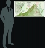
1929 Ljungstedt / Virginia Conservation Commission Map of Virginia
Virginia-ljungstedt-1929$350.00

Title
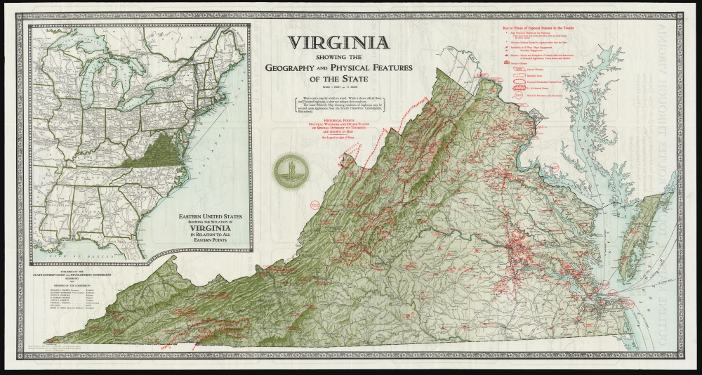
Virginia Showing the Geography and Physical Features of the State.
1929 (dated) 23 x 44 in (58.42 x 111.76 cm) 1 : 696960
1929 (dated) 23 x 44 in (58.42 x 111.76 cm) 1 : 696960
Description
This large, colorful map of Virginia was produced in 1929 for the Virginia Conservation Commission to promote tourism. Its publication coincided with the rise of automobile culture and statewide ambitions to capitalize on the great American road trip.
A large inset map to the left shows the location of the state in relation to the eastern part of the United States.
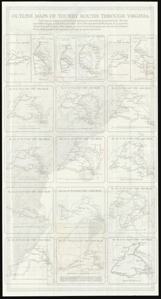
On the verso are 18 recommended automobile travel routes, ranging from day trips to excursions as long as twelve days.
A Closer Look
Based on the surveys by Olof A. Ljungstedt for the USGS, the map presents Virginia in vivid relief, including its roads, railroads, rivers, and cities. Superimposed over the base map, in red, are 'Historical Points, Natural Wonders, and Other Places of Special Interest To Tourists'. A key breaks down these elements into the locations of historical markers (erected both by the state and by other agencies), battlefields (the size of the cannon indicates the size of the battle), and historical 'shrines,' such as the homes and birthplaces of 'Notable Men.' Natural wonders, battlefield parks, national forests, and recreation centers are also marked. Among these is the projected Shenandoah National Park.A large inset map to the left shows the location of the state in relation to the eastern part of the United States.
On the verso are 18 recommended automobile travel routes, ranging from day trips to excursions as long as twelve days.
Publication History and Census
This map was printed by J. W. Clement Co., based on Olof A. Ljungstedt's surveys on behalf of the United States Geological Survey. We see 11 examples of this 1929 issue of the map listed in institutional collections.CartographerS
The Office of the Coast Survey (later the U.S. Geodetic Survey) (1807 - present), founded in 1807 by President Thomas Jefferson and Secretary of Commerce Albert Gallatin, is the oldest scientific organization in the U.S. Federal Government. Jefferson created the "Survey of the Coast," as it was then called, in response to a need for accurate navigational charts of the new nation's coasts and harbors. The first superintendent of the Coast Survey was Swiss immigrant and West Point mathematics professor Ferdinand Hassler. Under the direction of Hassler, from 1816 to 1843, the ideological and scientific foundations for the Coast Survey were established. Hassler, and the Coast Survey under him developed a reputation for uncompromising dedication to the principles of accuracy and excellence. Hassler lead the Coast Survey until his death in 1843, at which time Alexander Dallas Bache, a great-grandson of Benjamin Franklin, took the helm. Under the leadership A. D. Bache, the Coast Survey did most of its most important work. During his Superintendence, from 1843 to 1865, Bache was steadfast advocate of American science and navigation and in fact founded the American Academy of Sciences. Bache was succeeded by Benjamin Pierce who ran the Survey from 1867 to 1874. Pierce was in turn succeeded by Carlile Pollock Patterson who was Superintendent from 1874 to 1881. In 1878, under Patterson's superintendence, the U.S. Coast Survey was reorganized as the U.S. Coast and Geodetic Survey (C & GS or USGS) to accommodate topographic as well as nautical surveys. Today the Coast Survey is part of the National Oceanic and Atmospheric Administration or NOAA. More by this mapmaker...
Carl Olof Axel Ljungstedt (October 20, 1865 - September 15, 1949) was a Swedish-born American surveyor and civil engineer. He was born in Stockholm; Nothing is known of his childhood or education, but by 1892 he was employed by the USGS as a draftsman, having been appointed to the service in Missouri. He was naturalized a citizen of the United States on December 21, 1895,The 1910 census had Ljungstedt living in Bethesda, Maryland with his wife and adopted son; he was by this time employed by the U.S. Geological Survey. He produced a 1922 'Shaded relief map of Virginia' for the Virginia Geological Survey, as well as USGS maps of West Virginia, Pennsylvania, Montana, and the Geological Map of the United States. He died in Rockport, Maine in 1949. Learn More...
The J. W. Clement Company (1908 - 19xx) was an American printing and publishing firm based in Buffalo, New York. Founded in 1908 by Helen C. Springer, David L. Johnston, and Gustave Hornung, the firm eventually grew to become one of the largest printing and publishing firms in the eastern U.S. It stopped publishing maps in 1963 when the superintendent of the map department retired. At some point, the J. W. Clement Company became associated with the Matthews-Northrup Company, another Buffalo-based publishing firm, but we have been unable to determine any details about that event. Learn More...
Condition
Very good. Short marginal mends at two folds just touching printed image; else excellent.
References
OCLC 28163299.